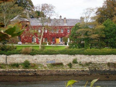
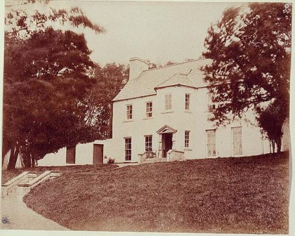
Ross House
Houses within 5km of this house
Displaying 9 houses.
Houses within 5km of Ross House
Displaying 9 houses.
| House name | Description | |
|---|---|---|
| Newport House | Built in the late 18th century, this house was the main residence of the O'Donels in the 19th century. It now functions as a hotel. |
|
| Ardagh Lodge | Ruane writes that it was built as a yachting lodge in the 1790s for the Palmer family. It was the residence of the Stuart family during the bathing season in the 1830s. Bought by the Stoney family in 1965. A house is still extant at the site. | |
| Milcum House | Ruane states that this house was built in 1754 by the Browne family [of Westport] and that it was first known as 'Seamount'. There was another Milcum house, built in the small townland of Milcum by the Binghams in the early 18th century, which was the house marked 'in ruins' on the first Ordnance Survey map. Seamount was occupied by Connell O'Donel in 1837. At the time of Griffith's Valuation it was unoccupied but in the possession of Nathaniel P. Simes. In the 20th century it was the home of Miss Laprimandaye, Sir Anthony Beever, the Brittains, the Percivals and Mr and Mrs Peter Mullowney. Milcum is still extant and occupied. |
|
| Moyour | This property was held in fee by Martha McDonnell at the time of Griffith's Valuation, when it was valued at almost £5. Described in the sale advertisement of 1870 as a 'commodious thatched house'. It is labelled as "in ruins" on the 25-inch Ordnance Survey map of the 1890s. | |
| Teevmore | A two-storey house occupied by James Stuart in 1837 and owned by Nathaniel P.Simes at the time of Griffith's Valuation but unoccupied. Substantial buildings are shown at the site on the 1st edition Ordnance Survey map but these have all but disappeared by the publication of the 25-inch edition of the 1890s. Some of the old outbuildings have been converted into a house. |
|
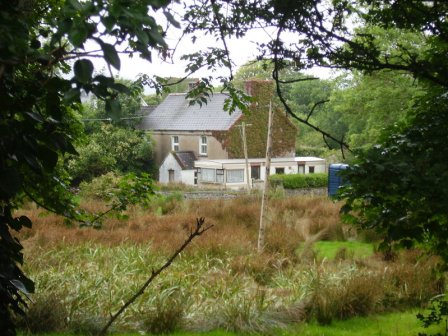
| Burrishoole Lodge | At the time of Griffith's Valuation this property was owned by Captain Alex Wyndham and valued at £5. It is recorded as a"steward's house". Described by the Irish Tourist Association surveyor in 1942 as a house of no more than 100 years old, an "example of pseudo or imitation Tudor architecture" and the home of Ernie O'Malley, author and freedom fighter. It is still extant. | |
| Rosmindle | An O'Malley house occupied by a Mr Garvey in 1814, it was in ruins by the time of the first Ordnance Survey. | |
| Rosehill | Built by Sir Samuel O'Malley in the early 19th century but a ruin by the time of the first Ordnance Survey. Occupied by Mr P.Gibbons in 1814. | |
| Rossanrubble | A small building is shown in this townland at the time of the first Ordnance Survey. Jonathan Pim was the owner of the townland at the time of Griffith's Valuation but there were no buildings with substantial valuation. A house labelled Rosbarnagh Lodge is shown on the 25-inch Ordnance Survey map of the 1890s and this building is still extant. |