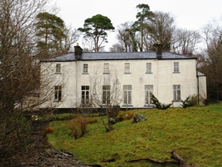
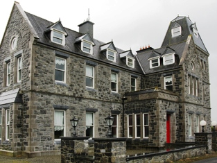
Keenagh Lodge
Houses within 15km of this house
Displaying 16 houses.
Houses within 15km of Keenagh Lodge
Displaying 16 houses.
| House name | Description | |
|---|---|---|
| Treanlaur House or Lodge | At the time of Griffith's Valuation the house at Treanlaur was leased by Peter Denis Browne from the Westport estate and valued at almost £9. It was occupied by Charles Henry Laprimaudaye in the 1870s. Treanlaur is still extant. |
|
| Carrowkeel | In the Ordnance Survey Name Books of the 1830s Carrowkeel House, the residence of Walter Bourke, is described as "in good repair". The house was valued at £6 at the time of Griffith's Valuation. It is labelled Carrowkeel House on the 1st edition Ordnance Survey map of 1838 but is not shown on the 25-inch edition of the 1890s. | |
| Glenmore | At the time of the first Ordnance Survey Glenmore was occupied by the Rev St George Knox, curate of Crossmolina, as the Ormes were living in Dublin. Glenmore became the property of Godfrey Fetherstonhaugh after the 1853 sale. His mother was an Orme of Abbeytown. Well maintained and owned by a French family who advertised the sale of the house in September 2006. |
|
| Fortland | The Jacksons held this property from the Pratts of Enniscoe. It was described in the 1830s as a plain house ornamented with a few trees and scrubs. At the time of Griffith's Valuation it was leased by George H. Jackson from Mervyn Pratt when it was valued at £12. It is still extant ad now owned by Billy Cook. |
|
| Wood Park | This was the earlier house on this estate, shown as Woodpark on the 1st edition Ordnance Survey map of 1838. It was lived in by the Anderson family in the 1830s and 1840s. At the time of Griffith's Valuation it was held in fee by Thomas Jones and valued at £6. A house diminished in size but still labelled Wood Park is shown on the 25-inch map of the 1890s. This property does not appear to be extant now. [Charles Coyne also lived at Massbrook in the mid 19th century. See also under Massbrook] | |
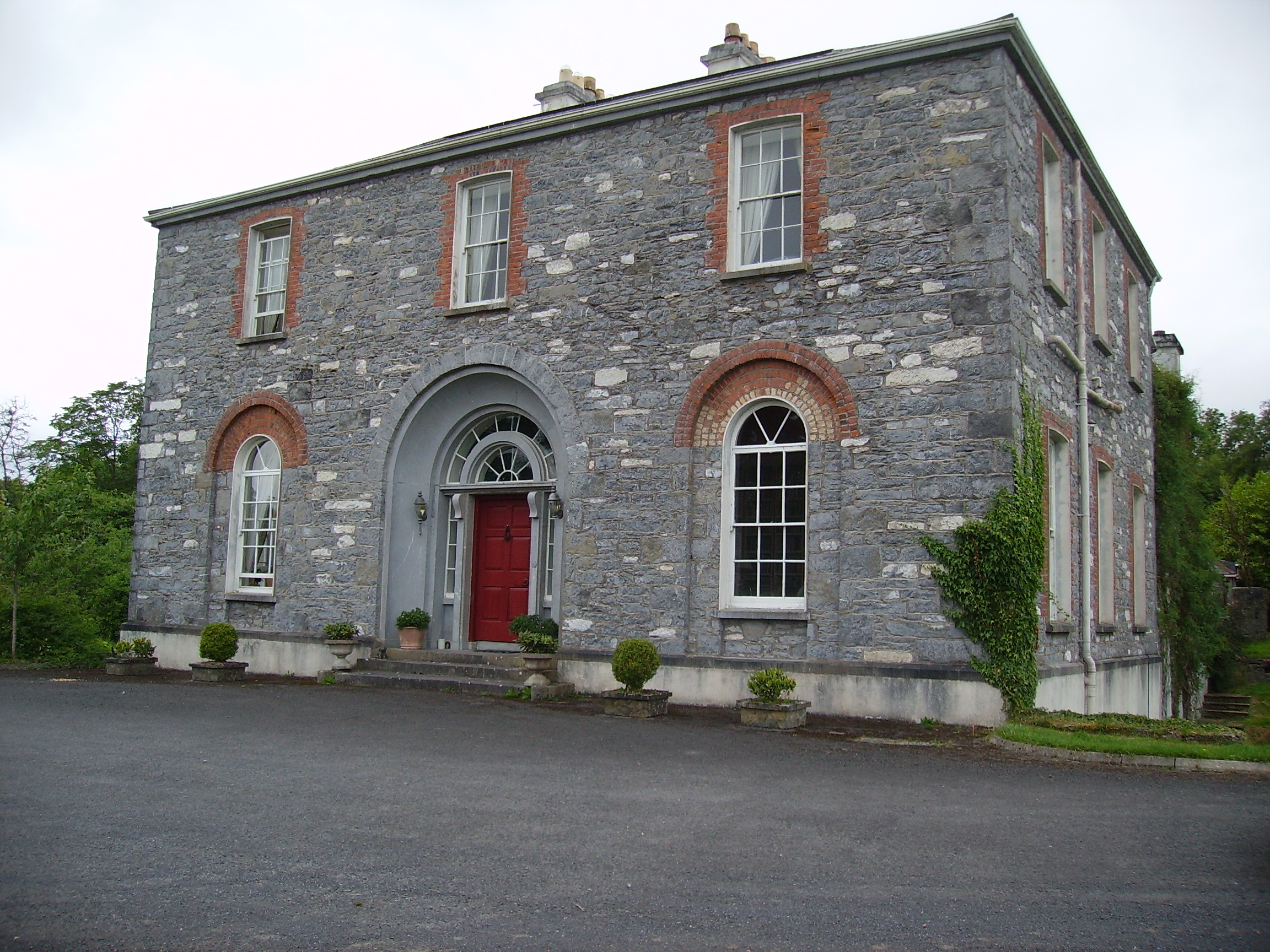
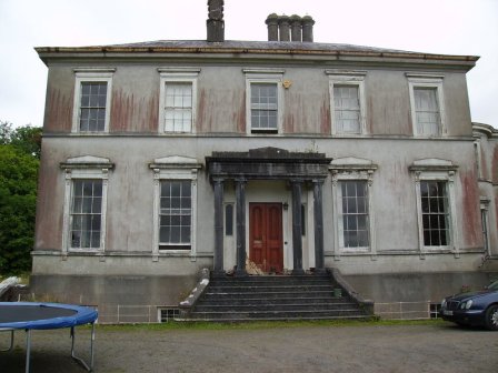
| Enniscoe House | The site of an old Bourke castle on the shore of Lough Conn, the house was built before 1786 as Wilson refers to Prospect as the seat of Mr. Jackson at that time. It was held in fee by Mervyn Pratt at the time of Griffith's Valuation, when it was valued at £50. It appears as Inishcoe House on both the 1st and 25-inch ediitons Ordnance Survey maps but is now known as Enniscoe House. The North Mayo Family History centre is based in adjacent buildings and the house offers guest acommodation. |
|
| Errew Grange | A Victorian Gothic house built circa 1870s. It was bought from Granville Knox by the Burkes of Ballina, solicitors. The Burkes leased it to the Order of Jesus and Mary before the Order moved to Gortnaraby in 1916. It became a hotel but burnt down in 1949 and was later restored. |
|
| Owenmore or Millbrook | Ordnance Survey Field Name Books record a 'neat cottage' in the townland of Correens, built in 1796 and called Millbrook. Irish Tourist Association File records Owenmore as the residence of the Misses Knox in 1942, erected about 1830 by the Orme family. The house belonged to the McCausland family in the latter part of the 20th century. Now owned by Gerry O'Mara. |
|
| Abbeytown | The original historical abbey buildings in this townland are described as 'in ruins' at the time of the first Ordnance Survey. It was formerly the residence of a Mr Crofton but was then occupied by a caretaker for the Orme family. Abbeytown House is shown a litte to the north on the later 25-inch map of the 1890s. The property was bought by Anthony Carolan of Crossmolina at the sale in 1852 and the house was later lived in by the parish priest. Abbeytown is still extant and occupied. |
|
| Ballycarroon | A house dating from the early 19th century. At the time of Griffith's Valuation it was occupied by Isadore Andrew Lynch, who sub leased it from Henry Charlton. Later occupied by members of the Craven and Connor families. A house still exists at the site. | |
| Gortnaraby/Gortnor Abbey | Ruane dates this house to the mid 18th century.In 1786 Wilson refers to it as the seat of Mr. Ormsby. At the time of Griffith's Valuation, it was leased from John Ormsby by an individual named Connop and valued at £25. In 1916 it was taken over by the Order of Jesus and Mary and now functions as a secondary school. |

|
| Castlehill | In 1786 Wilson refers to Castlehill as the seat of Mr. [Mc]Cormack. The Cormacks lived at Castlehill until the mid 1830s. A new house was built in the late 1830s for John Walsh, an attorney of Hume Street, Dublin. At the time of Griffith's Valuation, it was held in fee by him and valued at £34. It was the residence of Edward Walsh in 1894. It is still extant. |
|
| Altnabrocky | A shooting lodge built in 1848. It was valued at £2 at the time of Griffith's Valuation. Professor Seamus Delargy, Chairman of the Irish Folklore Society, stored all the Society's manuscripts there for safekeeping during World War II. | |
| Lodge | There is no suitable building named in this townland on the first edition of the Ordnance Survey map. A shooting lodge is, however, shown on the 25-inch Ordnance Survey map of the 1890s. This building is no longer extant. | |
| Massbrook | The Irish Tourist Association file makes it clear that there were two houses at Massbrook, both in good condition in the 1940s. One was of French design erected in the 1890s by Colonel Johnston, the then owner of the estate. There was also an older and smaller house, see under Woodpark. D.15166 in the National Archives refers to the house and demesne of Massbrook in 1868. Described by Bence Jones as a late Victorian house, the seat of the Walsh family. In the early 1990s Mrs Mary Robinson, former President of Ireland, purchased the house known as Massbrook, formerly owned by Denis Ferranti. | |
| Mullenmore | In 1786, Wilson refers to Mullennore as the seat of Mr. Cormack, "pleasantly situated on the edge of Lough Conn". The townland was in the ownership of the Palmer estate at the time of Griffith's Valuation and there was no substantial house there. |