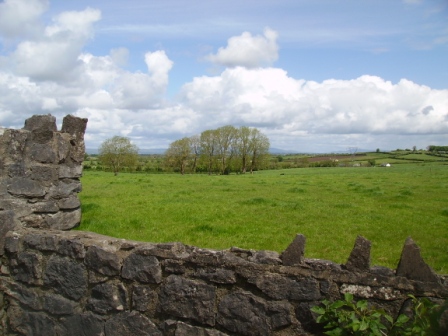
Ballysheedy
Houses within 5km of this house
Displaying 30 houses.
Houses within 5km of Ballysheedy
Displaying 30 houses.
| House name | Description | |
|---|---|---|
| Summerville | Built in the 1780s by Joseph Massey Harvey, a Quaker merchant, who married Rebecca Fisher and still occupied by him in 1814. Joseph and Rebecca were the parents of William Henry Harvey, a distinguished botanist. At the time of Griffith's Valuation Summerville was valued at £33 and occupied by James T. Fisher who held the property from Eliza Harvey. The house is now an accommodation and conference centre of the Mary Immaculate College for training primary teachers. The college was founded in 1898. |

|
| Ballyclogh | The home of a branch of the Morony family during the 19th century. Occupied by James Todd in the early 1850s who held the property valued at £38 from the Moronys. An occupied house is still located at this site. |

|
| Ballyclogh Lodge | Ballyclogh House and Lodge are both marked on the first Ordnance Survey map of county Limerick. At the time of Griffith's Valuation John Russell held land in the townland with associated buildings valued at £12 from Michael Furnell. There were also mills in the townland valued at £35. Valued at £10+ in 1906 when occupied by George Furnell, Ballyclogh remained in the possession of the Furnell family until 1973. | |
| Derryknockane | George Gloster held this house in fee at the time of Griffith's Valuation when the buildings were valued at £20. | |
| Lemonfield House | Sometimes spelt Leamonfield, this house was the home of a junior branch of the Bevan family in the first half of the 19th century. Griffith's Valuation records Thomas Bevan as the occupier holding the property from the Reverend William Lloyd. It was valued at £14. ''Burke's Irish Family Records'' refers to Arthur Russell of Lemonfield, sixth son of John Norris Russell of Limerick. He died 1890. The house is no longer extant. | |
| Ballycummin | Roche Castle was a residence of Sir David Roche at the time of Griffith's Valuation held from the Bishop of Limerick and valued at £30. | |
| Friarstown (New) | A 2 storey house with offices which was built in 1826 by Vere Hunt on the townland boundary between Friarstown and Friarstown North. It was the residence of Vere Hunt at the time of Griffith's Valuation, held in fee and valued at £20. No house appears to exist at this location now. |
|
| Coolyhenan House | A house occupied by Michael Shine at the time of Griffith's Valuation and held from the representatives of M. Honan, valued at £28, with a demesne of 343 acres. Though buildings survive at the site they appear to be in a derelict condition. | |
| Roxborough | Occupied by William Westropp in 1814 and Lewis refers in 1837 to the ''fine mansion and demesne'' of the Honourable J. P. Vereker. The Ordnance Survey Name Book refers to the rebuilding of Roxborough by Major Vereker in 1832 at the expense of approximately £1200. Viscount Gort held Roxborough in fee at the time of Griffith's Valuation when it was valued at £40. The house was advertised for sale in June 1852 and again in June 1853. Possibly bought by the McMurrays who were certainly resident by 1862. In 1894 Slater refers to it as the seat of A. Crawford. Now a more modern house appears to be located at this site. |
|
| Lickadoon | The Ordnance Survey Field Name Book records the date for the building of this 3 storey house, the seat of George Parsons, as circa 1779 at a cost of about £1000. By the time of Griffith's Valuation John O'Brien was residing at Lickadoon which he held from George Biggs. The buildings were valued at £20. In 1942 this house was the property of Mr William Leahy, a solicitor, and formerly the residence of the the Urquhart Hunts (ITA). | |
| Kilrush | A house occupied by Daniel Gabbott and held from Tottenham Harvey at the time of Griffith's Valuation. The house was valued at £40 and was surrounded by 3 acres of land. It was situated on the Barrington estate. [Marked as Thorn Ville on the first Ordnance Survey map]. | |
| Shannon View | It was valued at £22+ at the time of Griffith's Valuation, occupied by Thomas Kelly and held from Henry O. Seward. Thomas Kelly was an uncle of James Michael Kelly of Rockstown Castle and Cahircon. He married Letitia Roche, a granddaughter of Philip Roche of Shannon View and his wife, Margaret Kelly of Limerick. This house is no longer extant and extensive urban development has taken place in the area. | |
| Shannon Park | The residence of the O'Ferralls from at least 1814 when occupied by Michael O'Ferrall. Michael Richard O'Farrell was the occupier at the time of Griffith's Valuation and the house worth £10+ with 146 acres was located on the Brown estate. | |
| Sunville | Described as the seat of Thomas Wallnutt in the Ordnance Survey Field Name Book and built in 1821 for £900. It was occupied by Margaret Wallnutt in the early 1850s and held from William F. Taverner and valued at £24. | |
| Coolraine House | Occupied by John Vereker at the time of Griffith's Valuation, valued at £30 and held from the Marquess of Lansdowne. It was still extant until the 1940s but the site is now occupied by suburban housing. | |
| Shelburne | The National Inventory of Architectural Heritage (buildings of Ireland) states that this was a home of William Petty-FitzMaurice (1737-1805), 2nd Earl of Shelburne and 1st Marquess of Lansdowne. The Ordnance Survey Field Name Book refers to the building of Shelburne in 1837 at a cost of £2,000. Circa 1840 it was the seat of H.N.Seymour. At the time of Griffith's Valuation it was occupied by a representative of Robert Gabbett and held from the Marquess. It was the home of Thompson Russell in 1878 and of Henrietta Rose in 1887. Now located in the grounds of Ardscoil Rís. |
|
| Bellevue | The description in the National Inventory of Architectural Heritage records the building of this house as circa 1820 and that it was the home of the artist Douglas Alexander (1871-1945), one of three brothers who were prominent Quaker merchants in the city of Limerick. At the time of Griffith's Valuation Bellevue valued at £35 was occupied by William Alexander. Another house occupied by James Alexander and valued at £31 stood close by. Both houses were held from the Marquis of Lansdowne. Later this house was the home of the Cleeves family, toffee makers. |

|
| Ardhu | A house built post 1850, the seat of the Rose family at the beginning of the 20th century. Now functions as the Clarion Hotel suites. |
|
| Tivoli | Marked on the first Ordnance Survey map, Tivoli Cottage valued at £48 was occupied by Major Wheeler and held from Sir Matthew Barrington at the time of Griffith's Valuation. Since 1952 it has been the centre of a boys' secondary school known as Villiers School. |

|
| Ashbourne | A 2 storey house located on the Earl of Limerick's estate, this house was the seat of the Honourable Robert O'Brien in the 1830s. It was occupied by Richard Wilson in the early 1850s and held from Eliza Harvey. Garrett Hugh Fitzgerald's interest in the property was advertised for sale in May 1851. By the 1870s it was the home of the Synan family. This house is now demolished. | |
| Strand House | Strand House appears to be the house also known as "Stonetown House" and marked as such on the first Ordnance Survey map. The Ordnance Survey Name Book describes Stonetown House as the seat of Daniel Gabbett and that it was built between 1760 and 1770 by G. Vandeleur at a cost of £1,100. At the time of Griffith's Valuation it was the residence of William Gabbett, valued at £44 and held from Elizabeth Vereker. Part of the original garden now occupied by The Strand Hotel. | |
| Bellefield | Bellefield was the residence of George Furnell at the time of Griffith's Valuation. He held it from William Gabbett and it was valued at £33. William's brother Daniel lived at Bellefield at one time. A Charles A. Marrett is recorded as resident at Belfield, Limerick in 1814. Belfield Park is now the location of the Regional Maternity Hospital. | |
| Ballinacurra House | Marked on the first Ordnance Survey map and situated on the outskirts of Limerick city this house was occupied by Edmund Palmer at the time of Griffith's Valuation when it was valued at £23 and held from Patrick O'Shea. Later the home of Hugh Massy. He died at Ballinacurra in 1881. Now in use as an office. |
|
| Kilmoyle | A house built by the Boyds, merchants in Limerick city, circa 1845 on the Lansdowne estate and originally known as Westfield. For many years the residence of the Catholic Bishops of Limerick. Sold by the Diocese to Aidan Brooks for development in 2007 for a sum reputed to be > €20 million. |

|
| Friarstown | The National Inventory of Architectural Heritage states that he house was built in 1827 for David Urqhart Hunt and cost £10,000. At the time of Griffith's Valuation the house was occupied by Henry Hunt who held it from the Reverend Richard Maunsell, valued at £35. This property is now known as Friarstown Stud. |

|
| India Villa | Valued at £18 at the time of Griffith's Valuation, India Villa was held on a lease from Patrick A. Shannon to William Phayre and was described in 1856 as "an exclusive modern residence". It is no longer extant. | |
| Albert Villa | Occupied by William Finch at the time of Griffith's Valuation and valued at £31. Described in 1856 as a large mansion house, "erected by the late Mr Shannon" and occupied by John C. Drysdale. By the 1890s this house is labeled "Lanahrone" on the 25-inch Ordnance Survey map. It is no longer extant and a modern housing estate now occupies the site. | |
| Rosbrien | A home of a branch of the Quin family descended from John Quin, second son of Thady Quin (1645-1726). Wilson, writing in 1786, refers to Rosbrien as the fine seat of Mr. Quin. It is labelled Rossbrien House on both the 1st and 25-inch edition Ordnance Survey maps but is no longer extant. | |
| Cahernarry House | Originally a Cripps residence, occupied by a member of the Crips family in the 1770s and 1780s and by J. Cripps in 1837. By the time of Griffith's Valuation Henry Watson was in residence. The house was valued at £8. It is not visible on the 25-inch Ordnance Survey map of the 1890s. Modern farm buildings occupy the site now. | |
| Singland House | A building labelled Singland House, in the townland of Singland, appears on the 1st edition Ordnance survey map of the 1830s. A smaller property, labelled Singland Cottage, is shown nearby. On the later 25-inch map of the 1890s, the original Singland House is no longer visible and Singland Cottage is named Singland House. It is no longer extant. The original Singland house is probably that referred to by Wilson as the seat of Mr. Dwyer in 1786. |