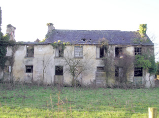
Clonshavoy
Houses within 5km of this house
Displaying 12 houses.
Houses within 5km of Clonshavoy
Displaying 12 houses.
| House name | Description | |
|---|---|---|
| Ashroe | The Ordnance Survey Name Books record the building of Ashroe House in 1770 for £850. The residence of the Evans family in the late 18th and 19th century, held from Sir Matthew Barrington at the time of Griffith's Valuation, when it was valued at £23+. Wilson mentions it as the seat of Mr. Evans in 1786. The National Inventory of Architectural Heritage suggests modifications were made to the house during the nineteenth century. It is still extant and well-maintained. |

|
| Glenstal | Described by Bence Jones as a "massive Norman-Revival castle", built for the Barrington family. The building began in 1837 but was not completed until the 1880s. Noted by Slater as the seat of Sir Charles Burton Barrington in 1894. The buildings were valued at £65 in the early 1850s and at £58 in 1906. Now known as Glenstal Abbey, it is a boys' boarding school run by the Benedictine monks, who bought the property from the Barringtons in 1927. |

|
| Abington House | Abington House in the townland of Dromeliagh is marked on the first Ordnance Survey map. In 1786 Wilson states "at Abingdon, is a very pleasant seat of Sir Nicholas Lawless". At the time of Griffith's Valuation a house valued at £17 was occupied by Michael Apjohn in this townland. In the 1860s this house was occupied by John Connell Fitzgerald and his wife Margaret (Apjohn). ''The Limerick Chronicle'' of 1 Oct 1872 records the death of Mary Anne Apjohn of Abington House, widow of Michael Apjohn. The property was held from Lord Cloncurry. A ruined house is still extant at the site. |
|
| Farnane House | Located on the Cloncurry estate Farnane was the home of the Costelloe family from at least 1837. Occupied by Thomas Costelloe in the early 1850s and valued at £12+. It is labelled Farnane House on the 1st edition Ordnance Survey map but is not labelled on the later 25-inch edition of the 1890s. It is no longer extant. | |
| Wilton | In 1786 Wilson refers to Wilton-Hall as the seat of Mr. Perceval. A house labelled Wilton is shown on the 1st edition Ordnance Survey map. It was occupied by George Duhy at the time of Griffith's Valuation, valued at £14 and held from Lord Cloncurry. On the 25-inch map of the 1890s this property is labelled Wilton Constabulary Barracks. It is no longer extant. | |
| Raheen | A steward's house on the Bourke estate was recorded at Raheen in the early 1850s. It was valued at £11+. | |
| Thornfield | Leet records Thorn-field as the residence of Thomas Thornley in 1814. By the mid 19th century it was the residence of Sir Richard Bourke held by him in fee and valued at £25. The Ordnance Survey Field Name Book refers to Sir Richard Bourke repairing the house circa 1840. It was 2 storeys high, 60x50 feet. This house has remained in the possession of Sir Richard's descendants into the 21st century. |

|
| Maddyboy | Occupied by John Burke in 1814, by Captain Wickham in 1837 and by Benjamin Lucas in the early 1850s. The buildings were valued at £14 and the property held from John Lucas. | |
| River Ville [Mulkear] | Built circa 1800 and the seat of Arnold Hill circa 1840 this house was occupied by Samuel F. Dickson at the time of Griffith's Valuation and held by him from William D. Farrer with 206 acres, The buildings were valued at almost £16.The house is labelled River Ville on the 1st edition Ordnance Survey map but as Mulkear on the 25-inch edition of the 1890s. A house is still extant at the site. | |
| Cappercullen | Tierney writes that Lord Carbery built this house in 1717. It was inhabited by the Grady family in the latter half of the 18th century and Wilson refers to it as their seat in 1786. It was in ruins by the time of the first Ordnance Survey. The site of this house is now the tennis court at Glenstal. | |
| Clonkeen House (Barrington) | Croker Barrington, second son of Sir Croker Barrington, was the occupant of a mansion house at Clonkeen (Barrington) in 1906, valued at £48. The Barringtons owned a house in this area at the time of Griffith's Valuation which was valued at almost £10. This older property is known as Clonkeen House and was enlarged later in the nineteenth century. The 25-inch Ordnance Survey Map of the 1890s shows a second property, labelled Barrington's Bridge House [R683547]. This latter property is locally known as The Red House. Houses are still extant at both sites. Clonkeen House was offered for sale in 2013. |

|
| Clonsingle | A house situated on the Tipperary/Limerick county border, occupied by R. Young in 1837 and by Robert Young in the early 1850s, when it was valued at £30 and held in fee. Robert Young was still resident in the 1870s. A house is still located at this site. |