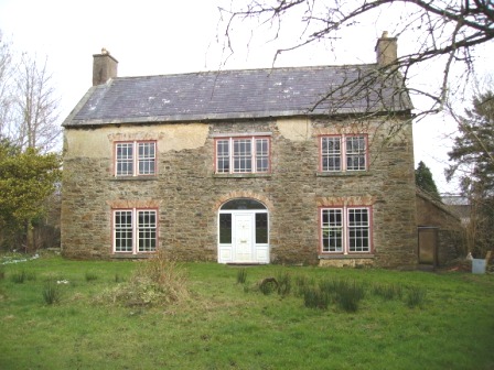
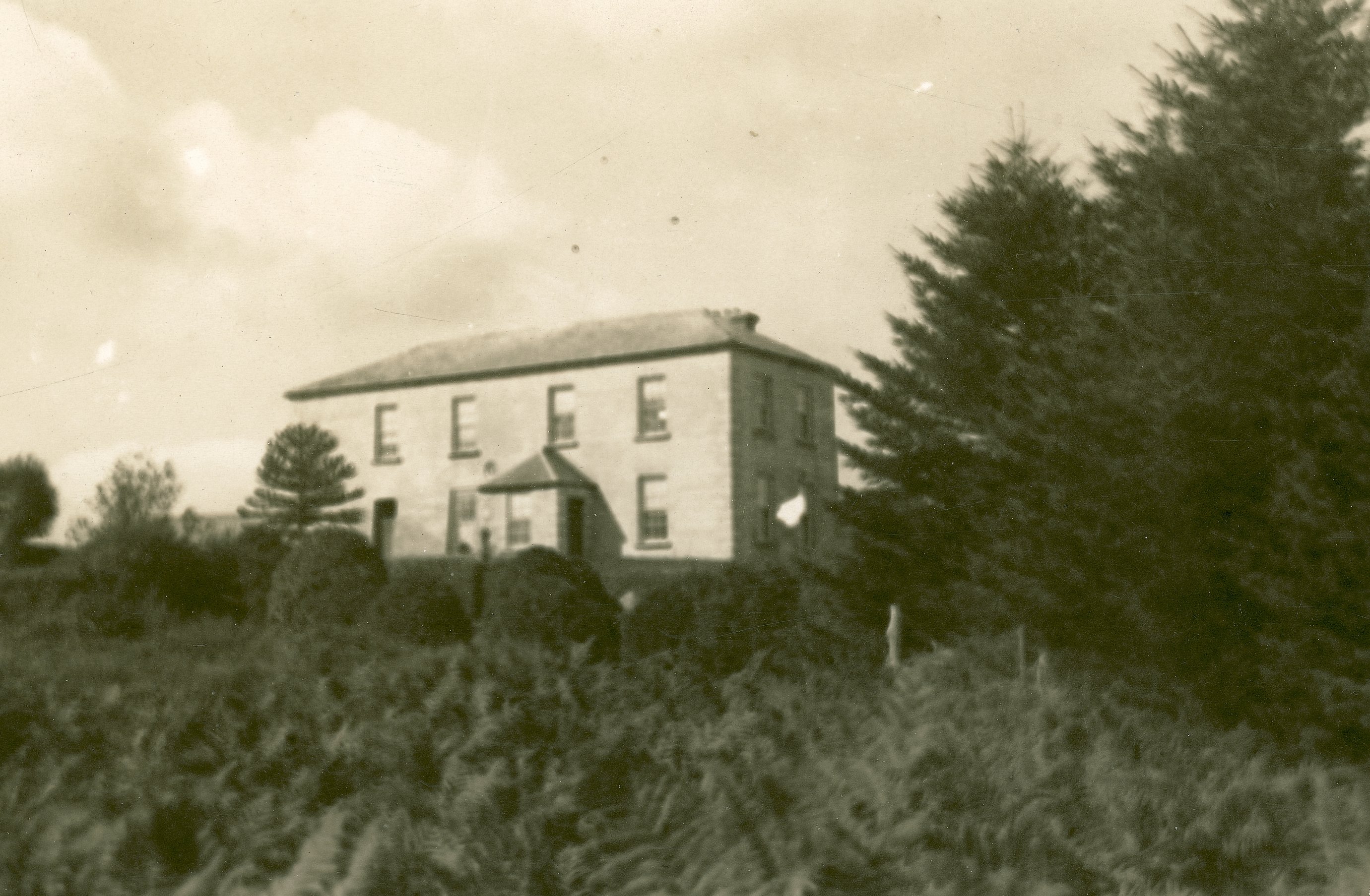
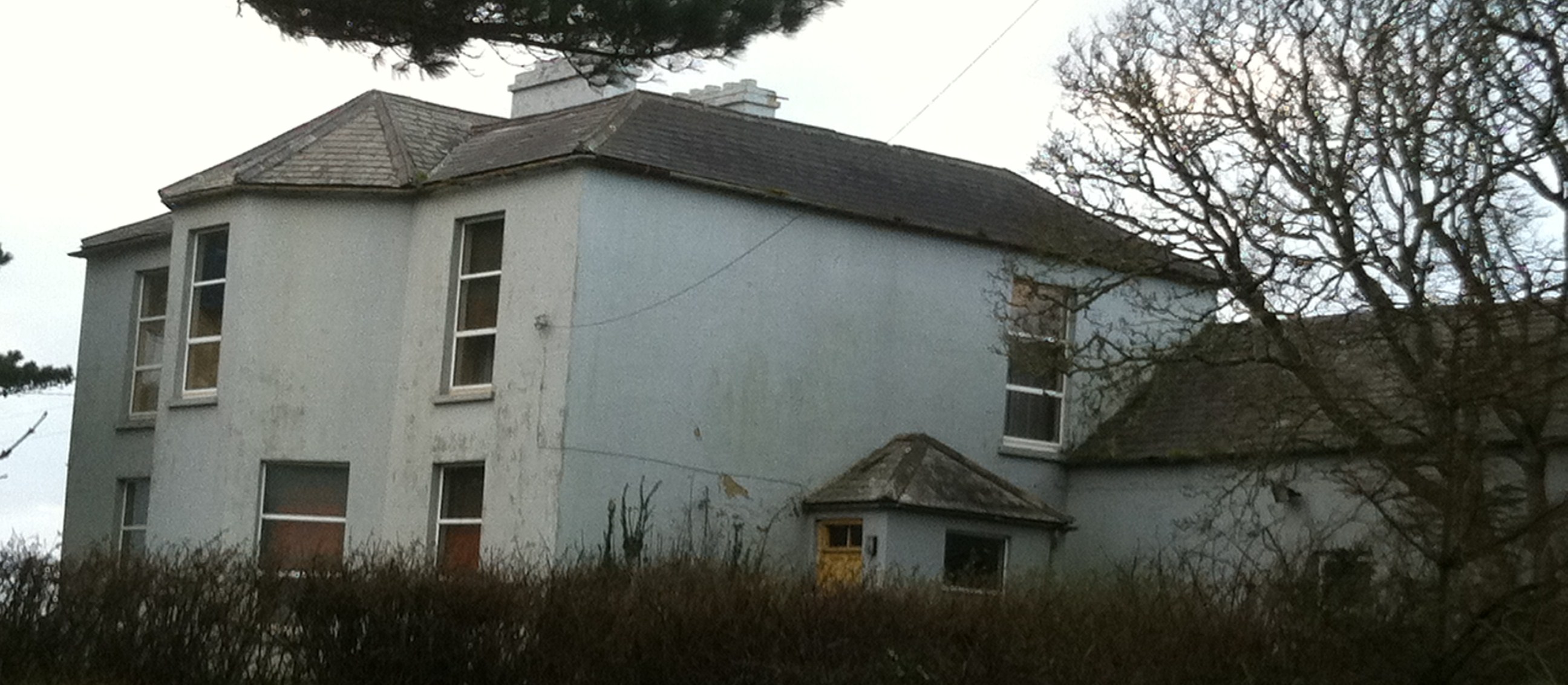
Dangananella House
Houses within 15km of this house
Displaying 40 houses.
Houses within 15km of Dangananella House
Displaying 40 houses.
| House name | Description | |
|---|---|---|
| Ballyartney | A house built by the Quaker family Barclay in the 18th century and their home in the 18th and 19th centuries. In 1786 Wilson mentions Ballyartney as the seat of Mr. Barclay. The house was occupied by Charlotte Barclay at the time of Griffith's Valuation but she held it from the Court of Chancery. Home of the O'Dea family in the 20th century. Unoccupied in 2009. |
|
| Kildeema | Arthur O'Donnel was resident here in 1814. At the time of Griffith's Valuation William Mathews occupied a house and over 400 acres at Kildeema on the Wyndham estate. There was a tile yard on the property and the buildings were valued at £35. The Mathews continued to live here into the 20th century. |
|
| Carrowduff | Two houses are marked in the townland of Carrowduff on the first Ordnance Survey map. One was 'in ruins', R055 764. The other was named Emma Ville. At the time of Griffith's Valuation John Gray held a house valued at £15 and 56 acres from the Wyndham estate in this townland. Carrowduff House appears to have been renovated as it is labelled on both the 25-inch 1890s and the 1942 edition of the Ordnance Survey map. Neither house is extant now. | |
| Ballard | The residence of John Singleton in 1814. Occupied by the Reverend M. Comyn Parish Priest in 1837 and by John Singleton who held from William Gabbett at the time of Griffith's Valuation. | |
| Knocknagore | A house on the Stacpoole estate built by Edmund Mahony who Weir writes married Mary Stacpoole of the Eden Vale family and still occupied by their descendants in the 20th century. | |
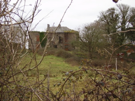
| Annagh | The townland of Annagh was in the possession of the Stacpooles from the early 18th century and the house was probably built in the second decade of that century. In the 1770s William Stacpoole moved from Annagh to Eden Vale. Thomas Heher was living in the house in 1814 and by the time of Griffith's Valuation George Brew was resident. The house was a ruin in the early 20th century. | |
| Berry Lodge | A house on the Stacpoole estate, occupied by Francis Woulf in 1814 and by a member of the O'Dwyer family in the mid 19th century. This house is still a residence. |

|
| Cloonmore | At the time of Griffith's Valuation occupied by William McMahon, held from Timothy McMahon and valued at £10. This was a one storey thatched house, a modern house is now located near the site. |
|
| Quilty House or Salus House | Summer residence of the Crowe family, this house is marked on the first Ordnance Survey map of 1842. It was valued at £25 at the time of Griffith's Valuation and recorded as a mansion house in 1906. It is labelled Salus House on subsequent Ordnance Survey maps but is no longer extant. | |
| Tromra | A house situated just south of the village of Quilty held from the Mahons. At the time of Griffith's Valuation this house was occupied by Admiral Sir Burton Macnamara baronet, the sixth son of Francis Macnamara of Doolin. It was valued at £18. A house of £9 valuation across the road from his residence was known as Tromra Lodge and was occupied by Lieutenant J. Morris of the Royal Navy at this time, grid reference R019 742. Neither house exists any longer. | |
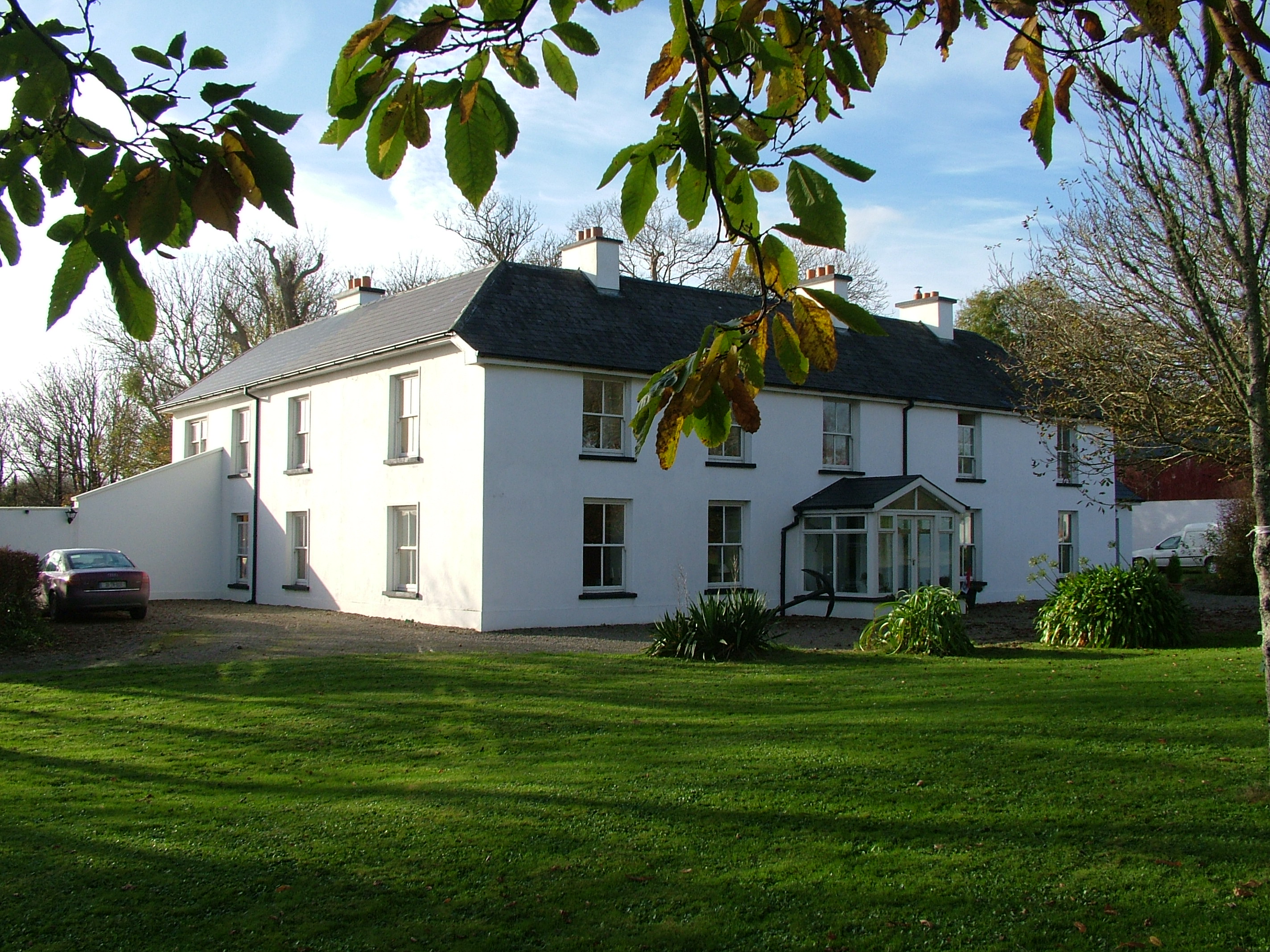
| Drumellihy | A house on the Westby estate occupied by J. O'Brien in 1837 and by Michael Studdert at the time of Griffith's Valuation, when the house was valued at £20. It has remained in Studdert possession for over a hundred years. The date 1811 is inscribed on a stone at the gateway of this house. |
|
| Creegh House | A house on the Stewart estate, Weir writes that it was built for James Kelly on his marriage to Margaret Kenny of Freagh Castle and five generations of their descendants have lived there. | |
| Gower Hall | A house on the Burton estate held by Francis Keane from Henry S. Burton at the time of Griffith's Valuation and valued at £12. It had previously being occupied by James Lillis in 1814 and also by Richard Pilkington who married Maria Blood of Applevale in 1805. Previously, in 1786, Wilson refers to Gower as the seat of Mr. Ames, "situated on a hill". The house was reconstructed in the late 19th century and is still a family home, the centre of a dairying enterprise. |

|
| Mount Pleasant | An 18th century house that was the home of Richard Bury, son of John Bury of Shannon Grove, county Limerick. In the 19th century it was the residence of the Cox family. Griffith's Valuation shows that Captain J. Cox held the property from the representatives of Anthony Hickman. The house was valued at £22. Two other houses in the townland of Clarefield were also occupied by members of the Cox family, Kate Ville and Mary Ville. This house is now a ruin. |
|
| Ballykett | Home of a branch of the Hickman family in the 18th century. Weir writes that the Tymons lived here at the end of the 18th century. Occupied by Thomas Pilkington in 1814 and later by the O'Donnell family and then the Brews. No house is named on the first Ordnance Survey map of 1842. George Brew held a house valued at 2 shillings at the time of Griffith's Valuation. The original house was demolished and replaced by a late 19th century house. Also known as Elmgreen, Taylor and Skinner's map 1778 shows two houses beside each other named Elmgreen occupied by Hickman and Ballykett by Monsell. | |
| Querrin | Originally built in the Dutch style by the Van Hogart family who intermarried with the Hickmans of nearby Ballykett. Later the home of the Borough family, William Borough was resident in 1814 and it was later occupied by their descendants, the Counihans. Dr John F. Counihan was in possession of Querrin in 1906. This house close to the shore of the Shannon is still a family home, old walls are still evident and the house has been modernised. |
|
| Cappagh House (Kilrush) | Occupied by John Trousdell in 1814. Later the home of the Blairs who intermarried with the Persses of Moyode, county Galway. At the time of Griffith's Valuation it was occupied by William Blair leasing from the Vandeleur estate when the house was valued at £14. The property was labelled Cappagh House on the 25-inch Ordnance Survey map of the 1890s. Modern building has taken place in the area. | |
| Broomhill House | Situated just north of Kilrush. Weir writes that this was an old house built before the town of Kilrush. It was occupied by Robert Parkinson in 1814 and by John Kelly at the time of Griffith's Valuation who held it from Colonel Crofton M. Vandeleur. A house is still extant at the site. | |
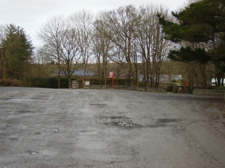
| Kilrush House | An early 19th century house, home of the Vandeleur family, though they were in residence in the eighteenth century as Wilson refers to Kilrush as the seat of Crofton Vandeleur in 1786. In the mid 19th century it was valued at £85. In 1897 it was completely destroyed by an accidental fire. The site of the house is now a car park for those wishing to visit the Vandeleur Walled Garden, which has recently been restored, or to walk in the woods. |
|
| Shannon View | A house on the Vandeleur estate, occupied by S. O'Donnell in 1814 and by Simon O'Donnell at the time of Griffith's Valuation. Buildings still exist at the site. | |
| Pella House | A Studdert home on the Vandeleur estate valued at £13 in the mid 19th century. Weir writes that the house was built by Admiral John Fitzgerald Studdert and it remained a Studdert home until 1900. Though a house is still extant at the site the original house is now ruinous. |
|
| Clonderalaw | Weir writes that this house was either built or bought by a branch of the Studderts of county Limerick in the mid 18th century and that it remained their home until the mid 20th century. In 1786 Wilson refers to it as the seat of Mr. Studdert. It was part of the Wandesforde estate in county Clare. It was the home of Mrs Gore (nee Studdert) in the 1940s but according to the Irish Tourist Association surveyor it was not in good repair and "likely to go the way of all the other big houses of Clare". However it has survived into the 21st century with its roof on. In 1894 it was the residence of Captain George Studdert. | |
| Thornberry House | Originally a Brew family home, then a rectory and by the mid 19th century in the possession of the Studdert family held from Jane Robinson. Later the home of Colonel Thomas Lloyd. The house was demolished in 1949. | |
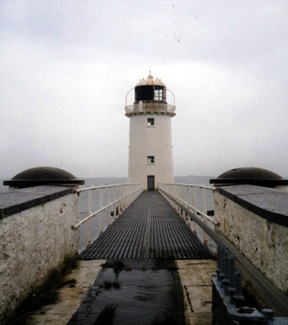
| Tarbert Lighthouse & Keepers House | At the time of Griffith's Valuation, Robert Leslie was leasing this property to the Board of Ordnance, when it included the lighthouse and lightkeeper's house and associated buildings, valued at £22. The lighthouse is still extant and operational. |
|
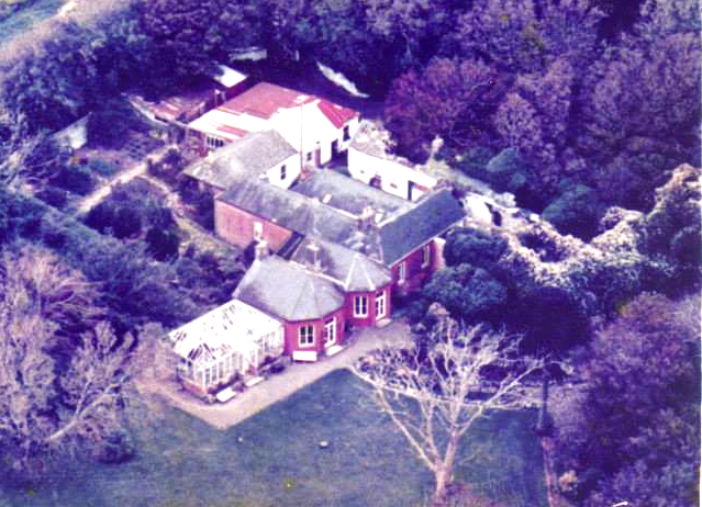
| Tarbert House | Tarbert House was owned by Robert Leslie at the time of Griffith's Valuation when it was valued at £24 10s. Both Leet in 1814 and Lewis, in 1837, note it as the seat of R. Leslie. In 1906 it was valued at £25. The National Inventory of Architectural Heritage suggests the house was built c.1720. In 1786 Wilson describes it as "happily situated on an eminence commanding an extensive view". The house has remained in the Leslie family since that time though the estate was sold to the tenants c.1904. It is open to the public during the summer months. |
|
| Burrane | The Hodges lived here for over a hundred years following a marriage in 1754 with a Monsell of Burrane though Wilson still refers to it as the seat of Mr. Monsell in 1786. It was held from the Reeves family of nearby Besborough who came to hold the head rent through an 18th century marriage with a Spaight of Burrane. Weir writes that the house was demolished in the early 20th century. | |
| Besborough | Occupied by Reverend Theobald Butler in 1837 and still in his possession at the time of Griffith's Valuation. He held the property from Letitia Hickman and it was valued at over £22. By the 1870s this house was the home of Robert William Cary Reeves and it was still in his possession in 1906. Later in the 20th century the house became the home of the Hassett and Sexton families. | |
| Carrowdotia House | A house on the Vandeleur estate, it was the residence of William Daxon in 1814 and of R.D.Daxon in 1837. Valued at £17 at the time of Griffith's Valuation and occupied by James Cathro. This house now appears to be the centre of a working farm. |

|
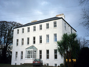
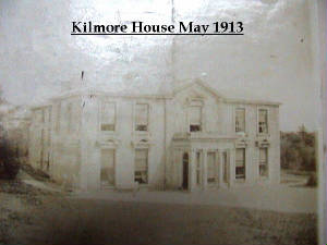
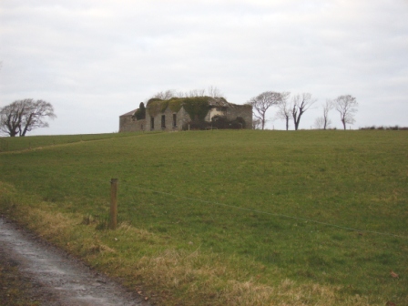
| Kilmore | The home of a branch of the Hickman family in the 18th and 19th centuries. In 1786 Wilson refers to it as the seat of Mr. Hickan. Inherited by the Gores in the 1860s. Burnt in July 1922. |
|
| Woodlawn House | Situated on the Hickman estate, this house valued at over £13 was unoccupied at the time of Griffith's Valuation and the lease held by Denis Culligan. Joseph Studdert had occupied the house in 1837. He was a grandson of Maurice Studdert of Elm Hill, county Limerick. One of Joseph's sons married Mary Gore of Tyredagh Castle and the Gore Hickmans appear to have occupied the house in the late 19th and early 20th centuries. This house is now a ruin. |
|
| Oaklands | A one storey 18th century house on the Hickman estates occupied by William Henn in 1814 and by R. Hunt in 1837. The residence of the Bennett family from at least the mid 19th century and sold by the Misses Bennett in 1929. | |
| Doonnagurroge Castle | Weir writes that this is a 17th century house with a Hodges coat of arms over a door. William Monsell is recorded as the proprietor of Donogroge, Kilrush in 1814. Situated on the Hickman estate it was occupied by George Crowe Hodges in 1837 and at the time of Griffith's Valuation. The Clare Journal (17 Nov 1856) records the death of this gentleman aged 70. The home of the Talty family in the later part of the 19th century. |
|
| Doolough Lodge | At the time of Griffith's Valuation Matthew Kelly [of Kilrush] held a herd's house valued at £3 and 201 acres from Edward O'Brien at Treanmanagh. The house dates from about the mid 19th century and was the Irish home of Matthew's son General Sir Thomas Kelly Kenny. Weir writes that the General had King George V to stay in the house following the King's coronation in 1910. | |
| Seafield Lodge | The home of the Casey family in the late 18th and early 19th centuries. Occupied by William Casey in 1814. Leased by Captain Francis Casey to William Brew in the mid 19th century and it remained a Brew home until it was burned down in 1922. | |
| Belleview/Bellevue | A house located on the Vandeleur estate close to the town of Kilrush, the residence of Captain Jewell in 1814 and of Nicholas S. O'Gorman at the time of Griffith's Valuation, when it was valued at £11. Weir writes that this was a late 18th century house, still extant. |
|
| Cappagh Lodge | Another larger house in Ballynote West townland, valued at £18 at the time of Griffith's Valuation and occupied by Robert H. Borough, who held it from Nicholas S. O'Gorman. This house is labelled Cappagh Lodge on the 25-inch Ordnance Survey map of the 1890s. Local sources indicate it was later occupied by the Butler family. Later in the twentieth century it was taken over by the Ryan family whose descendants still live there. | |
| Shannon View (Tarbert) | At the time of Griffith's Valuation, Richard Hinde held a farmhouse at Coolnanoonagh, valued at £2 15s. A house labelled Shannon View appears at this location on the 25-inch edition Ordnance Survey map, published in the 1890s. A house is still extant at the site. | |
| Fort House | This house near the town of Kilrush was the residence of John Trousdell in 1814. Occupied by Richard Studdert in the early 1850s who held the house valued at £7 and three acres from Brew Cox Donovan. Weir writes that it was the agent's house for the Vandeleur estate at one time. | |
| Summer Lodge | Part of the Studdert estate held from the Marquis of Conyngham, the buildings were valued at £12+ at the time of Griffith's Valuation and the house was in the occupation of Jonas Studdert. A house still exists at the site. | |
| Querrin Lodge | Querrin Lodge was enlarged after the publication of the 1st edition Ordnance Survey Map and Griffith's Valuation. Borough family history indicates that it became the property of Randal Borough of Cappagh Lodge in the early 1850s. It is labelled Querrin Lodge on the 25-inch edition map of the 1890s. The building is still extant but derelict. |