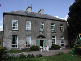
Cloonmurray
Houses within 10km of this house
Displaying 34 houses.
Houses within 10km of Cloonmurray
Displaying 34 houses.
| House name | Description | |
|---|---|---|
| Ballaghawbeg | Richard Irwin's estate owned a herd's house valued at £2 together with over 400 acres at Ballaghawbeg, barony of Castlereagh, at the time of Griffith's Valuation. The Census of Elphin in 1749 recorded that Charles O'Conor, farmer, held this property at the time. Some ruins exist at the site. | |
| Milltown | Roderick O'Conor/O'Connor occupied the property at Milltown, barony of Castlerea, valued at £36, at the time of Griffith's Valuation. It was also recorded as his seat in both 1814 and 1837. Gormley states that nothing of the house now remains save for traces of the mile long avenue. | |
| Brierfield | The Hawkes family built a chapel of ease at Brierfield in 1720. Brierfield was their main residence in the 18th and 19th centuries. Sold to Cox Cotton in the late 19th century, no longer extant. | |
| Ballymacurly | Andrew McDermott was farming at Ballymackeriley, parish of Cloonygormican in 1749. Occupied by Michael Nolan in 1837 and in the 1850s and held from Hugh O'Byrne. |
|
| Holywell | Originally a Gunning home that passed to the Blakeneys by marriage. In 1786 Wilson mentions it as the seat of Charles Blakeney. Occupied by C. W. Blakeney in 1837 and by Henry Smyth in the 1850s who held the property from John Goodall. The property is no longer extant. | |
| Derrane House | The home of the Corr family in the 19th century, Henry Corr is recorded as living at "Durham" in 1814. Henry "Gorr" was residing in a property here valued at £12 at the time of Griffith's Valuation. It is recorded as "Derrane House [in ruins]" on the 25-inch Ordnance Survey map of the 1890s and very little trace remains of it now. | |
| Drumdaff | Charles Croghan, a farmer, lived at Drumduff in 1749. Home of the Digby family in the 19th century. Held in fee by George Digby at the time of Griffith's Valuation when the buildings were valued at £17.It is still extant and maintained. |

|
| Fairymount | The home of Edward Mills in 1814. In 1828 Edward Mills of Fairymount was a member of the Grand Panel of county Roscommon. Residence of Mr Lyster at the time of the first Ordnance Survey. By the time of Griffith's Valuation the largest house in the townland of Fairymount was valued at £1.15s, leased by Anne Lyster to Michael Connolly. | |
| Cloonyquin | Home of the French family, including the song writer Percy French, sold by the family in the 1950s. In 1786 Wilson refers to it as a seat of Arthur French in 1786. Valued at £24 in the mid 19th century. The house was demolished in the 1960s. See www.percyfrench.ie. |
|
| Mount Pleasant | The residence of John Devenish in the mid 19th century. In 1894 Slater noted it as the seat of Michael Murray. It does not appear to be extant. On the first Ordnance Survey map another house known as Riverdale is also located at M907 775 within the Mount Pleasant demesne. Buildings are still present at this site. | |
| Cargins Park | The home of the Kelly family from the mid 18th century. Wilson refers to "Cargans, the seat of the late Daniel Kelly" in 1786. It was occupied by John D'Arcy when the estate was sold in 1852. A Victorian three bay house was the home of Daniel Kelly. Sold to Captain Drought in the mid 19th century, held by him in fee and valued at £15. The present house is not the same as Kelly's Victorian one. Renovated in the early 21st century. | |
| Cloonfree | The residence of William Mahon. Apparently the residence of George Knox in the 1840s. http://www.ballykilcline.com/story_f.html | |
| Castlenode House | Residence of Thomas Morton esq in 1822 and of J. Morton in 1837. In the mid 1850s, George Walpole was the occupant of this house, which he held from the Pakenham Mahon estate when it was valued at £8. A house still occupies the site of the original Castlenode House. | |
| Strokestown House | Late 17th century house altered in the early 19th century and home of the Mahon family for three centuries. In 1786 Wilson described it as "fine mansion house with ample and beautiful demesne". Referred to as "Bawn House", the mansion of Lord Hartland, by Lewis in 1837. Valued at £70 in the mid 19th century. Now a major tourist attraction containing the Famine Museum. http://www.strokestownpark.ie/ |
|
| Newtown Glebe | Newtown Lodge was occupied by Anthony Dignam in 1814 and the Glebe House at Newtown, valued at £18, was occupied by Reverend Joseph Morton at the time of Griffith's Valuation. It was leased from the Pakenham-Mahon estate. It is still extant. | |
| Cloonfinlough Lodge | Occupied by Robert Devenish at the time of Griffith's Valuation, who held the property from John Caulfeild. Buildings are still extant at the site. | |
| Clogher Beg | Mary Gormley writes that this house was built by the Knoxes who acquired some of the Plunkett of Castle Plunkett estate. Occupied by Thomas Stafford at the time of Griffith's Valuation, held from James Murphy. | |
| Foxborough | In 1786 Wilson refers to Foxborough as the seat of Arthur French. Occupied by Patrick Taaffe at the time of Griffith's Valuation, who was leasing from Christopher French. The house was then valued at £20. It is now a ruin though the stable yard survives. | |
| Ardkeenagh House | Michael Plunkett was farming at Ardkeenagh in 1749. In 1814 it was the home of Nicholas Peyton and of Mrs Hawkes in 1837. At the time of Griffith's Valuation the house was vacant but the surrounding lands were held by Patrick Moran from James Somerville. Buildings are still extant at the site. | |
| Bloomfield | In the possession of John Farrell in 1814 and of H. O'Farrell medical doctor in 1837. In the mid 19th century held by the Reverend Peter Toler in fee and valued at £10. Toler appears to have purchased Bloomfield from the sale of the Cargins Park estate by the trustees of Daniel Kelly. | |
| Mount Browne | At the time of Griffith's Valuation occupied by George Browne who held the property from James G.Plunkett, valued at £25. The sale rental of the Gunning Plunkett estate in June 1857 states that Mount Browne was held by a fee farm grant from Jane Plunkett, mother and guardian of the owner, to George Browne, dated 30 Oct 1852. Occupied by the representatives of Arthur Browne in 1894 and 1906. | |
| Bettyfield | Recorded as the seat of Sir John Conroy or O'Mulconry in the Ordnance Survey Field Name Books. Arthur O'Connor was the main tenant in the townland of Shankill at the time of Griffith's Valuation. | |
| Creta | Occupied by George Harken in 1814 and Daniel Hughes in the mid 1850s and valued at £8. Creta Cottage was occupied by Captain Dillon in 1837. A house is still extant at the site. | |
| Toberpatrick | Originally a Wynne property, occupied by Mulloy McDermott in 1837. In the 1830s the townland is recorded as including the ruins of Clooncaface House. The residence of Alonzo Lawder in the mid 19th century, held in fee and valued at £20. Occupied by B. F. McDonnell in 1906. A later house is extant at the site now. | |
| Cherryfield | Home of the Mills family in 1778. Noted by Wilson as "the fine seat of Oliver Mills" in 1786. Lewis refers to it as a seat of the same family in 1837. It was occupied by Michael Butler in the 1850s and held from John Carroll, valued at £10. It came into the ownership of the McGreavy family in the latter part of the nineteenth century and remained in their possession until the 1960s. It is now derelict. | |
| Castleplunkett | Gormley states that the Plunketts built a mansion near Castleplunkett village sometime between 1655-1660. This building was later destroyed by fire in the mid-nineteenth century and the stones later used in building in the area. | |
| Lisroyne Lodge | A house on the outskirts of Strokestown, part of the Strokestown House demesne, valued at £10 at the time of Griffith's Valuation and occupied by Michael Flynn. Some buildings are still extant at the site. | |
| Toomona | The home of Michael Connor, a gentleman in 1749, just outside Tulsk. The residence of Michael's grandson Peter O'Connor in 1814 and 1837. At the time of Griffith's Valuation Toomona was valued at £10 and was occupied by Maria French who held it from Lord Crofton. Later occupants included Colonel Lynham, Matt Flanagan, the Murphy and Fallon families. Accidently burnt in the 1970s. | |
| Lisnaneane | Gormley states that the widow of Dominick O'Conor Don lived at Lisnanean after Dominick's death in 1795. Later it was the home of Malachy Madden in 1814 and of Catherine O'Conor Don's nephew Robert Nolan and his family in the 1830s. No demesne is marked on the first Ordnance Survey map. At the time of Griffith's Valuation the house was valued at £5 and was held by Robert Nolan in fee. A house still exists at the site. | |
| Rossmore | Rossmore East was part of the estate of James Murphy at the time of Griffith's Valuation. The house was built circa 1860s (Buildings of Ireland). However the Ordnance Survey Field Name Books record a house and large gardens in the 1830s. |
|
| Brook Lodge | The Ordnance Survey Name Books refer to Brook Lodge in the south of this townland. The house is labelled Brook Lodge on the 1st edition Ordnance Survey map but seems to have disappeared by the time the 25-inch edition was published in the 1890s. Modern buildings occupy the site now. | |
| Corbally House (Roscommon) | Patt Dunn, an agent, was living at Corbally in 1749. The home of members of the Plunkett family in the early 19th century. Occupied by William Phibbs at the time of Griffith's Valuation, held from John Egan and valued at £8. A house still exists at the site. | |
| Ballyoughter | Occupied by John Goldsmith at the time of Griffith's Valuation. He held the house valued at £8 and 60 acres from Marcus McCausland. Another John Goldsmith was residing in Ballyoughter a hundred years earlier at the time of the Elphin Census. Wilson also refers to the house as the seat of Mr. Goldsmith in 1786. A later house, also named Ballyoughter House, is shown on the 25-inch Ordnance Survey map of the 1890s and there is still a house at this site, | |
| Grange House | This house marked on the first Ordnance Survey map but not named would appear to have been the Ormsby's main residence in this townland. In 1786 Wilson refers to Grange as the seat of Gilbert Ormsby. It is labelled Grange House on the 25-inch Ordnance Survey map of the 1890s. The townland was part of the Farrell estate at the time of Griffith's Valuation. There is still a house extant at this site. |