Blacker
The estate of St. John Blacker, of Ballylongford and Killylea, county Armagh, amounted to over 8000 acres in county Kerry in the 1870s as well as 200 acres in Armagh. He was a descendent of Samuel Blacker, of the Carrickblacker family. In 1880 he assumed the name Douglas under the terms of the will lof his uncle, Charles Douglas, of Grace Hall, county Armagh. His estate held townlands in the parishes of Aghavallen and Lisselton, barony of Iraghticonnor at the time of Griffith's Valuation.
Associated Families
Houses
| Name | Townland | Civil Parish | PLU | DED | Barony | County | Map Ref | |
|---|---|---|---|---|---|---|---|---|
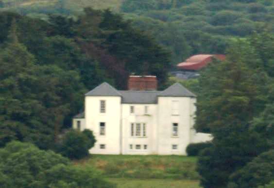
| Aghangran House | Aghanagran | Aghavallen | Listowel | Carrig 113 | Iraghticonnor | Kerry |
OSI Ref: Q988435
OS Sheet: 5 Discovery map: 63 |
|
| Ballyline | Ballyline East | Aghavallen | Listowel | Lislaughtin | Iraghticonnor | Kerry |
OSI Ref: Q996430
OS Sheet: 5 Discovery map: 63 |
|
| Farranawana House | Farranawana | Kilnaughtin | Listowel | Lisselton | Iraghticonnor | Kerry |
OSI Ref: R053468
OS Sheet: 3 Discovery map: 64 |
|
| Aughrim | Aughrim | Murher | Listowel | Leitrim 125 | Iraghticonnor | Kerry |
OSI Ref: R074412
OS Sheet: 6 Discovery map: 64 |
|
| Ballydonohoe | Ballydonohoe | Kilfergus | Glin | Glin 78 | Shanid | Limerick |
OSI Ref: R091 474
OS Sheet: 17 Discovery map: 64 |
|
Map of Estate Houses
Click on the markers to view more details about each house.
Archival sources
- D959, D1252 : c1675-20th cent: deeds c1675-c1920, maps and rentals 1826-77, estate corresp 19th cent, legal papers from c1880; Public Record Office, Northern Ireland
- MS858: L C M Blacker, 'A History of the Family of Blacker in Carrickblacker, Ireland' 1901-1952. ; Yorkshire Archaeological Society
Contemporary printed sources
- PARLIAMENTARY PAPERS. ''Return of owners of land of one acre and upwards, in the several counties .... in Ireland''. HC 1876, LXXX: 141
- HUSSEY DE BURGH, U. H. ''The Landowners of Ireland. An alphabetical list of the owners of estates of 500 acres or £500 valuation and upwards in Ireland''. Dublin: Hodges, Foster and Figgis, 1878. [available online at www.askaboutireland.ie] : 36
- ''GRIFFITH'S VALUATION OF IRELAND'[Primary Valuation of Tenements]', 1850-1858. : Iraghticonnor Barony: 1 (Aghanagran Lower), 7 (Ballyline East), 73 (Farranawana), 121 (Aughrim)
- LEET, Ambrose. ''A directory to the market towns, villages, gentlemen's seats, and other noted places in Ireland''. Dublin: Printed by B. Smith, 1814 : 16 (Aughana-green)
- LEWIS, Samuel. ''A Topographical Dictionary of Ireland''. London: S. Lewis & Co., 1837: Vol.I, 18 (Aghavallin Parish)
- ORDNANCE SURVEY NAME BOOKS County Kerry: Vol.I, Aghavallen Parish, 46.
- BATEMAN, John. ''The great landowners of Great Britain and Ireland''. London: Harrison, 1883. : p.136
Modern printed sources
- BURKE, Sir Bernard. ''A genealogical and heraldic history of the Landed Gentry of Ireland''. London: Harrison & Sons, 1912: 45
- Bary, Valerie. ''Historical Genealogical Architectural notes of some Houses of Kerry'' Whitegate, county Clare: Ballinakella Press, 1994. : 17 (Aughanagran)
- MONTGOMERY-MASSINGBERD, Hugh (ed). ''Burke's Irish Family Records''. London: Burke's Peerage, 1976: 113-115
- WALFORD, Edward. 'The County families of the United Kingdom''. London: Chatto and Windus, 1885): p.91