Barony: Fore (Westmeath)
Houses
Displaying 30 houses.
| Name | Townland | Civil Parish | PLU | DED | Barony | County | Map Ref | |
|---|---|---|---|---|---|---|---|---|
| Gore Port [Derrymacegan] | Clareisland or Derrymacegan | Foyran | Granard | Finnea | Westmeath |
OSI Ref: N436816
OS Sheet: 1 Discovery map: |
||
| Annis Grove | Money | Foyran | Granard | Finnea | Westmeath |
OSI Ref: N447806
OS Sheet: 1 Discovery map: |
||
| Tullystown | Tullystown | Foyran | Granard | Finnea | Westmeath |
OSI Ref: N452806
OS Sheet: 1 Discovery map: |
|
|
| Gaulstown House (Fore) | Ballynagall | Lickbla | Granard | Glore | Westmeath |
OSI Ref: N437726
OS Sheet: 3 Discovery map: |
|
|
| Carlanstown | Carlanstown | Lickbla | Granard | Knockarrow | Westmeath |
OSI Ref: N436771
OS Sheet: 1 Discovery map: |

|
|
| Castletown Cottage | Castletown Lower | Lickbla | Granard | Knockarrow | Westmeath |
OSI Ref: N439791
OS Sheet: 1 Discovery map: 41 |
|
|
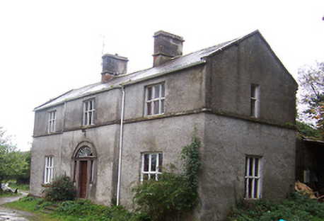
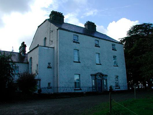
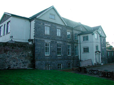
| Lickbla House [ Rockbrook](Fore) | Lickbla | Likbla | Granard | Glore | Westmeath |
OSI Ref: N445742
OS Sheet: 3 Discovery map: 41 |
](https://landedestates.ie/storage/img/orig/3618.png)
|
|
| Newcastle (Fore) | Newcastle | Lickbla | Granard | Glore | Westmeath |
OSI Ref: N416753
OS Sheet: 3 Discovery map: 41 |
||
| Tromra House | Tromra | Rathgarve | Granard | Coolure | Westmeath |
OSI Ref: N453718
OS Sheet: 3 Discovery map: 41 |
|
|
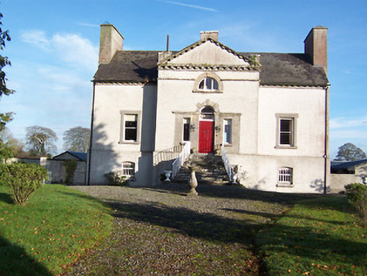
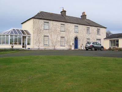
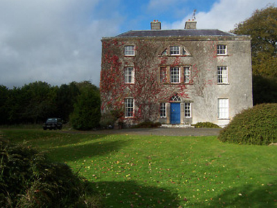
| Mayne Glebe [Mayne Rectory] | Mayne | Mayne | Granard | Coole | Westmeath |
OSI Ref: N417714
OS Sheet: 3 Discovery map: 41 |
![Photo of Mayne Glebe [Mayne Rectory]](https://landedestates.ie/storage/img/orig/3615.png)
|
|
| Lakeview House (Fore) | Coole | Mayne | Granard | Coole | Westmeath |
OSI Ref: N412725
OS Sheet: 3 Discovery map: 41 |
||
| Coolure | Coolure Demesne | Mayne | Granard | Coolure | Westmeath |
OSI Ref: N420695
OS Sheet: 7 Discovery map: 41 |
|
|
| Derrya | Derrya | Mayne | Granard | Coolure | Westmeath |
OSI Ref: N408693
OS Sheet: 7 Discovery map: 41 |
||
| Newtown House (Fore) | Newtown | Mayne | Granard | Coolure | Westmeath |
OSI Ref: N420715
OS Sheet: 3 Discovery map: 41 |
||
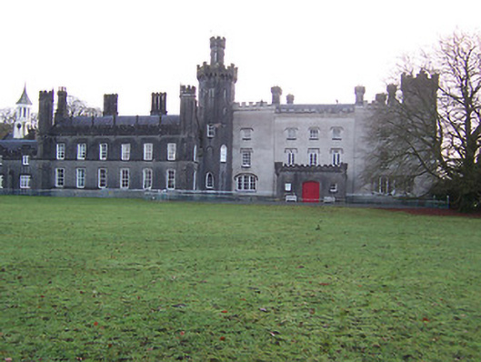
| Tullynally Castle | Pakenhamhall or Tullynally | Mayne | Granard | Coolure | Westmeath |
OSI Ref: N443704
OS Sheet: 3 Discovery map: 41 |
|
|
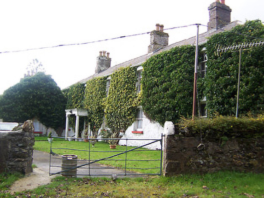
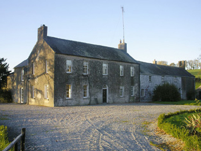
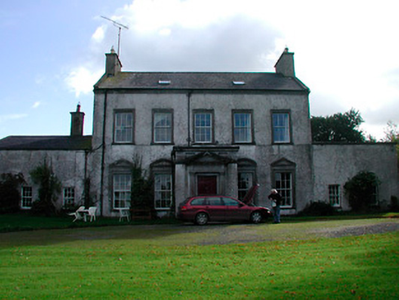
| Turbotstown [Turbotstown House] | Turbotstown | Mayne | Granard | Glore | Westmeath |
OSI Ref: N421728
OS Sheet: 3 Discovery map: |
![Photo of Turbotstown [Turbotstown House]](https://landedestates.ie/storage/img/orig/3616.png)
|
|
| Ballyknock House | Derrynagarragh | Faughalstown | Castletowndelvin | Kilpatrick 30 | Westmeath |
OSI Ref: N503649
OS Sheet: 8 Discovery map: 41 |
||
| Gartlandstown House | Gartlandstown | Faughalstown | Castletowndelvin | Kilpatrick 30 | Westmeath |
OSI Ref: N481632
OS Sheet: 12 Discovery map: 41 |
|
|
| Streamstown House | Streamstown | Kilpatrick | Castletowndelvin | Kilpatrick 30 | Westmeath |
OSI Ref: N521623
OS Sheet: 13 Discovery map: 42 |
|
|
| Clondalever House | Clondalever | Kilpatrick | Castletowndelvin | Kilpatrick 30 | Westmeath |
OSI Ref: N521623
OS Sheet: 13 Discovery map: 42 |
||
| Kinturk House | Kinturk Demesne | Rathgarve | Castletowndelvin | Kinturk | Westmeath |
OSI Ref: N463698
OS Sheet: 7 Discovery map: 41 |

|
|
| Barbavilla | Barbavilla Demesne | St Feighins | Castletowndelvin | Collinstown | Westmeath |
OSI Ref: N520652
OS Sheet: 8 Discovery map: 41 |
|
|
| Benison Lodge | Benisonlodge or Bratty | St Feighins | Castletowndelvin | Faughalstown 27 | Westmeath |
OSI Ref: N468674
OS Sheet: 7 Discovery map: 41 |
||
| Sallymount House | Clonnageeragh | St Feighins | Castletowndelvin | Fore West | Westmeath |
OSI Ref: N516720
OS Sheet: 4 Discovery map: 41 |
||
| Gillardstown | Gillardstown | St Feighins | Castletowndelvin | Collinstown 26 | Westmeath |
OSI Ref: N486666
OS Sheet: 7 Discovery map: 41 |
||
| Hilltown | Hilltown | St Feighins | Castletowndelvin | Hilltown 29 | Westmeath |
OSI Ref: N494752
OS Sheet: 3 Discovery map: 41 |
|
|
| Loughpark | Loughpark | St Feighins | Castletowndelvin | Kinturk | Westmeath |
OSI Ref: N489689
OS Sheet: 7 Discovery map: 41 |
|
|
| Lough Bawn | Carrick | St Marys | Castletowndelvin | Fore East 35 | Westmeath |
OSI Ref: N549707
OS Sheet: 4 Discovery map: 42 |

|
|
| Cummerstown House | Cummerstown | St Marys | Castletowndelvin | Fore East 35 | Westmeath |
OSI Ref: N545689
OS Sheet: 8 Discovery map: 42 |
||
| Glenidan | Glenidan | St Marys | Castletowndelvin | Fore East 35 | Westmeath |
OSI Ref: N558699
OS Sheet: 8 Discovery map: 42 |