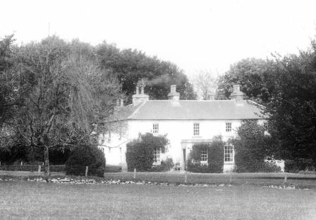
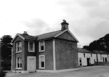
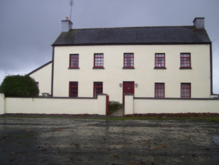
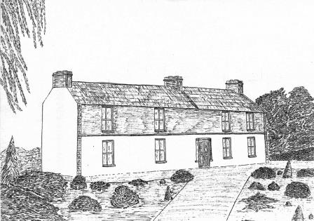
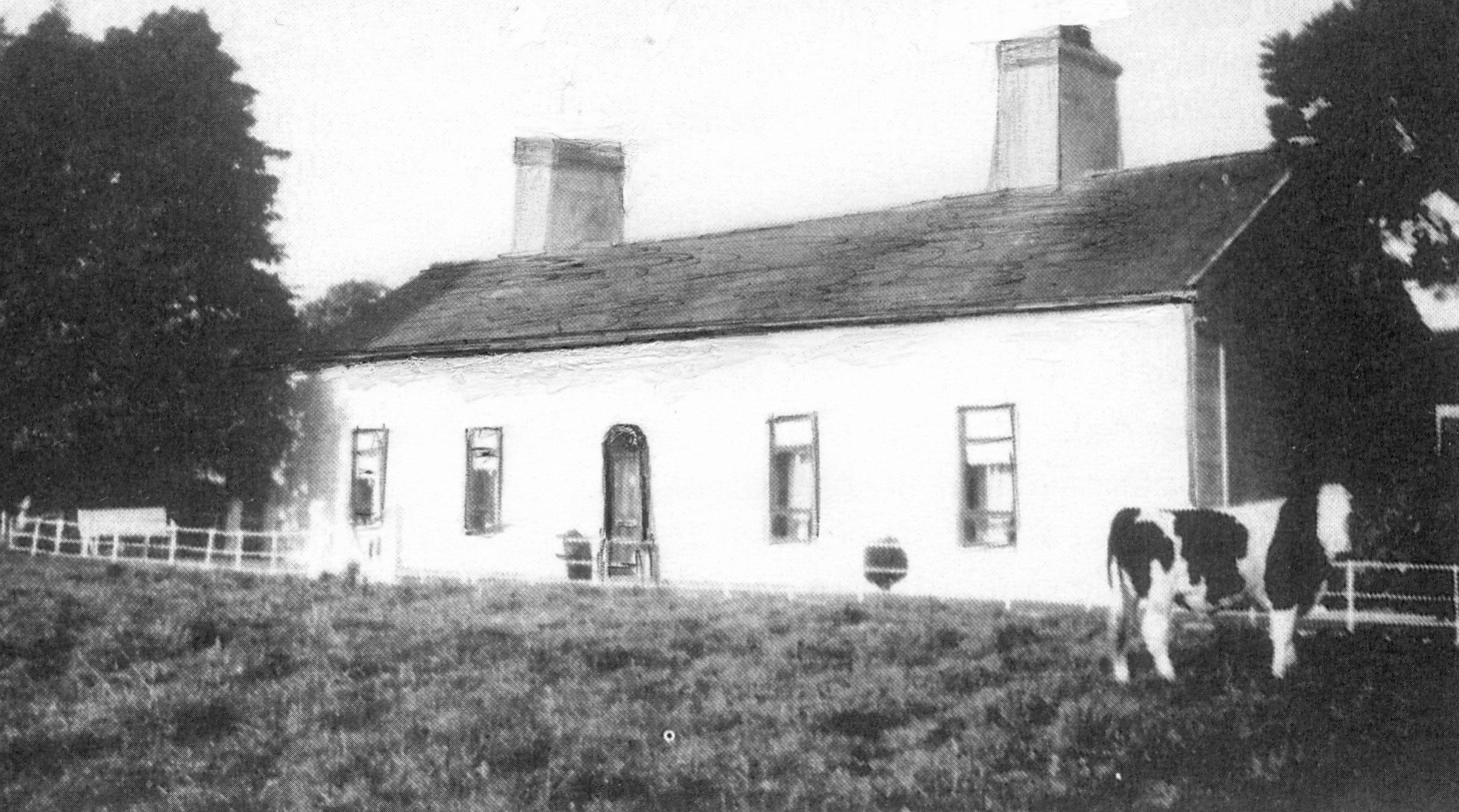
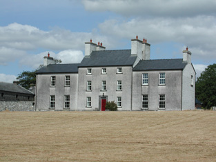
Gorteen
Houses within 10km of this house
Displaying 25 houses.
Houses within 10km of Gorteen
Displaying 25 houses.
| House name | Description | |
|---|---|---|
| Wellfort | Marked on the first edition Ordnance Survey map as Wilfort House, this property was held in fee by Richard D'Arcy at the time of Griffith's Valuation when it was valued at £18. It is named as Wellfort House on the 25-inch Ordnance Survey map of the 1890s. Wellfort is no longer extant. |
|
| Durrow | In 1786 Wilson refers to "Durra" as a seat of Mr. Bagot. At the time of Griffith's Valuation, Francis Hurley was leasing a property valued at £7 together with over 100 acres, from the Bagot estate at Durrow, barony of Ballymoe. A house is still extant at the site. |
|
| The Hermitage | The original house, named Hamlet Cottage, was beside the road and is marked on the 1838 Ordnance Survey map. A new house was later built and is labelled The Hermitage on the 25-inch Ordnance Map of the 1890s. A house is still extant at the site. |
|
| Roseberry House | Described as 'an excellent two story slated house' in 1850. At the time of Griffith's Valuation it was held in fee by William Bodkin and valued at £15. This house is no longer extant. | |
| Carrolton House | The house known as Beagh Lodge, an O'Carroll house, is shown on the First Edition Ordnance Survey . It is not visible on the 25-inch Ordnance Map of the 1890s. A house on a nearby site is labelled Carrolton House on the latter map. The original house is not extant though there are later buildings. |

|
| Springfield House | 18th century two-storey thatched house, described in 1863 as a house of ancient construction, still occuppied by the McDermott family in the early 20th century. At the time of Griffith's Valuation, it was occupied by Owen McDermott who was leasing from William McDermott and Glasgow Connolly and was valued at almost £12.. Portion of the house is still extant. |
|
| Clooncah | A house built after the publication of the 1st Ordnance Survey map, at the time of Griffith's Valuation it was by John Love. The house was valued at £12 and held from John Armstrong. In 1885 Walford describes John Armstrong as a magistrate for county Galway, and of "Clooncagh and South Hill, Clifden". The site at Clooncah is now occupied by farm buildings. | |
| Turlough House (Ballymoe) | Held in fee by John Cheevers at the time of Griffith's Valuation when the buildings were valued at £7 10s. Occupied by John J. Cheevers in the early 20th century. This house is no longer extant | |
| Glinsk House | In 1786 Wilson refers to Glinsk as the "seat of the late Sir John Burke" and also as the seat of Sir Rickby Burke. Glinsk Castle and a substanial house are both marked on the 1838 Ordnance Survey map. The castle is shown on the 25-inch map of the 1890s but there is no trace of the house. At the time of Griffith's Valuation, Allen Pollok held buildings valued at £1 15 at the site, recorded as a herd's house. | |
| Kedagh Park | Held by Bartholomew Kelly in fee at the time of Griffith's Valuation when it was valued at £11 10s. The house is labelled Kedagh Park on the First Edition Ordnance Survey map but as Clondoyle House on the 25-inch map of the 1890s. A house still exists at the site. | |
| Cloondoyle | In 1786, Wilson refers to "Clondowel" as the seat of Mr. Blake. At the time of Griffith's Valuation it was occupied by Thomas Kelly and held from [his father] Bartholomew Kelly. The house was valued at £8. It is labelled Clondoyle House on both the First and 25-inch editions of the Ordnance Survey map. A house still exists at the site. |
|
| Ashfield | At the time of Griffith's Valuation held by John Kelly in fee when the house was valued at £8. A building still exists at the site. | |
| Newtown | John Burke, a gentleman, was living at Newtown in 1749. Valued at £4 in the mid 1850s. The property seems to have disappeared by the time of the 25-inch Ordnance map of the 1890s. | |
| Mount Kelly | A Kelly property in the mid 18th century, which passed to a branch of the Bellew family through marriage. The original house was known as Drum House but was in ruins by the 1820s. Mount Kelly was owned by John William Browne at the time of Griffith's Valuation. The 19th century house appears as Lakeview.on the 1st edition Ordnance Survey map but as Mount Kelly on the 25-inch edition of the 1890s. A house still exists at the site. |
|
| Woodfield | Home of a branch of the Kirwan family in the 18th and early 19th centuries. By the time of Griffith's Valuation, the townland was owned by the Hancock family but no house had a substantial valuation. A house still exists at the site. | |
| Frenchlawn | At the time of Griffith's Valuation, the estate of William W.R. Sandford was leasing a property valued at £12 at Frenchlawn, barony of Castlereagh, to James Glancey. In 1837 Lewis recorded Frenchlawn as the seat of Mrs. French. In 1814 it was the residence of Christopher French. There is still an occupied house at this site. |
|
| Cleaboy House | Patrick Balfe was leasing a property valued at £10 from Teresa Madden at Cleaboy, barony of Castlereagh, at the time of Griffith's Valuation. A house is still extant at the site. | |
| Caher | At the time of Griffith's Valuation, Harriett Dickson and Maria Squirl were leasing a property valued at £5 together with 235 acres at Caher, barony of Castlereagh, to Bernard Sweeney. | |
| Willsbrook House | Originally a property of the Wills family who inherited the Sandford estate through Mrs. Mary Wills. In the 1850s Willsbrook was leased by Michael O'Connor. In 1814 it had been the seat of Daniel O'Connor. Willsbrook House is no longer extant. | |
| Laragh and Ross | The residence of Thomas Tighe in 1814. In 1830 held in fee by the Mahons of Cavetown. At the time of Griffith's Valuation occupied by Patrick Joseph O'Connor who held the house from Patrick O'Connor. Modern farm buildings occupy the site now. | |
| Corrastoona More House | In 1749 Richard Kirwan was living at Coristoonamore. This house appears to have been the residence of K. Lyster [Kirwan Lyster?] in 1814 and of F.T. Byrne in 1837. Occupied by Patrick O'Connor in the mid 1850s, who held the house from Christopher Hamilton. Valued at £2 in 1906 and in the occupation of Sir N. O'Conor. It is no longer extant. | |
| Bopeep Lodge | A Blakeney property that was leased to H. French in the 1830s and to Robert French in the 1850s. |
|
| Dundermot | A Blakeney property, built circa 1750.Taylor and Skinner note is as occupied by Owens esquire in 1778. In 1786, Wilson refers to it as the seat of Samuel Owens Lee. It was the residence of Richard Kelly in 1814 and held by Patrick O'Connor at the time of Griffith's Valuation when the house was valued at £36. In the 1890s it became the home of the Blake-Kellys, although Nicholas O'Conor is recorded as the occupier in the valuation lists for 1906. Still extant and restored in the early 21st century. |
|
| Leabeg | Wilson refers to Leabeg as the seat of Mr. "Irvine" in 1786. The residence of Edward Irwin in 1814 and held by Daniel H. Irwin in fee at the time of Griffith's Valuation, when the house was valued at £6. It is described as "in ruins" on the 25-inch Ordnance Survey map of the 1890s. | |
| Marnellsgrove | The home of the Marnell family at the beginning of the 19th century. Richard Marnell was resident in 1814. |