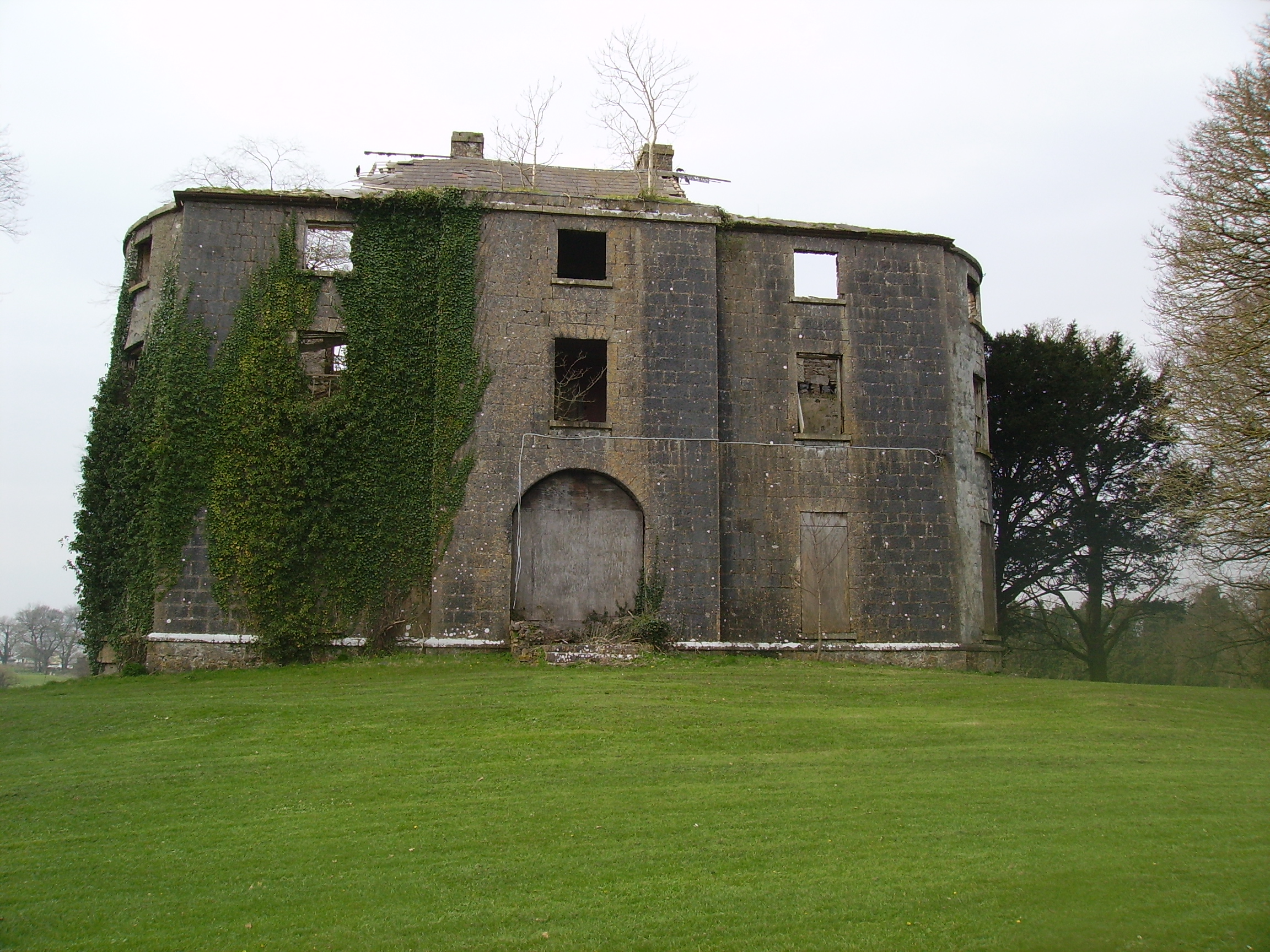
Carrolton House
Houses within 10km of this house
Displaying 13 houses.
Houses within 10km of Carrolton House
Displaying 13 houses.
| House name | Description | |
|---|---|---|
| Clonbern Park | A house built after the publication of the 1st edition Ordnance Map. The property in this townland was held by Charles O'Rorke at the time of Griffith's Valuation when it was valued at almost £8. Clonbern Park no longer exists but the stable block and walled garden are still evident on the site. |
|
| Ballintava | In 1906 Samuel Barret owned the mansion house at Ballintava which was valued at almost £14. The house is extant and appeared to be in the process of renovation in the early 21st century. |

|
| Springfield House | 18th century two-storey thatched house, described in 1863 as a house of ancient construction, still occuppied by the McDermott family in the early 20th century. At the time of Griffith's Valuation, it was occupied by Owen McDermott who was leasing from William McDermott and Glasgow Connolly and was valued at almost £12.. Portion of the house is still extant. |
|
| Gorteen | The residence of Patrick O'Beirne by 1837 and of Anne O'Beirne at the time of Griffith's Valuation, who held the house from Patrick Grehan. It was valued at £8. The original house is no longer extant. | |
| Carrowntryla | Occupied by Henry esq in the 1770s and in 1786. It was the home of the Handcock family in the 19th century, sold to Captain Dick in 1897 and occupied by him in the early years of the 20th century. Bought by Major Gerald Stratford Handcock in 1928 and inherited by his niece, Mrs Voss, who sold the house to Hector McDonnell, a Galway building contractor. The house is no longer extant. |
|
| Mount Kelly | A Kelly property in the mid 18th century, which passed to a branch of the Bellew family through marriage. The original house was known as Drum House but was in ruins by the 1820s. Mount Kelly was owned by John William Browne at the time of Griffith's Valuation. The 19th century house appears as Lakeview.on the 1st edition Ordnance Survey map but as Mount Kelly on the 25-inch edition of the 1890s. A house still exists at the site. |
|
| Dunmore House | William D. Griffith, brother of Richard Griffith of ''Valuation'' fame, was agent to Sir George Shee in the mid 19th century and lived at Dunmore House. In 1894 Slater refers to Dunmore House as the seat of Captain Robert W. Martin. A fine ruin situated on the edge of the golf course. |
|
| Prospect | Richard Ouseley (1733-1804) rebuilt Prospect House and let it to Captain Charles O'Connor. The remains of outbuildings are still visible. |
|
| Dunmore Castle | A tower house occupied by the Ouseley family from the late 17th century. In ruins by the late 19th century. |

|
| Woodfield | Home of a branch of the Kirwan family in the 18th and early 19th centuries. By the time of Griffith's Valuation, the townland was owned by the Hancock family but no house had a substantial valuation. A house still exists at the site. | |
| Carrowpadden | Carrowpadden House is marked on the Taylor and Skinner map of 1778. In 1786 Wilson refers to it as the seat of Mr. Higgins. A herd's house occupied by Thomas Higgins who held it from James Higgins is recorded in the townland of Carrowpadden East at the time of Griffith's Valuation. It was valued at almost £5. This property appears to have been built after the first Ordnance Survey map was published. There is still a house extant at the site. | |
| Lowberry | The Encumbered Estates' Sale notice of May 1856 indicates that the mansion at Lowberry had "formerly" stood in the demesne and recommends it as a "most desirable site for building". It is shown on the First Edition Ordnance Survey map but no buildings are recorded in the townland at the time of Griffith's Valuation. It is labelled "Lowberry House (in ruins)" on the 25-inch map of the 1890s. A portion of these ruins still remain at the site. | |
| Dunmore Lodge | Melvin states that the Dunmore estate had been inherited by the Gores in the early eighteenth century and that Ralph Gore resided at Dunmore during that century. His mansion was subsequently in use as a barracks until it was destroyed during the Civil War in the early twentieth century. Marked on the Taylor and Skinner map of 1778 as the residence of the Earl of Ross and also noted as "the fine seat of the Earl of Ross" by Wilson in 1786. In 1814 Leet noted "Dunmore Lodge" as the residence of John Egan. |