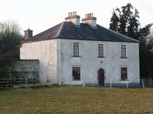
Carrownacregg West
Houses within 5km of this house
Displaying 9 houses.
Houses within 5km of Carrownacregg West
Displaying 9 houses.
| House name | Description | |
|---|---|---|
| Vermount | Also known as Munine or Moneen, the house was described as 'in ruins' on the Ordnance Survey 6 inch map (1932), following its burning in 1923. Extensive outbuildings are still in use and part of the yard is now a residence. McHale writes that this was, in fact, the original house. The National Inventory of Architectural Heritage suggests that the family occupied this building while Vermont House was being constructed. In 1786, Wilson refers to a house called "Munnine" as a seat of Mr. French. |
|
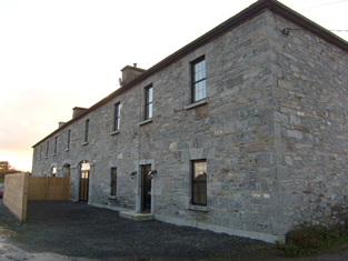
| Cross House | Built in the early 19th century and the home of the Evans family afterwards. The walls of the house and extensive farm buildings still remain alongside some modern farm buildings. |
|
| Windfield | Originally a Blake house, Wilson refers to it as the seat of Mr. Blake in 1786. It was sold to the Jameson family in the early 1820s and occupied by J. Lynch in the late 1830s. Catherine Lynch was leasing the property at the time of Griffith's Valuation, when it was valued at £30. The house was burnt in 1921 and nothing remains now. |
|
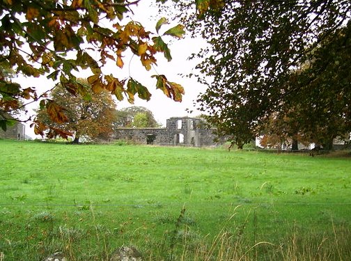
| Corgary or Corgerry | The house known as Corgary was part of the Joyce estate. At the time of Griffith's Valuation, it was occupied by Eleanor Morgan, leasing from Walter Joyce, and valued at £30. It was shown on the 25-inch Ordnance Survey map of the 1890s but labelled "in ruins" on the 6-inch map of 1932. | |
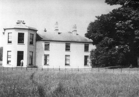
| Summerville/Thomastown | Home of Dominick G. Bodkin in 1814. The Bodkins intermarried with the Kilkellys. In 1855 the mansion house was described as 3 storeys high and in good repair. By the 1870s John Lyons of Summerville, Moylough, owned 218 acres in county Galway. In 1906 another source records Summerville, valued at £13.10 shillings, as occupied by John Lyons. Renovated in 2006 by its present owner Pat Lyons. |
|
| Cloverfield | Joseph E. Nolan was resident at the time of Griffith's Valuation when the house was valued at £4. It appears to have become ruinous by the time of the 25-inch Ordnance Survey map of the 1890s. | |
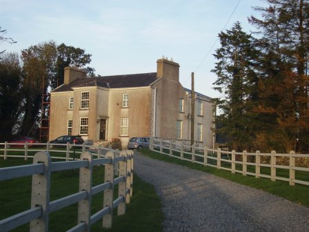
| Lakeview | Built by the Carr family and occupied by Michael Carr at the time of Griffith's Valuation when the house was valued at £13. A house is shown though not labelled on the 1st edition Ordnance Survey Map. It is named as Lakeview House on the 25-inch edition of the 1890s. Lakeview is still extant. |
|
| Moyloughmore | The O'Rorkes lived in the rectory at Moylough. At the time of Griffith's Valuation, Reverend John O'Rorke was leasing a property valued at £11 from Charles O'Rorke. The rectory is still extant. |
|
| Castle Bellew | Occupied by Peter Geraghty in the mid 1850s when it was valued at almost £9, this house is labelled as Castle Bellew House on the 25-inch Ordnance Survey map of the 1890s. It is no longer extant with some ruins remaining at the site. |