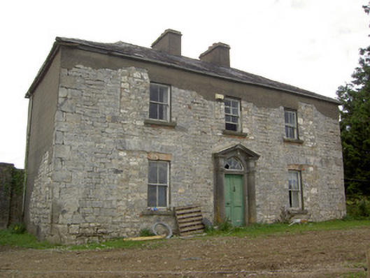
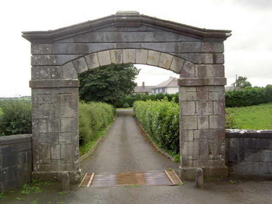
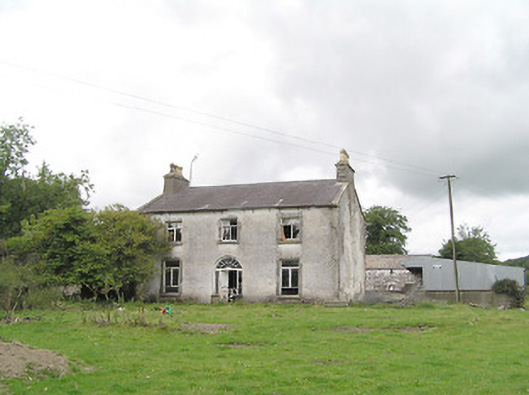
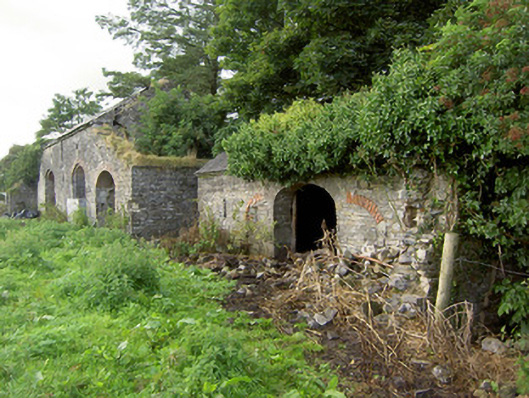
Millbrook (Granard)
Houses within 5km of this house
Displaying 12 houses.
Houses within 5km of Millbrook (Granard)
Displaying 12 houses.
| House name | Description | |
|---|---|---|
| Ballinlough House | Thomas Gosslin was the immediate lessor of Ballinlough House at the time of Griffiths Valuation in the early 1850s, when it was valued at £18. In 1814 Leet referred to it as the residence of J.C. Irwin. In 1835 the Valuation Office books mention Edward Irwin as the occupier. The building is still extant but no longer in use. |
|
| Dalystown House | Francis Tuite was leasing this property from the Thornton estate at the time of Griffiths Valuation, when it was valued at over £10. In the 1870s it was recorded as the address of Laurence Reynolds. This property is labelled Rockfield House on the 1st edition Ordnance Survey map but as Dalystown House on the 25-inch map of the early 20th century. In 1906 it was still in the ownership of Laurence Reynolds and valued at almost £23. The National Built Heritage Service suggests 1820 as a building date for the surviving farmyard complex. Dalystown House has been demolished. |
|
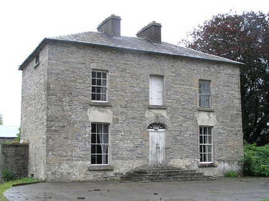
| Castle Nugent | At the time of Griffiths Valuation in the 1850s, William Webb was leasing this property from Arthur Kingston, when it was valued at £18. It was also recorded by Lewis as the seat of W. Webb in 1837. IN 1814 Leet referred to it as the residence of John West. The National Built Heritage Service suggests it was built c.1775. It is still extant but disused. |
|
| Moorhill House | At the time of Griffiths Valuation in the 1850s, John Simpson was leasing this property from Major Blackall’s estate, when it was valued at £26. It is still extant. |

|
| Lisryan | James Ennis was leasing this property from the Blackall estate at the time of Griffiths Valuation in the early 1850s, when it was valued at over £20. It is not labelled on any edition of the Ordnance Survey map, though a much-expanded building is shown on the 25-inch edition. The site is now occupied by a modern house. | |
| Mossvale | The Ordnance Survey Name books of the 1830s noted Mossvale as the seat of J. Barber. At the time of Griffiths Valuation. in the early 1850s, it was being leased from the Hamilton estate by William Lewis, when it was valued at £20. It was later demolished but the stables and other estate architecture survives. |
|
| Fernmount (Granard) | John B. Kirk was leasing this property from Richard Greville’s estate at the time of Griffiths Valuation in the 1850s, when it was valued at over £10. It is not named on the 6” OS map but a more substantial house is labelled Fernmount on the 25” map of the early 20th century. It is still extant. | |
| Higginstown House (Granard) | At the time of Griffiths Valuation in the early 1850s, Francis Tuite was leasing this property from Richard Greville’s estate when it was valued at £15. It is labelled Higginstown House on the 25” edition OS map of the early 20th century. The site is now occupied by large farm buildings. {Francis Tuite and his family are buried in the Church of Ireland church yard in Granard, see https://www.igp-web.com/IGPArchives/ire/longford/cemeteries/granard.htm ] | |
| Cloonfin House | John Thompson held this property in fee at the time of Griffiths Valuation in the early 1850s, when it was valued at £40. It has been demolished but a number of estate buildings survive. | |
| Toneen Lodge | At the time of Griffiths Valuation in the early 1850s, Nathaniel Callwell held this property in fee when it was valued at £25. A house labelled Toneen lodge is shown on the 1st edition Ordnance survey map at N343782. It is described as a small house in the Ordnance Survey Name Books. The current house, situated a short distance away, is labelled Toneen Lodge on the 25-inch edition of the early 20th century and is still extant. |

|
| Cartroncar House | Richard Taylor was leasing this property from Thomas Bond’s estate at the time of Griffiths Valuation, when it was valued at £25. In 1835 James Bond was recorded by the valuers as the occupier and the house had a valuation of £32. The Ordnance Survey Name Books note the existence of the house and demesne of Cartroncar in the townland, 'the seat of J.W. Bond'. It is still extant but disused. |
|
| Tully (Granard) | A steward’s house owned by Willougby Bond was located at Tully and valued at £15 at the time of Griffiths Valuation in the 1850s. The National Inventory of Architectural Heritage suggests this site had a long history dating back to an O'Farrell castle in the 17th century and later occupied by Newcomen and Wilson families before becoming part of the Bond estate. The Ordnance Survey Name Books mention that it was part of Major Bond's demesne with 'much old timber about the place'. Buildings still exist at this site. |