Ballymore Parochial House
Houses within 5km of this house
Displaying 11 houses.
Houses within 5km of Ballymore Parochial House
Displaying 11 houses.
| House name | Description | |
|---|---|---|
| Coolatore | This house was not built at the time of the first edition OS survey. It was constructed about 1866 and was the home of members of the Upton family. In 1906 it was valued at £56, occupied by Henry N S Upton who held it with over 400 acres of untenanted land. According to the discover Ireland website it now provides self-catering accommodation. |

|
| Grouse Lodge | Grouse Lodge is named on both the first 6 inch and 25 inch OS maps. Described as a three-bay two-storey over basement country house with attic level, built c.1810 (boi), now in use as a residential recording studio. Grouse Lodge was built by a branch of the Fetherstonhaugh Family of Ardagh, County Longford and was occupied by Theodore Fetherston in 1814 and by William Fetherstonhaugh at the time of Griffith’s Valuation. The building valued at £24 was held from Edward Fetherstonhaugh, who was the occupant in 1837. It is still a family home. |

|
| Moyvoughly | Moyvoughly named Moyvoughly Lodge on the first edition OS map and Moyvoughly House on the 25 inch map. O’Brien writes that this was originally Arabin land purchased towards the end of the 18th century by the Grogans. This house was constructed by 1837 as C Arabin was resident, who was probably leasing it from the Grogans. By the time of Griffith’s Valuation (publ. 1854) John Ennis had acquired the house and lands as he is recorded as holding the property in fee . O’Brien writes that he rented the house to William Dargan, the railway entrepreneur, who was building the Mullingar to Dublin railway line and that the land was used to graze and accommodate the horses used in this work. In the mid-1850s Moyvougly was leased to Thomas Maher who eventually purchased the estate. Bought by the Fallon family in the 20th century, the house is now demolished but some outbuildings and stables survive. |
|
| Umma or Emoe House | Umma or Emoe House is named on the first edition OS map. It was a Magan home from at least the early 18th century. Thomas Magan was resident in 1814. O’Brien writes that Francis Magan was the last family member to reside at Emoe. It was recorded as his seat in 1837. He died in 1841. At the time of Griffith’s Valuation (publ. 1854) James Hill Shaw held the house valued at £15 from George A Boyd. Another building with the same name is marked on the 25 inch map to the south east of the original house and is still extant (N198 453). This second house was built in 1900 (O’Brien) by the Shaw family. James Shaw of Ballymahon purchased the lands in 1875. Occupied by the Skelly family in the 20th century. | |
| Mosstown | Mosstown House named on both the first edition OS map and the 25 inch map. O’Brien writes that Mosstown was originally a property belonging to the Judge family and was sold to Cuthbert Fetherstonhaugh in 1790 and he was recorded as occupant in 1814. In 1837 it was recorded as ‘the principal seat’ of the parish ‘the handsome residence of Theobald Fetherston H.’ It remained a Fethetstonhaugh property until sold to William Dargan in the Encumbered Estates Court in 1851 (O’Brien). At the time of Griffith’s Valuation (publ. 1854) it was valued at £40 and occupied by Thomas Smith who held it from William Dargan. Later this house was occupied by members of the Fosberry and Adamson families. In 1906 George A G Adamson was the occupant. The house was destroyed by fire in 1938 and is now a green field site. | |
| Gortmore [Longfield] House (Ballymahon) | Arthur H. Griffith was leasing this property from the King-Harman estate at the time of Griffiths Valuation in the early 1850s, when it was valued at almost £41. The house shown on the 1st edition Ordnance survey map is labelled Longfield House. The expanded range of buildings at the site, shown on the 25-inch map of the early 20th century, is labelled Gortmore House. O'Brien writes that Arthur Hill Griffith built this house c.1840 but that the Griffith family moved to Australia in 1871. He also notes that the previous house, known as Longfield, had been occupied by members of the Langstaff family. In 1837 Lewis referred to Longfield as the seat of J. Langstaff. Gortmore is no longer extant. | |
| Drumraney | This property is described as “in chancery” at the time of Griffiths Valuation, though it was being leased by John Carney from the estate of Alicia O’Connor Malone. It was valued at £14. It is labelled as Drumraney House on the 1st edition Ordnance Survey map of 1838 but as “Constabulary barracks” on later edition maps. It is not extant now. | |
| Shinglis House | The 1906 Survey of Untenanted Demesnes indicates John Malone as the owner of a property at Shinglis, valued at almost £32. The 1st edition Ordnance Survey map shows the ruins of Shinglis Court adjacent to this site but the 25-inch map labels Shinglis House a short distance to the north-east. O'Brien provides a detailed account of the evolution of the houses at this site, notably those occupied by the Malone family. He notes that Shinglis was demolished in the 1970s. | |
| Newgrove [Badgersbridge House] (Ballymahon) | This property was held in fee by Dillon Kelly at the time of Griffiths Valuation, when it was valued at over £10. It is labelled Newgrove or Badgersbridge House on the 1st edition Ordnance Survey map but does not appear on subsequent maps. The Valuation Office books show that the house had been valued at £15 in 1840. | |
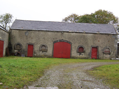
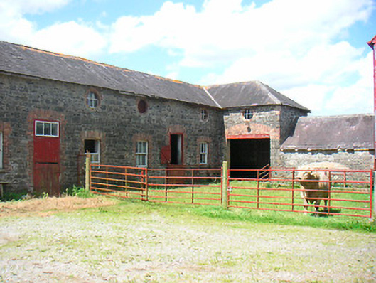
| Belmore Place | At the time of Griffiths Valuation in the early 1850s this property was held in fee by Robert W. Lowry, when it was valued at £16. It is labelled Belmore Place on all editions of the Ordnance Survey maps. O'Brien writes that the original house at this site had been occupied by Netterville Blake, who sold the property to Lowry in 1832. The National Inventory of Architectural Heritage suggests the surviving farm complex was built c.1850. The house was demolished in the 20th century. |
|
| Lissanode House | O'Brien writes that this house was occupied by the Russell family, probably from the early part of the eighteenth century. At the time of Griffiths Valuation, in 1854, it was occupied by Frederick W. Russell, leasing from the Boyd estate, when it had a valuation of £7. It was replaced by a more substantial house in the late nineteenth century following a fire. It is still extant. |