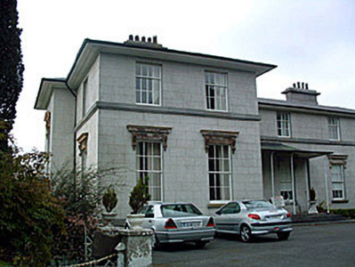
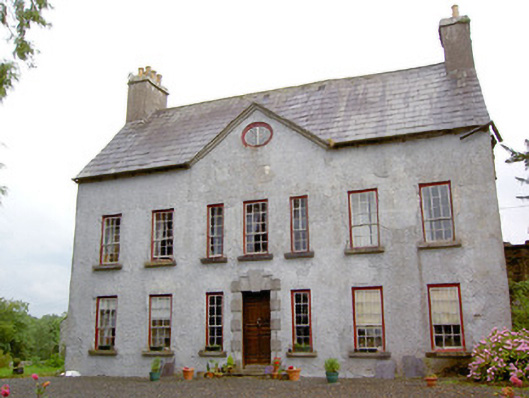
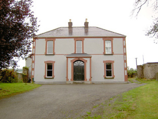
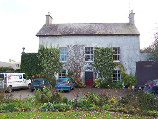
Kilcornan Lodge (Ballymahon)
Houses within 10km of this house
Displaying 48 houses.
Houses within 10km of Kilcornan Lodge (Ballymahon)
Displaying 48 houses.
| House name | Description | |
|---|---|---|
| Coolatore | This house was not built at the time of the first edition OS survey. It was constructed about 1866 and was the home of members of the Upton family. In 1906 it was valued at £56, occupied by Henry N S Upton who held it with over 400 acres of untenanted land. According to the discover Ireland website it now provides self-catering accommodation. |

|
| Grouse Lodge | Grouse Lodge is named on both the first 6 inch and 25 inch OS maps. Described as a three-bay two-storey over basement country house with attic level, built c.1810 (boi), now in use as a residential recording studio. Grouse Lodge was built by a branch of the Fetherstonhaugh Family of Ardagh, County Longford and was occupied by Theodore Fetherston in 1814 and by William Fetherstonhaugh at the time of Griffith’s Valuation. The building valued at £24 was held from Edward Fetherstonhaugh, who was the occupant in 1837. It is still a family home. |

|
| Ladywell | Although much of the demesne of Harmony Hall is shown in the townland of Bunown on the first edition OS map, the house Ladywell was not built at this time. An elegant Italianate country house, six-bay two-storey over (partial) basement country house on L-shaped plan, built about 1845 to a design by Sandham Symes (1808-1894), for the Mahon Family (boi). In the mid-19th century Ross Mahon was the occupant holding the building valued at £37 in fee. Members of the Metge, Crofton, Williams and Flannery have all been occupants of this house. It has extensive views over Killinure Lough to the south. |
|
| Killinure House | Killinure House located close to the eastern shore of Lough Ree is an early 19th century house originally constructed by a branch of the Murray Family. Occupied by Alexander Murray in 1814 and by Major General Murray in 1837. It was later the home of the Maunsell Family in the mid-to-late nineteenth-century. Members of the Brereton and Metge families were residents in the 20th century. It was later the home of the Reid family who opened it as a hotel. The Glasson Lakehouse hotel resort is located there now. |

|
| Annagh | Annagh was a Dillon home as probably were Glenmore and Lakeview houses also in this townland. There is a building still at the Glenmore site but the other two houses are gone. O’Brien writes that an early 19th century house was built in front of an earlier house and that Dillons lived here from at least the mid-18th century. In 1814 and 1837 Christopher R Dillon was resident and Mary Ann Dillon in the mid-19th century when the house was valued at £10 and held from Lord Ashtown of Woodlawn, County Galway. In the latter part of the 20th century the house was abandoned and is now derelict. | |
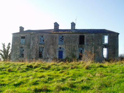
| Auburn | Auburn - Detached five-bay two-storey over raised basement house, built or rebuilt in the early 19th century (boi) This house takes its name from the Goldsmith Poem ‘The Deserted Village’, which was apparently inspired by the countryside surrounding this property where Goldsmith grew up as a boy. Auburn House was reputedly remodeled in the early nineteenth-century by John Hogan, whose father, a solicitor, acquired the property and estate from the Naper Family (of Loughcrew, Oldcastle, Co. Meath) in settlement of legal costs. J Hogan was the occupant in 1837. It was later sold to William Henry Daniel c.1848 and later to G.A.G. Adamson in 1864. In 1906 the buildings were valued at £34 and Charles G Adamson was the occupier. The Adamson family continued to reside at Auburn until about 1980. The house is now a ruin. |
|
| Easthill House | Detached three-bay early nineteenth-century Regency villa, built in 1803. This house was originally built by a branch of the Handcock-Temple family of nearby Waterstown House and by 1814 was the home of Richard Cuppaidge, who is also recorded in 1837 as the occupant. John Cuppaidge was resident at the time of Griffith’s Valuation. The house was the property of the Clynes, Dolan and O’Shea families in the 20th century. |
|
| Harmony Hall | O’Brien writes that Harmony hall was built in 1788 by Colonel William Caulfield, a member of a branch of the Caulfield family, Earls of Charlemont. In 1842, Colonel John Caulfield sold the house to Arthur Dunn Chaigneau and purchased Bloomfield House, Mullingar. Griffith’s Valuation records Chaigneau as the occupant and that the house was valued at £50. The National Inventory of Architectural Heritage states that the house was built by the Handcock Temple family. Occupied by Edward Molony Gleeson of the Athlone Woollen Mills in the 1880s. Occupied by the Fox, Wilson and Fitzsimons families in the 20th century. |
|
| Lackan Lodge | O’Brien writes of Walter Dillon living at Lackan in 1796. Lackan Lodge, valued at £14, was occupied by William Thomson in the mid-19th century. He held the property from the Dillons minors. A new building has been erected on this site. |
|
| Waterstown House | This Palladian style country house on rectangular plan, constructed c.1745 was designed by the German architect Richard Castle (1695-1751) for Gustavus Handcock and his wife Elizabeth Temple. It has important historical connections with the Temple-Handcock family, who were originally granted the lands around Waterstown as payment for services to the Crown during the Cromwellian Wars (boi). Robert Handcock Temple was resident in 1814 and 1837. Valued at £47 in the mid-19th century it was occupied by Robert Holmes. The buildings had increased in value to £61.15 in 1906. It remained within the Temple-Handcock family until mid-1923 when they sold the estate to the Land Commission. In 1928 the pedimented doorcase at Waterstown was removed and re-erected at Lissglassick House (Longford) and the house became a ruin in the 1930s. |
|
| Belville | O’Brien writes that Belville was built about 1775 for Richard Cuppaidge and by the early 1780s was occupied by the Jones family. It remained the Jones family home until at least the time of Griffith’s Valuation (publ. 1854) when Gustavus Jones Junior was resident. The house was valued at £23. It is now a ruin. | |
| Carn Park | Carn Park was built by the Adamson family in the late 18th century. Travers Adamson, son of William Gustavus Adamson was resident in 1814 and W G Adamson in 1837. At the time of Griffith’s Valuation (publ. 1854) the property was in Chancery, Robert Adamson was the occupant and the buildings were valued at £24. On 17 June 1870 when the house and lands were advertised for sale in the Land Court the house was described as a ‘commodious dwelling house (with suitable out offices) on Lot 1, which, although somewhat out of repair, is capable (at a moderate outlay) of being made a comfortable residence for a gentleman and his family. The house is prettily situated on the slope of a hill, commanding an extensive view’. It was bought by the Rev Thomas Thompson Gray of Dorrington, Drumraney, who was Vice Provost of Trinity College, Dublin, 1916-1924. The house was demolished in the mid-20th century. | |
| Coolvuck House | O’Brien writes that this early 19th century house was probably built by Francis Dillon, who was recorded as the occupant in 1814. Valued at £13 at the time of Griffith’s Valuation (publ. 1854), it was occupied by Eneas McDonnell who held the property from James George Murphy. Occupied by Thomas Groarke, a farmer and his sister in 1901 and by Thomas Killoughy, a shepherd who held it from Thomas Groarke in 1911. | |
| Mount Temple House | Mount Temple House is marked on the first edition OS map, south of Holy Trinity Church and named on the 25 inch map. Leet records Richard Telford as resident at Mount Temple. At the time of Griffith’s Valuation (publ. 1854) Sarah Russell held the house and 182 acres from the Hon R T H Temple, the buildings were valued at £12. This house now provides accommodation for guests. See lodging-world.com/ei/hotels/mount-temple-house-in-moate-91944640. |
|
| Twyford | Twyford House was originally built about 1760 by the Handcock Family of Waterstown House, Glassan, but passed into the ownership of the Hodson Family, at the end of the 18th century. In 1814 John Hodson was resident and E Hodson in 1837. Valued at £24 John Hodson was the occupant at the time of Griffith’s Valuation (publ. 1854), holding the property from John Longsworth. The Hodsons continued to reside at Twyford until it was sold about 1960. The house is now derelict. |
|
| Moyvoughly | Moyvoughly named Moyvoughly Lodge on the first edition OS map and Moyvoughly House on the 25 inch map. O’Brien writes that this was originally Arabin land purchased towards the end of the 18th century by the Grogans. This house was constructed by 1837 as C Arabin was resident, who was probably leasing it from the Grogans. By the time of Griffith’s Valuation (publ. 1854) John Ennis had acquired the house and lands as he is recorded as holding the property in fee . O’Brien writes that he rented the house to William Dargan, the railway entrepreneur, who was building the Mullingar to Dublin railway line and that the land was used to graze and accommodate the horses used in this work. In the mid-1850s Moyvougly was leased to Thomas Maher who eventually purchased the estate. Bought by the Fallon family in the 20th century, the house is now demolished but some outbuildings and stables survive. |
|
| Umma or Emoe House | Umma or Emoe House is named on the first edition OS map. It was a Magan home from at least the early 18th century. Thomas Magan was resident in 1814. O’Brien writes that Francis Magan was the last family member to reside at Emoe. It was recorded as his seat in 1837. He died in 1841. At the time of Griffith’s Valuation (publ. 1854) James Hill Shaw held the house valued at £15 from George A Boyd. Another building with the same name is marked on the 25 inch map to the south east of the original house and is still extant (N198 453). This second house was built in 1900 (O’Brien) by the Shaw family. James Shaw of Ballymahon purchased the lands in 1875. Occupied by the Skelly family in the 20th century. | |
| Ballinacor | Ballinacor is named on the first edition OS map. This two-storey, five-bay house was erected c 1740 and was the home of the Nugent family who were resident here from the 17th century until the mid-19th century. Referenced on the Taylor and Skinner maps of the late 1770s and occupied by Edward Nugent in 1814. In 1852 James Nugent, Count Nugent, sold the Ballinacor estate to the Halls. The sale rental describes the house as ‘large and commodious and in perfect habitable order’. At the time of Griffith’s Valuation (publ. 1854) Charles Hall held the house valued at £23 in fee. In 1906, Major George C Hall was recorded as the occupant. Bought by the Finnerty family in the early 20th century, the house is now demolished but the main entrance gates remain. |
|
| Mount Dalton | Mount Dalton, named on the first edition OS map but on the 25 inch map (c 1914) as Loughazon Hall. It is a six-bay two-storey over basement country house, built 1784, on a rectangular plan. Erected by Count Richard D'Alton (d. 1790) on his return to Ireland following a distinguished career in the Austrian Service but subsequently vacated by him when he took up the post of Governor of the Austrian Netherlands (Lewis 1837 II, 491-2). Lewis describes the house as standing 'on the banks of a fine sheet of water ... formerly the seat of the ancient family of D'Alton ... the house which is now the residence of O W C Begg was built in 1784 by Count Richard D'Alton'. Valued at £16, it was unoccupied at the time of Griffith’s Valuation (publ. 1854) and the immediate lessor was Thomas Babington. Historic connections with the D'Alton family including Count Oliver D'Alton (d. 1799); Ignatius Dillon Begg (d. 1813) and Countess Elizabeth Begg (née D'Alton) (d. 1832); Oliver William Costello Dillon Begg (d. 1848) [of] Mount Dalton Rathconrath (Lewis 1837 xi); and the Brabazon family. Mount Dalton is the home of the Brabazon Gibson family. | |
| Knappoge House | Robert Wallace was listing this property from Colonel Henry White’s estate at the time of Griffiths Valuation in the early 1850s, when it was valued at over £10. A house is extant at the site but may not be original. | |
| Ballymulvey House | John Shuldham was the owner of an extensive milling complex, valued at £35, at Ballymulvey at the time of Grffiths Valuation in the early 1850s. In 1837 Lewis had also referred to Ballymulvey as a seat of the Shuldham family. The property is labelled Ballymulvey House on the 1st edition OS map but “in ruins” on the 25” edition of the early 20th century when the woollen factory is located nearby. Some ruins of this complex remain at the site. | |
| Antely Cottage | A property labelled Antely Cottage is visible on the 25-inch OS map of the early 20th century. At the time of Griffiths Valuation, in the early 1850s, Robert de Ricci, MD, was leasing lands in this area from the Shuldham estate. The National Built Heritage Service suggests that Antely Cottage evolved from an earlier, possibly 1760s structure on the site. It is still extant and occupied. |
|
| Moygh House | John Shuldham held this property in fee at the time of Griffiths Valuation, when it was valued at £35. In 1837 Lewis referred to Moigh as the seat of M. Shuldham. It is labelled Moygh House on all OS editions. It is still extant. |
|
| Creevaghmore (Ballymahon) | Edwin Moore Sandys was leasing Creevaghmore House to William Hogan at the time of Griffiths Valuation in the early 1850s, when it was valued at £20. In 1837 Lewis referred to “Creevagh” as the seat of R. Sandys. Leet refers to 'Creevagh' as the seat of John Fetherston in 1814. Creevaghmore is still extant. The National Built Heritage Service suggests it was built in the mid 18th century. |
|
| Laurel Lodge (Shrule) | Thomas Hussey was occupying this property at the time of Griffiths Valuation in the 1850s, when it was valued at just over £10. In 1838 the original Valuation Office books noted the occupant as Edward Nugent. The Ordnance Survey name books of the mid 1830s state that the townland was part of the Ledwith estate. The house is not named on the 1st edition OS map but is labelled Laurel Lodge on the 25” map of the early 20th century. It is now a ruin. | |
| Clooncallow House | Clooncallow House was occupied by Thomas Bredin at the time of Griffiths Valuation in the 1850s when it was valued at £12. He was also noted by the valuers as the occupier in 1840, though his name was spelt 'Braydon' at the time. Thomas Bradon is also recorded as a landholder in Clooncallow in the Tithe Applotment records in 1829. It is still extant and occupied. |
|
| Forgney House | Thomas Lennon was occupying Forgney House at the time of Griffiths Valuation in the 1850s, when it was valued at £12 and leased from the King Harman estate. It is possible that this is the same property which the valuers recorded as occupied by William Atkinson in 1840 and then valued at over £13. The house is not visible on the 25” map of the early twentieth century and the area is now covered by forestry. Elsewhere in the same townland, a house is labelled Forgney Old House (N205545) on the 1st edition Ordnance Survey map but does not appear on later maps. | |
| Newcastle House (Ballymahon) | The extensive property at Newcastle was originally the seat of the Harman family, which came into the King family through marriage. In 1837 Lewis referred to it as the seat of the Dowager Countess of Ross. At the time of Griffiths Valuation in the 1850s it was the seat of Laurence King-Harman and was valued at £90. In 1906 it was owned by Col. W.H. King-Harman. It remained in the family until the twentieth century when it was sold to an order of religious sisters. In the later 20th century and again more recently it has functioned as a hotel. A Center Parcs resort is now located in an area of the former demesne. |
|
| Cartron House (Ballymahon) | At the time of Griffiths Valuation in the 1850s, Thomas Wright was leasing this property from the King Harman estate when it was valued at £10. In 1837 it was noted by Lewis as the seat of J. Wright. It is still extant. |
|
| Rathmore House (Ballymahon) | Robert C. Barbar was occupying this property, then valued at over £12, at the time of Griffiths Valuation. Lewis had also noted it as his seat in 1837. It was leased from the King Harman estate. This property was labelled Rathmore House on the 1st edition Ordnance Survey map but a later house (Grid Reference N150546) carries this label on the 25-inch edition of the early twentieth century. The latter is still extant. |
|
| Castlecore/Castlecor House (Ballymahon) | The National Built Heritage Service suggests that the original building at Castlecore was built as a hunting lodge in the mid 18th century by a member of the Harman family from Newcastle House. It underwent several changes and additions during the 19th century. Between the 1830s and the 1850s it was in the hands of Thomas Hussey and at the time of Griffiths Valuation, it was valued at £10. Hussey advertised it for sale in the Encumbered Estates Court in 1855, when it was described as 'of a peculiarly convenient construction, built about 50 years at a cost of £4000'. The 'Freeman's Journal' reported that it was sold for over £6000. By the 1870s it was the seat of John Bond. In 1906 Castlecore was owned by Emily C. Clarke and valued at £44 10s. It is named as Castlecor House on the 1st edition Ordnance Survey map but as Castlecore House on the later 25-inch edition. It is still extant. |
|
| Gortmore [Longfield] House (Ballymahon) | Arthur H. Griffith was leasing this property from the King-Harman estate at the time of Griffiths Valuation in the early 1850s, when it was valued at almost £41. The house shown on the 1st edition Ordnance survey map is labelled Longfield House. The expanded range of buildings at the site, shown on the 25-inch map of the early 20th century, is labelled Gortmore House. O'Brien writes that Arthur Hill Griffith built this house c.1840 but that the Griffith family moved to Australia in 1871. He also notes that the previous house, known as Longfield, had been occupied by members of the Langstaff family. In 1837 Lewis referred to Longfield as the seat of J. Langstaff. Gortmore is no longer extant. | |
| Drumnacor House | At the time of Griffiths Valuation in the 1850s, John Bond held this property in fee when it was valued at £15. In 1837 Lewis had recorded Drumnacor as the residence of W. Sandys. In 1906 it was owned by John Bond’s representatives. The site is now occupied by a farmyard. | |
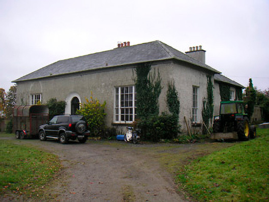
| Ardnagragh | Alicia Nugent was leasing this property, which included a mill, from the Digby estate at the time of Griffiths Valuation in the early 1850s, when it was valued at £23. The National Inventory of Architectural Heritage indicates that the house is still in use though the mill has been demolished. | |
| Drumraney | This property is described as “in chancery” at the time of Griffiths Valuation, though it was being leased by John Carney from the estate of Alicia O’Connor Malone. It was valued at £14. It is labelled as Drumraney House on the 1st edition Ordnance Survey map of 1838 but as “Constabulary barracks” on later edition maps. It is not extant now. | |
| Shinglis House | The 1906 Survey of Untenanted Demesnes indicates John Malone as the owner of a property at Shinglis, valued at almost £32. The 1st edition Ordnance Survey map shows the ruins of Shinglis Court adjacent to this site but the 25-inch map labels Shinglis House a short distance to the north-east. O'Brien provides a detailed account of the evolution of the houses at this site, notably those occupied by the Malone family. He notes that Shinglis was demolished in the 1970s. | |
| Newgrove [Badgersbridge House] (Ballymahon) | This property was held in fee by Dillon Kelly at the time of Griffiths Valuation, when it was valued at over £10. It is labelled Newgrove or Badgersbridge House on the 1st edition Ordnance Survey map but does not appear on subsequent maps. The Valuation Office books show that the house had been valued at £15 in 1840. | |
| Dorrington House | At the time of Griffiths Valuation St. George Gray held this property in fee when it was valued at £32. It is labelled Dorrington House on all editions of the Ordnance Survey maps. In 1906 it was the property of Wellington Gray and valued at £44. O'Brien writes that the house was demolished during the twentieth century and a newer house constructed at the site but extensive estate architecture survives. |
|
| Walderstown Lodge | William Potts was leasing this property from the Gray estate at the time of Griffiths Valuation in the early 1850s, when it was valued at £12. O'Brien writes that it was possibly built by the Dorrington Hackett family of nearby Dorrington House. It was acquired by the Gray family by inheritance and became a dower house. It is still extant. |
|
| Littletown House [Lodge] | William Magill was leasing this property from Joseph Manly at the time of Griffiths Valuation in the early 1850s when it was valued at almost £14. On the 1st edition Ordnance Survey map it appears to be located within the townland of Doonis but on the 25-inch edition of the early 20th century it seems to be within the townland of Cartroncroy. The house is labelled Littletown Lodge on the 1st edition map but as Littletown House on the 25-inch edition. It survived into the twentieth century but is no longer extant. In 1837 Lewis referred to Littleton Lodge as the seat of W. Lennox Napier. Another Littletown House is shown on the 1st edition Ordnance Survey map in the adjacent townland of Littletown [N096519] but this is described as 'in ruins' on the later map. William Magill of Littleton, Ballymahon was recorded as the owner of over 350 acres in County Longford in the 1870s. | |
| Moyvore | Peter Odlum was leasing this property from the Grogan estate at the time of Griffiths Valuation, when it was valued at £12. | |
| Beech Lawn (Ballymahon) | George Meares was leasing this property from the Grogan estate at the time of Griffiths Valuation, when it was valued at almost £17. A house is still extant at this site. | |
| Annaville House | Francis Longworth was leasing this property from William Dawson at the time of Griffiths Valuation in the early 1850s, when it was valued at almost £14 and included a mill. On the 25-inch Ordnance Survey map of the early 20th century it is labelled Annaville House. A house is still extant at the site. | |
| Noughaval House (Ballymahon) | William Dawson was leasing this property from the King-Harman estate at the time of Griffiths Valuation in the early 1850s when it was valued at £13. Lewis also referred to it as his seat in 1837. The National Inventory of Architectural Heritage suggests it was built in 1760. O'Brien notes that there is a family tradition that the roof had to be replaced in the nineteenth century having been damaged during ''the Night of the Big Wind'' in 1839. Noughaval is still extant and occupied. |
|
| Belmore Place | At the time of Griffiths Valuation in the early 1850s this property was held in fee by Robert W. Lowry, when it was valued at £16. It is labelled Belmore Place on all editions of the Ordnance Survey maps. O'Brien writes that the original house at this site had been occupied by Netterville Blake, who sold the property to Lowry in 1832. The National Inventory of Architectural Heritage suggests the surviving farm complex was built c.1850. The house was demolished in the 20th century. |
|
| Ballymore Parochial House | Thomas Coffey was leasing this property to Reverend Thomas Guinan at the time of Griffiths Valuation when it was valued at £12. A smaller house appears at this location on the 1st edition map of 1838 but a house labelled “Parochial House” is shown on the early 20th century 25-inch edition. Buildings still extant at site but may not be original. | |
| Lissanode House | O'Brien writes that this house was occupied by the Russell family, probably from the early part of the eighteenth century. At the time of Griffiths Valuation, in 1854, it was occupied by Frederick W. Russell, leasing from the Boyd estate, when it had a valuation of £7. It was replaced by a more substantial house in the late nineteenth century following a fire. It is still extant. | |
| Lissaquill House | In 1837 Lewis referred to Lissaquill House as the seat of Harding Fetherstone. At the time of Griffiths Valuation in 1854 this property was occupied by John Hogan, leasing from O'Brien Dillons, when it was valued at £9. The Valuation Office Books of 1841 noted the house here as having a valuation of £10 and occupied by Harding Fetherstone. A house and farm are still extant at this location. |