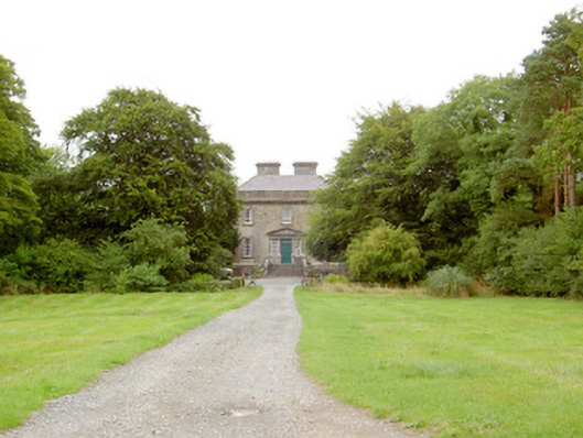
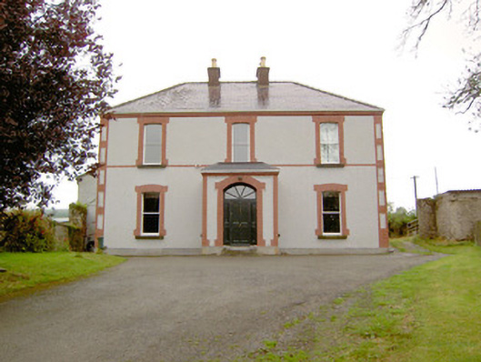
Drumnacor House
Houses within 5km of this house
Displaying 12 houses.
Houses within 5km of Drumnacor House
Displaying 12 houses.
| House name | Description | |
|---|---|---|
| Ledwithstown House | In 1837 Lewis referred to Ledwithstown House as the seat of W. Ledwith. Leet's Directory referred to it as the residence of Richard Dillon in 1814. By the time of Griffiths Valuation in the 1850s, it was held in fee by Edward Ledwith and valued at £15. The National Built Heritage Service suggests it was built c.1745 and was possibly designed by Richard Castle. It is still extant. In the 20th century it had become derelict but has been refurbished |
|
| Ballymulvey House | John Shuldham was the owner of an extensive milling complex, valued at £35, at Ballymulvey at the time of Grffiths Valuation in the early 1850s. In 1837 Lewis had also referred to Ballymulvey as a seat of the Shuldham family. The property is labelled Ballymulvey House on the 1st edition OS map but “in ruins” on the 25” edition of the early 20th century when the woollen factory is located nearby. Some ruins of this complex remain at the site. | |
| Antely Cottage | A property labelled Antely Cottage is visible on the 25-inch OS map of the early 20th century. At the time of Griffiths Valuation, in the early 1850s, Robert de Ricci, MD, was leasing lands in this area from the Shuldham estate. The National Built Heritage Service suggests that Antely Cottage evolved from an earlier, possibly 1760s structure on the site. It is still extant and occupied. |
|
| Moygh House | John Shuldham held this property in fee at the time of Griffiths Valuation, when it was valued at £35. In 1837 Lewis referred to Moigh as the seat of M. Shuldham. It is labelled Moygh House on all OS editions. It is still extant. |
|
| Laurel Lodge (Shrule) | Thomas Hussey was occupying this property at the time of Griffiths Valuation in the 1850s, when it was valued at just over £10. In 1838 the original Valuation Office books noted the occupant as Edward Nugent. The Ordnance Survey name books of the mid 1830s state that the townland was part of the Ledwith estate. The house is not named on the 1st edition OS map but is labelled Laurel Lodge on the 25” map of the early 20th century. It is now a ruin. | |
| Cartron House (Ballymahon) | At the time of Griffiths Valuation in the 1850s, Thomas Wright was leasing this property from the King Harman estate when it was valued at £10. In 1837 it was noted by Lewis as the seat of J. Wright. It is still extant. |
|
| Rathmore House (Ballymahon) | Robert C. Barbar was occupying this property, then valued at over £12, at the time of Griffiths Valuation. Lewis had also noted it as his seat in 1837. It was leased from the King Harman estate. This property was labelled Rathmore House on the 1st edition Ordnance Survey map but a later house (Grid Reference N150546) carries this label on the 25-inch edition of the early twentieth century. The latter is still extant. |
|
| Castlecore/Castlecor House (Ballymahon) | The National Built Heritage Service suggests that the original building at Castlecore was built as a hunting lodge in the mid 18th century by a member of the Harman family from Newcastle House. It underwent several changes and additions during the 19th century. Between the 1830s and the 1850s it was in the hands of Thomas Hussey and at the time of Griffiths Valuation, it was valued at £10. Hussey advertised it for sale in the Encumbered Estates Court in 1855, when it was described as 'of a peculiarly convenient construction, built about 50 years at a cost of £4000'. The 'Freeman's Journal' reported that it was sold for over £6000. By the 1870s it was the seat of John Bond. In 1906 Castlecore was owned by Emily C. Clarke and valued at £44 10s. It is named as Castlecor House on the 1st edition Ordnance Survey map but as Castlecore House on the later 25-inch edition. It is still extant. |
|
| Littletown House [Lodge] | William Magill was leasing this property from Joseph Manly at the time of Griffiths Valuation in the early 1850s when it was valued at almost £14. On the 1st edition Ordnance Survey map it appears to be located within the townland of Doonis but on the 25-inch edition of the early 20th century it seems to be within the townland of Cartroncroy. The house is labelled Littletown Lodge on the 1st edition map but as Littletown House on the 25-inch edition. It survived into the twentieth century but is no longer extant. In 1837 Lewis referred to Littleton Lodge as the seat of W. Lennox Napier. Another Littletown House is shown on the 1st edition Ordnance Survey map in the adjacent townland of Littletown [N096519] but this is described as 'in ruins' on the later map. William Magill of Littleton, Ballymahon was recorded as the owner of over 350 acres in County Longford in the 1870s. | |
| Annaville House | Francis Longworth was leasing this property from William Dawson at the time of Griffiths Valuation in the early 1850s, when it was valued at almost £14 and included a mill. On the 25-inch Ordnance Survey map of the early 20th century it is labelled Annaville House. A house is still extant at the site. | |
| Noughaval House (Ballymahon) | William Dawson was leasing this property from the King-Harman estate at the time of Griffiths Valuation in the early 1850s when it was valued at £13. Lewis also referred to it as his seat in 1837. The National Inventory of Architectural Heritage suggests it was built in 1760. O'Brien notes that there is a family tradition that the roof had to be replaced in the nineteenth century having been damaged during ''the Night of the Big Wind'' in 1839. Noughaval is still extant and occupied. |
|
| Lissaquill House | In 1837 Lewis referred to Lissaquill House as the seat of Harding Fetherstone. At the time of Griffiths Valuation in 1854 this property was occupied by John Hogan, leasing from O'Brien Dillons, when it was valued at £9. The Valuation Office Books of 1841 noted the house here as having a valuation of £10 and occupied by Harding Fetherstone. A house and farm are still extant at this location. |