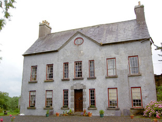
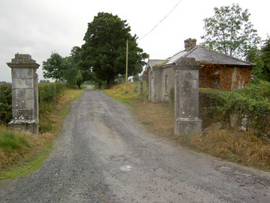
Gortmore [Longfield] House (Ballymahon)
Houses within 5km of this house
Displaying 12 houses.
Houses within 5km of Gortmore [Longfield] House (Ballymahon)
Displaying 12 houses.
| House name | Description | |
|---|---|---|
| Creevaghmore (Ballymahon) | Edwin Moore Sandys was leasing Creevaghmore House to William Hogan at the time of Griffiths Valuation in the early 1850s, when it was valued at £20. In 1837 Lewis referred to “Creevagh” as the seat of R. Sandys. Leet refers to 'Creevagh' as the seat of John Fetherston in 1814. Creevaghmore is still extant. The National Built Heritage Service suggests it was built in the mid 18th century. |
|
| Cartron House (Ballymahon) | At the time of Griffiths Valuation in the 1850s, Thomas Wright was leasing this property from the King Harman estate when it was valued at £10. In 1837 it was noted by Lewis as the seat of J. Wright. It is still extant. |
|
| Rathmore House (Ballymahon) | Robert C. Barbar was occupying this property, then valued at over £12, at the time of Griffiths Valuation. Lewis had also noted it as his seat in 1837. It was leased from the King Harman estate. This property was labelled Rathmore House on the 1st edition Ordnance Survey map but a later house (Grid Reference N150546) carries this label on the 25-inch edition of the early twentieth century. The latter is still extant. |
|
| Drumraney | This property is described as “in chancery” at the time of Griffiths Valuation, though it was being leased by John Carney from the estate of Alicia O’Connor Malone. It was valued at £14. It is labelled as Drumraney House on the 1st edition Ordnance Survey map of 1838 but as “Constabulary barracks” on later edition maps. It is not extant now. | |
| Shinglis House | The 1906 Survey of Untenanted Demesnes indicates John Malone as the owner of a property at Shinglis, valued at almost £32. The 1st edition Ordnance Survey map shows the ruins of Shinglis Court adjacent to this site but the 25-inch map labels Shinglis House a short distance to the north-east. O'Brien provides a detailed account of the evolution of the houses at this site, notably those occupied by the Malone family. He notes that Shinglis was demolished in the 1970s. | |
| Newgrove [Badgersbridge House] (Ballymahon) | This property was held in fee by Dillon Kelly at the time of Griffiths Valuation, when it was valued at over £10. It is labelled Newgrove or Badgersbridge House on the 1st edition Ordnance Survey map but does not appear on subsequent maps. The Valuation Office books show that the house had been valued at £15 in 1840. | |
| Kilcornan Lodge (Ballymahon) | Thomas Murray was leasing this property from Charles Edward Grogan at the time of Griffiths Valuation in the early 1850s, when it was valued at almost £14. In 1814 Leet referred to Kilcornan as the residence of Patrick McDermott. O'Brien details the various occupiers from 1785, the year from which he asserts the house dates. It is still extant. | |
| Annaville House | Francis Longworth was leasing this property from William Dawson at the time of Griffiths Valuation in the early 1850s, when it was valued at almost £14 and included a mill. On the 25-inch Ordnance Survey map of the early 20th century it is labelled Annaville House. A house is still extant at the site. | |
| Noughaval House (Ballymahon) | William Dawson was leasing this property from the King-Harman estate at the time of Griffiths Valuation in the early 1850s when it was valued at £13. Lewis also referred to it as his seat in 1837. The National Inventory of Architectural Heritage suggests it was built in 1760. O'Brien notes that there is a family tradition that the roof had to be replaced in the nineteenth century having been damaged during ''the Night of the Big Wind'' in 1839. Noughaval is still extant and occupied. |
|
| Belmore Place | At the time of Griffiths Valuation in the early 1850s this property was held in fee by Robert W. Lowry, when it was valued at £16. It is labelled Belmore Place on all editions of the Ordnance Survey maps. O'Brien writes that the original house at this site had been occupied by Netterville Blake, who sold the property to Lowry in 1832. The National Inventory of Architectural Heritage suggests the surviving farm complex was built c.1850. The house was demolished in the 20th century. |
|
| Ballymore Parochial House | Thomas Coffey was leasing this property to Reverend Thomas Guinan at the time of Griffiths Valuation when it was valued at £12. A smaller house appears at this location on the 1st edition map of 1838 but a house labelled “Parochial House” is shown on the early 20th century 25-inch edition. Buildings still extant at site but may not be original. | |
| Lissaquill House | In 1837 Lewis referred to Lissaquill House as the seat of Harding Fetherstone. At the time of Griffiths Valuation in 1854 this property was occupied by John Hogan, leasing from O'Brien Dillons, when it was valued at £9. The Valuation Office Books of 1841 noted the house here as having a valuation of £10 and occupied by Harding Fetherstone. A house and farm are still extant at this location. |