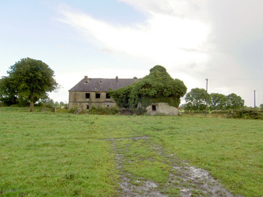
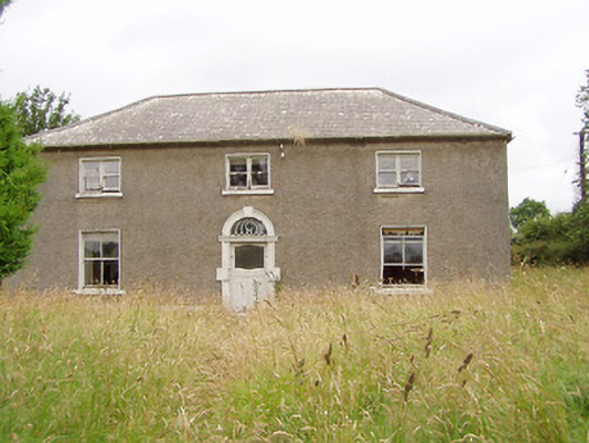
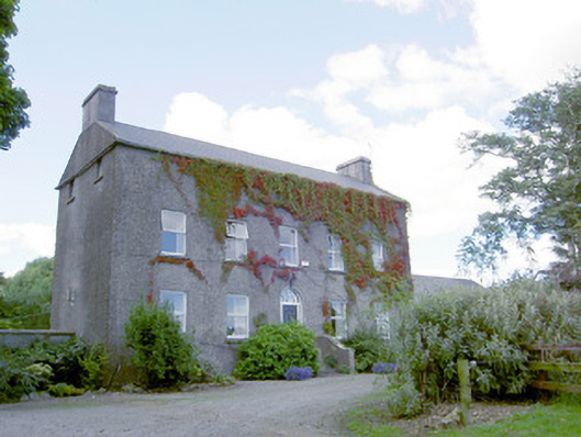
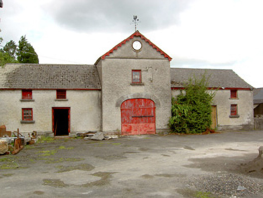
Castlewilder [Cloghdoo House]
Houses within 5km of this house
Displaying 11 houses.
Houses within 5km of Castlewilder [Cloghdoo House]
Displaying 11 houses.
| House name | Description | |
|---|---|---|
| Tennalick House | Tennalick House was associated with the nearby mill complex. At the time of Griffiths Valuation, it was leased by Stephen Cullen to Robert Diamond and was valued at £10. The mill complex was leased by John McCann & Co. also from Stephen Cullen and valued at £130. The Valuation Office House Books indicate that the house occupied by Robert Diamond was valued at £12 in 1840, while the mills, then held by William McCann, were valued at £62. The National Built Heritage Service suggests that the now-ruinous house at Tennalick dates from the early 18th century and may incorporate the remains of a 17th century house. It associates the site with the O’Farrell and Sankey families and later with the Gore estate, 1st Barons Annaly, before its acquisition by the White family, third Barons Annaly, in the early 19th century. Both the house and mills at Tennalick are now ruinous. |
|
| Colehill (Longford) | The Ordnance Survey Name Books noted that Colonel White was the proprietor of the townland of Colehill. The house of the same name was leased by a Mrs. Power to Captain Robert N. Bolton at the time of Griffiths Valuation in the 1850s, when it was valued at almost £18. The Valuation Office House books of the 1840s record Thomas Lennon as the occupier at that time. The National Built Heritage Service dates the original part of this house to the 1760s with later additions in the mid 19th century. It indicates that the house was associated with the Nugent family. It is still extant and occupied. |
|
| Foxhall (Ballymahon) | Richard M. Fox held this property in fee at the time of Griffiths Valuation in the 1850s, when it was valued at £40. The original valuation also noted it as his property in 1839 with a valuation of £39. In 1906 it was owned by the representatives of R.E. Fox. The Ordnance Survey Name Books mention that the demesne contained 38 acres of woodland in the mid-1830s. Leet referred to it as the residence of Richard Fox in 1814. The National Built Heritage Service suggests that the house at Foxhall was demolished in 1946. Estate architecture, including the stables, survives |
|
| New Port (Ballymahon) | At the time of Griffiths Valuation in the early 1850s, Patrick Ross was leasing this property from the Fox estate, when it was valued at almost £9. In 1814 Leet referred to it as the residence of J, Molloy. The Ordnance Survey Name Books mention it as a gentleman's residence belonging to Mr. Fox. The house is labelled New Port on the 1st edition Ordnance Survey map but does not appear on subsequent maps and is no longer extant. | |
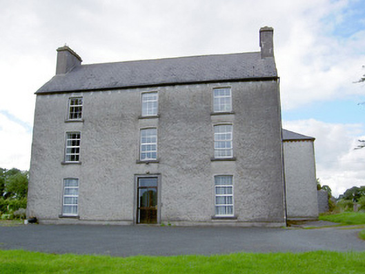
| Newtown House [Newtown Lodge] | Robert Hagerty was leasing this property from the Fox estate at the time of Griffiths Valuation in the early 1850s. The house at the site is labelled Newtown Lodge on the 1st edition Ordnance Survey map. The Ordnance Survey Name Books referred to this as a 'farm house' in the 1830s. A different house at the site is named as Newtown House on the later editions, the name by which it is still known. The National Built Heritage Service suggests the original house was built c.1810. It is extant and well-maintained. |
![Photo of Newtown House [Newtown Lodge]](https://landedestates.ie/storage/img/orig/3406.png)
|
| Sleehaun House | This property is not shown on the 1st edition OS map but is labelled Sleehaun Ho on the 25-inch edition of the early 20th century. It was occupied by Michael Ledwidge at the time of Griffiths Valuation in the early 1850s when it was valued at £13 and leased from the Fox estate. The National Built Heritage Service suggests it was built c.1850. It is still extant. |
|
| Treel House | William Atkinson was occupying Treel House at the time of Griffiths Valuation in the 1850s, when it and the adjacent mill were valued at £28. The National Built Heritage Service suggests the house was built c.1830. In 1839 the original Valuation Books, however, stated that at that time no house in the townland had a valuation of greater than £5 suggesting that Treel House was enlarged after that date. The Ordnance Survey Name Books noted in 1835 that the townland was then the property of Mr. Fox. Treel is still extant though not in use. |
|
| Clynan House | Bevan Slator was occupying Clynan at the time of Griffiths Valuation in the 1850s, when it was valued at £24. It was leased from William C. Rochfort. In 1840 the original valuation had recorded it as the seat of Bernard Slator with the same valuation. The National Built Heritage Service associates the property with the Coates and Slator families. It is now ruinous. | |
| Knockagh House [Hermitage] | Francis Kenny was leasing this property from the Robinson estate at the time of Griffiths Valuation in the early 1850s, when it was valued at almost £12. On the 1st edition Ordnance Survey map it is labelled Hermitage. The Ordnance Survey Name Books refer to “the gentleman’s seat called Hermitage in this townland”. On the 25-inch edition of the early 20th century it is labelled “Knockagh House – in ruins”. | |
| Richmount Hill | John Higgins, MD, was leasing this property from Jane Richardson’s estate at the time of Griffiths Valuation in the 1850s, when it was valued at over £15. In 1814 Leet referred to it as the seat of Auchmuty Richardson. The National Built Heritage Service suggests that this house was built c.1720. It is still extant and occupied. |
|
| Sunfield House | George Gamerson was leasing this property from the King Harman estate in the 1850s when it was valued at £12. The valuers' original valuation, which also includes a description of all buildings on the site, was over £20. The house is not named on the 1st edition OS map but is labelled Sunfield House on the 25” ed. A substantial farm occupies the site including the original buildings |
|