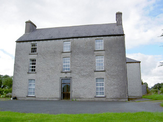
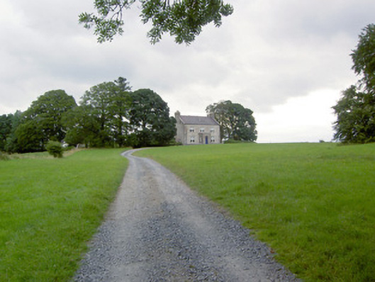
Tennalick House
Houses within 5km of this house
Displaying 10 houses.
Houses within 5km of Tennalick House
Displaying 10 houses.
| House name | Description | |
|---|---|---|
| Colehill (Longford) | The Ordnance Survey Name Books noted that Colonel White was the proprietor of the townland of Colehill. The house of the same name was leased by a Mrs. Power to Captain Robert N. Bolton at the time of Griffiths Valuation in the 1850s, when it was valued at almost £18. The Valuation Office House books of the 1840s record Thomas Lennon as the occupier at that time. The National Built Heritage Service dates the original part of this house to the 1760s with later additions in the mid 19th century. It indicates that the house was associated with the Nugent family. It is still extant and occupied. |
|
| Castlewilder [Cloghdoo House] | Richard P. O’Reilly, MD, held this property in fee at the time of Griffiths Valuation in the early 1850s, when it was valued at £30. On the 1st edition Ordnance Survey map it is labelled Cloghdoo House but as Castlewilder on the 25-inch edition of the early 20th century. The Ordnance Survey Name Books note that the townland at that time (1835) was the property of Mr. Wilder. In 1814 Leet referred to 'Castlewilden' as the seat of John Mangan. The National Built Heritage Service suggests the house and its complex of estate buildings was built in the 18th century but modified in the 1880s. |
![Photo of Castlewilder [Cloghdoo House]](https://landedestates.ie/storage/img/orig/3403.png)
|
| Clynan House | Bevan Slator was occupying Clynan at the time of Griffiths Valuation in the 1850s, when it was valued at £24. It was leased from William C. Rochfort. In 1840 the original valuation had recorded it as the seat of Bernard Slator with the same valuation. The National Built Heritage Service associates the property with the Coates and Slator families. It is now ruinous. | |
| Knockagh House [Hermitage] | Francis Kenny was leasing this property from the Robinson estate at the time of Griffiths Valuation in the early 1850s, when it was valued at almost £12. On the 1st edition Ordnance Survey map it is labelled Hermitage. The Ordnance Survey Name Books refer to “the gentleman’s seat called Hermitage in this townland”. On the 25-inch edition of the early 20th century it is labelled “Knockagh House – in ruins”. | |
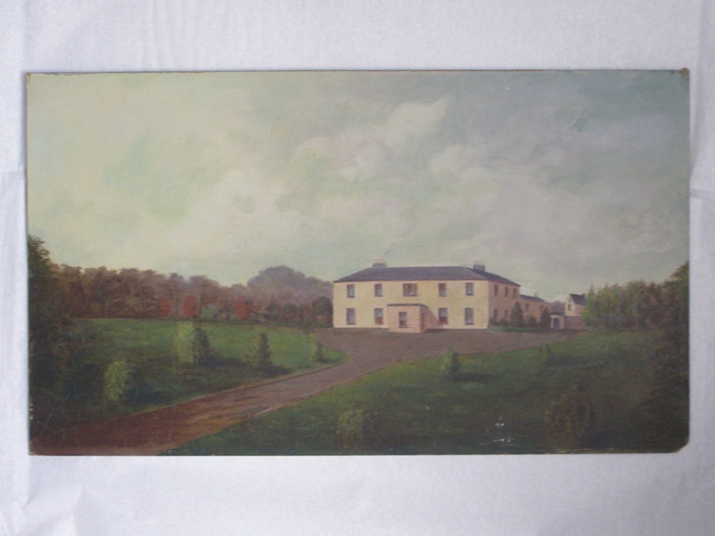
| Corrabola House | Hugh Morrow was leasing this property from the Jessop estate at the time of Griffiths Valuation in the 1850s, when it was valued at £28. Lyons records the sale of the house and estate in the Landed Estates Court in 1861. The schedule notes that it had been built by Morrow about 20 years previously and provides a good description of the house and demesne. The interest was purchased by the Jessop estate. The sale notice includes a lithograph of the house. A painting of this house, attributed to Arthur Morrow, is held in a New Zealand collection, where members of the Morrow family emigrated to in the 1860s. This house later features as the address of Thomas Alder Cusack, a Dublin solicitor who managed the Jessop estate. |
|
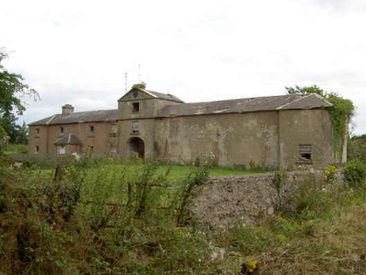
| Doory Hall | Doory Hall was the residence of F.T. Jessop at the time of Griffiths Valuation in the 1850s, when it was valued at £50. The National Built Heritage Service suggests that the current ruined property dates from the 1820s but that it replaced an earlier dwelling at the site. In 1906 it was owned by Louisa Jessop and still valued at £50. The remains of a large number of ancillary estate buildings area also visible at the site. |
|
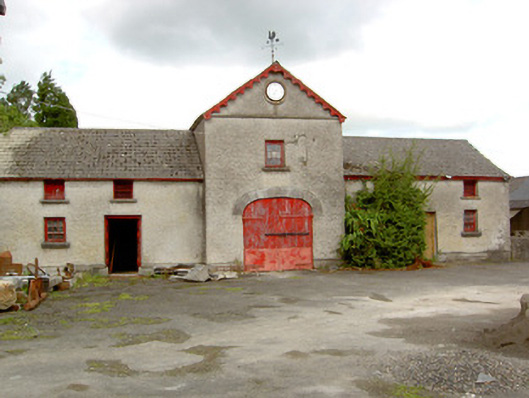
| Sunfield House | George Gamerson was leasing this property from the King Harman estate in the 1850s when it was valued at £12. The valuers' original valuation, which also includes a description of all buildings on the site, was over £20. The house is not named on the 1st edition OS map but is labelled Sunfield House on the 25” ed. A substantial farm occupies the site including the original buildings |
|
| Clooncallow House | Clooncallow House was occupied by Thomas Bredin at the time of Griffiths Valuation in the 1850s when it was valued at £12. He was also noted by the valuers as the occupier in 1840, though his name was spelt 'Braydon' at the time. Thomas Bradon is also recorded as a landholder in Clooncallow in the Tithe Applotment records in 1829. It is still extant and occupied. |
|
| Forgney House | Thomas Lennon was occupying Forgney House at the time of Griffiths Valuation in the 1850s, when it was valued at £12 and leased from the King Harman estate. It is possible that this is the same property which the valuers recorded as occupied by William Atkinson in 1840 and then valued at over £13. The house is not visible on the 25” map of the early twentieth century and the area is now covered by forestry. Elsewhere in the same townland, a house is labelled Forgney Old House (N205545) on the 1st edition Ordnance Survey map but does not appear on later maps. | |
| Newcastle House (Ballymahon) | The extensive property at Newcastle was originally the seat of the Harman family, which came into the King family through marriage. In 1837 Lewis referred to it as the seat of the Dowager Countess of Ross. At the time of Griffiths Valuation in the 1850s it was the seat of Laurence King-Harman and was valued at £90. In 1906 it was owned by Col. W.H. King-Harman. It remained in the family until the twentieth century when it was sold to an order of religious sisters. In the later 20th century and again more recently it has functioned as a hotel. A Center Parcs resort is now located in an area of the former demesne. |
|