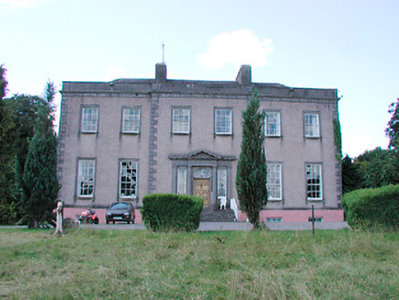
Lough Bawn
Houses within 10km of this house
Displaying 23 houses.
Houses within 10km of Lough Bawn
Displaying 23 houses.
| House name | Description | |
|---|---|---|
| Tromra House | Tromra was being leased by Wiilliam Riggs from the Pakenham estate at the time of Griffiths Valuation in the early 1850s when it was valued at £13. The Valuation Office Books of 1839 indicate Mrs. Mary Anne Riggs was occupying a property valued at £10 at that time. Tromra is still extant and occupied. |
|
| Archerstown House | Archerstown House, located on the shore of Archerstown Lough, is named on the first edition OS map with a police barrack at its front entrance. Also named on the 25 inch map but subsequently demolished. Archerstown was the home of John Maher in 1814 and of Robert Smyth in 1837. O’Brien records Thomas Smyth, ancestor of the Drumcree branch of the family, living at Archerstown in 1671. Samuel Arthur Reynell held the house valued at £50 from Robert Smyth at the time of Griffith’s Valuation (publ. 1854). He was agent to the Marquess of Westmeath and became Master of the Westmeath Hunt. The Reynells continued to live at Archerstown until the 1940s when it was sold. Acquired by the Land Commission in the 1960s the house was demolished. | |
| New Archerstown | This house is marked on the first edition OS map. The outbuildings were considerably extended by the time of the 25 inch map. Valued at £15 at the time of Griffith’s Valuation (publ. 1854), it was occupied by Thomas W Donaldson and held from Robert Smyth. Mrs Jane Crawford and her son lived here in 1901 and 1911. A building still occupies the site. | |
| Ballyhealy House | Ballyhealy House was the home of the Batty family. O’Brien describes it as a two-storey, five-bay late 18th century building. Charles Batty was resident in 1814 and P Batty in 1837. At the time of Griffith’s Valuation (publ. 1854) William Barry Batty lived here, holding the house valued at £30 from the Rev Edward Batty. The Rev Edward Batty of Ballyhealy owned over 1,200 acres in the 1870s. Espine Batty, JP, farmer and barrister was resident in 1901 and in 1906 but by 1911 Lt Claud O’Hagan and family lived here holding the property from the Battys. The house is now a ruin. | |
| Rosmead House | Rosmead House was set in an extensive demesne as shown on the first edition OS map. This was a seven-bay three-storey over basement mansion built in the late 18th century by Hans Widman Wood (1720-95). His eldest daughter Frances Elizabeth, wife of Admiral Hercules Robinson inherited the house. The Rosmead estate was sold by the Robinsons to Lord Vaux in 1852, when the house was described as an ‘imposing edifice’. In July 1879 it was for sale again and the Marquess de la Bedoyere who married Mildred, daughter of Lord Greville, came into possession. The 1879 sale rental gives descriptive details of the features of the house including the number of rooms and their dimensions and there is also a lithograph of the house. The Marquess was still occupying the mansion house, valued at £49.10 in 1906. It is now a ruin although the courtyard and entrance gate survive. |
|
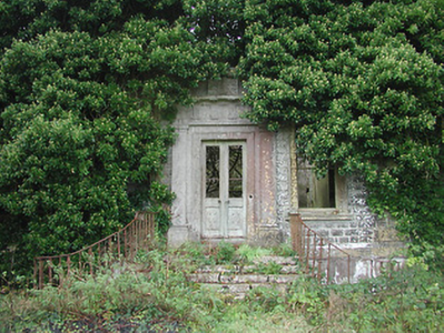
| Clonyn House | Clonyn/Clonin House, (also known as Clonyn or Delvin Castle) is named on the first edition OS map with a riding school to the rear and is recorded as ‘in ruins’ on the 25 inch map. A plaque with the crest of the Nugent family on the façade dates the building 1680. Later extensions to the house dating from the early 18th century to the early 19th century are evident. This was the home of the Earls and Marquess of Westmeath and in 1837 is described as such by Lewis. The first and only Marquess of Westmeath died in 1871 and his estates were inherited by his daughter Rosa, who was married to Lord Greville. However, by the time of Griffith’s Valuation (publ. 1854) Lord Greville was already in possession of Clonyn holding it in fee and valued at £60. By 1906 the buildings were valued at £130.3 and held with 824 acres of untenanted land however the estate was ‘In Chancery’. The Hon Priscilla Nugent was the occupant. The house became a ruin some years later and is now surrounded by Delvin Golf course. | |
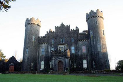
| Clonyn Castle | Clonyn Castle, five-bay two-and three-storey over basement Gothic Revival-style castle, built between 1867-1876 to the design of John McCurdy (1823-85) for Lord and Lady Greville-Nugent, both of whom died in 1883. Their sons followed careers in England and Australia and the house was only occupied by servants at the time of the 1901 census. Sold by the Grevilles in the 1920s this building remains a private residence. |
|
| Derry Cottage/Drumcree Cottage | Drumcree Cottage (also known as Derry Cottage) is named on the first edition OS map. Lewis records Derry Cottage as the home of Mrs Berry in 1837. Griffith’s Valuation (publ. 1854) records Letitia C Berry (nee Smyth) as resident in a house valued at £20 and held from Robert Smyth. A building still stands on the site. | |
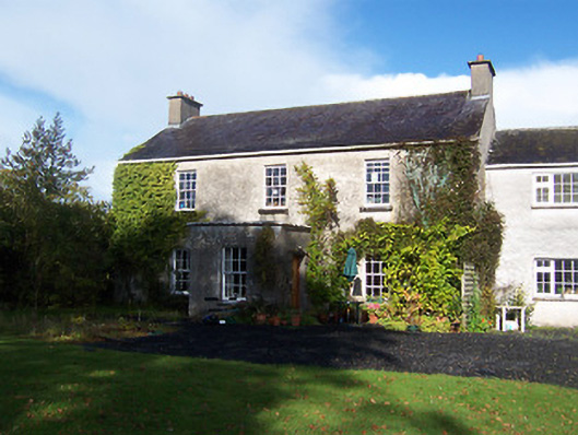
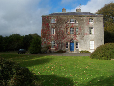
| Drumcree | Drumcree House was a seven-bay two-storey over basement Palladian country house, built in the mid-18th century for a branch of the Smyth family. In 1814 William Smyth was resident. By 1837 his son Robert occupied the house and Griffith’s Valuation (publ. 1854) records Robert Smyth holding the house in fee. It was valued at £60. By the early 20th century Henry Maxwell Smyth had inherited the property. He was there in 1906 when the valuation had increased to £75. O’Brien writes that the house was abandoned after the death of H M Smyth in 1961 and is now an ivy clad ruin. |
|
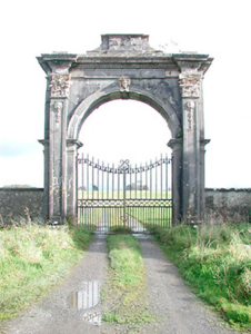
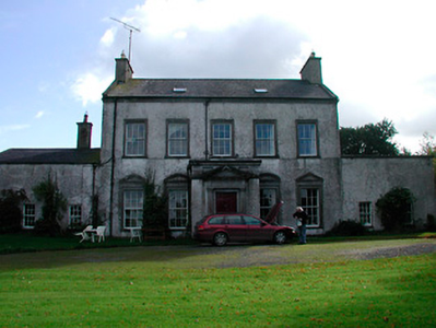
| Glananea/Ralphsdale | Glananea House, formerly Ralphsdale, as it is named on the first edition OS map, with laid out gardens immediately to the back of the house. This two-storey six-bay late 18th century house was built to the design of Samuel Wooley for Ralph Smyth, second son of William Smyth of Drumcree. Ralph’s son William Thomas inhabited the house in 1814 and was succeeded by his son another Ralph, who was resident in 1837 when Lewis recorded that his demesne is ‘entered by a beautiful gate’, which is now at Rosmead. At the time of Griffith’s Valuation (publ. 1854) the house was valued at £50 when occupied by William Edward Smyth who held it from Robert Smyth (of Drumcree). The Smyth family were resident in 1901 but a caretaker occupied the house in 1911. Glananea remains a private residence. |
|
| Gigginstown House | The original house, Gigginstown Lodge, was a Dardis home and is marked on the first edition OS map. It was occupied by Christopher Dardis in 1814 and Captain Brabazon O’Connor in 1837, who had married the widow of Michael Dardis. It is no longer extant (N528 615). Gigginstown House is described by O’Brien as ‘a two-storey, three-bay classical house designed by John S Mulvany’ built in the mid-1850s on a new site and recorded as unfinished at the time of Griffith’s Valuation (publ. 1854). Valued at £40, Elizabeth Busby was the occupant holding the house in fee. The property had been bought on her behalf and that of her sister in 1828. Alphonso Busby owned 1,408 at Gigginstown in the 1870s. James Taylor, farmer and his wife Kate were resident in the early 20th century. A stud and farm are now located at Gigginstown House, owned by Michael O’Leary, see https://www.gigginstownhouse.com/wp/ |
|
| Ballyknock House | Ballyknock House, Derrynagarragh, is marked on the first edition OS map at a road junction and named on the 25 inch map and appears to be extant. In 1814 Ballyknock was the residence of Richard McCormick. At the time of Griffith’s Valuation (publ. 1854) it was valued at £16.10, occupied by Catherine McCormick and held from Richard McCormick. It appears to have been located on the Berry estate. | |
| Clondalever House | Clondalever House is marked on the first edition OS map, but expanded and named on the 25 inch map. At the time of Griffith’s Valuation (publ. 1854) it was valued at £14, occupied by Edward Hope, who held it from George W Mansell or Maunsell (Oakley Park). A house is still located on this site. | |
| Kinturk House | Kinturk House, located just south of Castlepollard, is a five-bay three-storey over basement country house, built about 1760, remodelled and extended in 1821 for William Dutton Pollard (1789-1839) by Charles Robert Cockerell (1788-1863). It was valued at £90 in 1906. The house remained in the possession of the Pollard/Pollard Urquhart family until the mid-1930s when it was sold to the Congregation of the Sacred Hearts of Jesus and Mary who, in turn, sold it on to the Midland Health Board in 1971. |

|
| Streamstown House | Streamstown House, located on the eastern shore of Lough Derravargh, is a five-bay two-storey house, built about 1800. At the time of Griffith’s Valuation (publ. 1854) it was occupied by Thaddeus Lynch, valued at £11 and held from Benjamin Chapman. Michael Hope, JP and farmer, and family were resident here in 1901 and his widow Eliza and family in 1911. |
|
| Barbavilla | Barbavilla House is shown on the first edition OS map as situated in a large demesne with laid out gardens close to the house. It is a nine-bay two-storey over basement house, originally built by William Smyth in 1730. Smyth named the house after his wife Barbara Ingoldsby. The house was later altered by his grandson William Smyth in 1790. In the mid-19th century the house was valued at £72 and held in fee by William B Smyth. In 1906 William Lyster Smyth was the occupant when the buildings were valued at £58.5 and held with 434 acres of untenanted land. The Smyths sold Barbavilla in 1955. The house is now surrounded by large buildings relating to the production of artisan products for Barbavilla Dairy. |
|
| Benison Lodge | Benison Lodge, west of Lough Lene, is named on both the first edition six inch and 25 inch OS maps. O’Brien describes it as a late 18th century, five-bay, two-storey house, probably by the O’Reilly family, one of whom was shot dead in the house in 1803 by the coachman. In 1814 Thomas H Smyth lived here and the Rev T Smyth in 1837. By the time of Griffith’s Valuation (publ. 1854) John Henry Roper was occupying the house, valued at £30 and held from William P Urquhart of Castlepollard. In the 1870s Henry J Roper of Benison Lodge owned 447 acres. In the early 20th century Richard O’Neill and family were living in a first class house in this townland. The house is now a ruin. | |
| Sallymount House | Sallymount House is a three-bay two-storey house with dormer attic, dating from the early 19th century. It was the home of the Rotheram family for much of the 19th and 20th centuries. The Rotherams acquired it from the Nugent family. G S Rotheram was resident in 1837 and Griffith’s Valuation (publ. 1854) records George Rothram as the occupant holding the house valued at £35 from Priscilla Nugent. Members of the Rotheram family owned 560 acres in the 1870s. The estate was acquired by the Land Commission in the early 1960s and the house became derelict but has been restored recently. | |
| Gillardstown | Gillardstown is named on both the first edition six inch and 25 inch OS maps. A Mrs Scully was living at Gillerstown, Castlepollard, in 1814. At the time of Griffith’s Valuation (publ. 1854) Thomas Webb occupied the house, valued at £25 and held from Robert A Ellis. The house was the home of William Evans, a Civil Engineer and Law Agent, and his family in 1901 and of William Hardy, a farmer and his wife in 1911. The house is now the centre of a farming complex. | |
| Hilltown | Hilltown House, built in front of the ruins of a castle, is a three-bay three-storey over basement Palladian country house, built about 1780, possibly by William Webb. It was the home of William Webb in 1814 and in 1837. Valued at £26 at the time of Griffith’s Valuation (publ. 1854) it was occupied by George Webb and held from Lady Oranmore [and Browne]. Members of the Webb family were still resident in the early 20th century and O’Brien writes that the estate was acquired by the Land Commission. The house is still a private residence. |
|
| Loughpark | Lough Park House, situated on the shores of Lough Lene to the south east of Castlepollard, this five-bay two-storey house, built about 1790 was home to the Evans family for much of the 19th century. N Evans was resident in 1837 and Michael Evans at the time of Griffith’s Valuation (publ. 1854). He held the house valued at £20 from William P Urquhart of Castlepollard. Thomas Pender, farmer and family lived here in 1901 and Samuel R Sutton, farmer and family in 1911. The property remains a family home. |
|
| Cummerstown House | Cummerstown House, a two-storey, three-bay house, not built at the time of the first edition OS map but named on the 25 inch. Occupied by Laurence Levey at the time of Griffith’s Valuation (publ. 1854) when the building was valued at £10.10 and held from the trustees of Wilson’s Hospital. Home of farmer Samuel O’Neill and family at the beginning of the 20th century, now the address of Cummerstown Farm Aviation Ltd. | |
| Glenidan | Glenidan House is named on both the first edition six inch and 25 inch OS maps. Stephen Moore lived at Glenidan in 1814. Lewis records it as the residence of Blandford. Robert McCormick held Glenidan, valued at £10.10 from Patrick E Murphy at the time of Griffith’s Valuation (publ. 1854). This house appears to be still extant. |