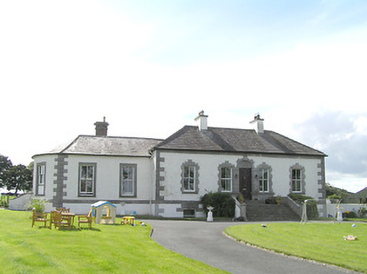
Fair View (Longford)
Houses within 5km of this house
Displaying 6 houses.
Houses within 5km of Fair View (Longford)
Displaying 6 houses.
| House name | Description | |
|---|---|---|
| Mount Dillon | Lewis writes that the house was situated on an isolated hill and formed "a conspicuous object in the surrounding scenery". Valued at £15 in the mid 19th century. Wilson, in 1786, refers to it as the seat of Mr. Dillon. In the possession of Samuel Russell in 1906 when the buildings were valued at £3. It is no longer extant. | |
| Brianstown House | In 1837 Lewis refers to Brianstown as the seat of Thomas G. Auchmuty. At the time of Griffiths Valuation in the early 1850s, it was held in fee by Henry Musters when it was valued at £22. The earlier Valuation Office books from 1840 note Auchmuty as the owner and the Valuation as £24. In 1814 Leet referred to it as the residence of Samuel Auhmuty. Brianstown is still extant and occupied. |
|
| Middleton House | Michael Quinn held Middlton in fee at the time of Griffiths Valuation in the early 1850s, when it was valued at almost £13. In 1837 Lewis referred to Middleton as the seat of H. Montfort while in 1814 Leet notes it as the residence of W.B. Montfort. It is still extant. |
|
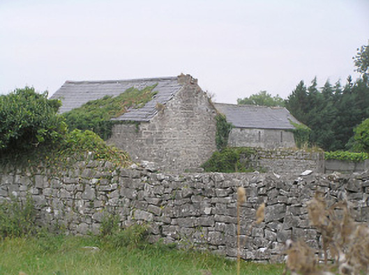
| Richmond Mill | At the time of Griffiths Valuation in the early 1850s, William Fleming was leasing this substantial site from the Gunning estate when the buildings were valued at £95. The Valuation Office Books note a valuation of £72 in 1840. The property is labelled as a distillery on the 1st edition Ordnance Survey map but as corn mill on the 25-inch map. The ruins of the miller’s house and mill buildings are still visible at the site. |

|
| Rhynmount (Rinnmount) | Reverend G. Moore was leasing this property from George J. Mitchell at the time of Griffiths Valuation, when it was valued at £10. It is labelled Rinn Mount on the 1st edition Ordnance Survey map but as Rhynmount on the later 25-inch edition. A modern house exists at this site now. | |
| Springfield (Clogher) | At the time of Griffiths Valuation in the early 1850s, Valentine S. Ripton was leasing this property from Reverend George Moore when it was valued at £10. The Valuation Office Books of 1840 also record him as the occupant. The house is labelled Clogher on the 1st edition Ordnance Survey map of 1838 but as Springfield on the 25-inch edition of the early 20th century. A house is still extant at the site. |
|