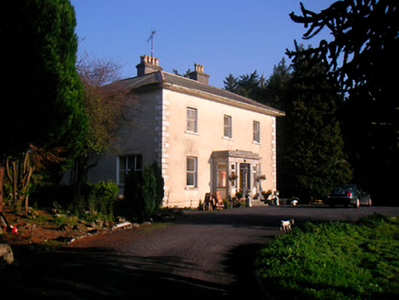
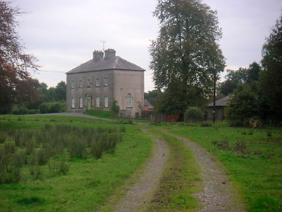
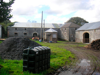
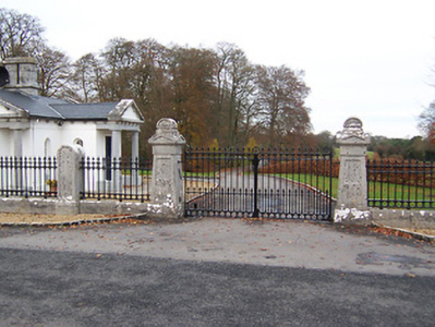
Reynella
Houses within 5km of this house
Displaying 13 houses.
Houses within 5km of Reynella
Displaying 13 houses.
| House name | Description | |
|---|---|---|
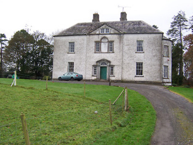
| Corbetstown | Corbetstown house, a D’Arcy home, is named on the first edition OS map. It is a three-bay two-storey over basement house, built about 1820. It must have replaced an earlier house as a D’Arcy is recorded at Corbetstown in the late 1770s. Francis D’Arcy was resident in 1814 and John D’Arcy in 1837. By the time of Griffith’s Valuation (publ. 1854) Joseph Purser was resident holding the house valued at £32 from the Earl of Longford. Occupied by Elizabeth and Frances Reynell in 1911, this house remains extant. |
|
| Huntingdon | Huntingdon, a five-bay two-storey over basement country house, built about 1770 by the Purdon family, it remained a Purdon home for all of the 19th century. Robert Purdon was resident in 1814 and 1837. Augustus Cooke Purdon held the house from Robert Purdon at the time of Griffith’s Valuation (publ. 1854), when it was valued at £20. Purdon family members were still resident in the early decades of the 20th century and the house remains extant. |
|
| Clonlost | Clonlost house is shown amidst a large demesne on the first OS map. The Nugent family were settled at Clonlost from the 17th century. The house was a two-storey, five-bay, late 18th century building (O’Brien). In 1814 it was the home of Lt Col Nugent. Lewis records it as the ‘ancient family seat of J Nugent’. At the time of Griffith’s Valuation (publ. 1854) Captain John J Nugent held it in fee when the house was valued at £40 and he owned an estate of over 3,000 acres in the 1870s. His daughter married William Lamb Palmer of Rahan, Co Kildare and it was their son Charles Colley Palmer who inherited Clonlost. Members of the Palmer family were still resident in the early years of the 20th century. The house is now a ruin. | |
| Edmondstown | Edmondstown named on both the first six inch and 25 inch OS maps. At the time of Griffith’s Valuation (publ. 1854) Richard W Reynell was the occupier, holding the house valued at £10 from the representatives of Marcus Sinnott. Buildings remain at the site. | |
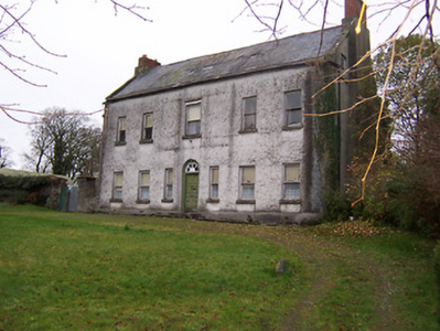
| Killynan House | Killynan House was located on the border between the two Killynan townlands of Pratt and Cooke. It was the home of the Reynell family who held it from the Winter family. Reverend Edward Reynell is recorded on the Taylor and Skinner maps of the late 1770s and was resident until his death in 1788. He was succeeded by his son Richard who occupied the house in 1814 and 1837. Richard was later succeeded by his son, Richard Winter Reynell, who died in 1887. The Reynells were related to the Winter family. This house is now demolished but outbuildings survive. |
|
| Clondrisse House | Clondrisse House, a small building marked on the first edition OS map and named on the 25 inch map. A small two-bay two-storey over basement house built about 1800 and extended in the late 19th century. O’Brien writes that it was the home of Myles O’Reilly in the first two decades of the 19th century. Rev Francis Winter, vicar of the nearby St. John the Baptist's Church of Ireland church was the occupant in the 1840s while Rodney Purdon was resident at the time of Griffith’s Valuation (publ. 1854), holding the house valued at £16, from Samuel Winter. Home of Major John Purdon retired in 1911. |
|
| Sheepstown House | Sheepstown house is named on the early 20th century 25 inch OS map. At the time of Griffith’s Valuation (publ. 1854) it was occupied by James Seery, valued at £15 and held from the representatives of Robert M Tighe. The Seery family were still resident at the beginning of the 20th century. This house is extant. | |
| Dardistown | Dardistown, described by O’Brien as a two-storey, three-bay Georgian house, a Fetherstonhaugh home in the late 18th century. In 1837 Lewis records ‘Durdistown’ as the seat of Theobald Fetherstonhaugh. By the time of Griffith’s Valuation (publ. 1854) the Metge family was in possession. John Branigan held the house valued at £12 from John C ‘Medge’ Metge. The Simons family were living in a first class house at Dardistown at the beginning of the 20th century. Buildings still occupy the site. | |
| Killagh House | Killagh House, named on the first edition OS map with a tuck mill and two corn mills closeby. This five-bay two-storey house was built about 1740 and a three-storey tower house is connected to the rear. At the time of Griffith’s Valuation (publ. 1854) it was valued at £10, occupied by Patrick Connell and held from Sir John Nugent. This building is no longer in use. https://www.antaisce.org/killagh-house-killeagh |
|
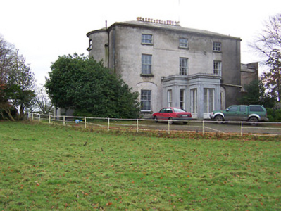
| Rockview House | Rockview House is a three-bay three-storey building over a basement. It was built in the early 19th century (but not recorded by Leet) for the Fetherstonhaugh family. In 1837 Mrs Richard Fetherstonhaugh was resident. At the time of Griffith’s Valuation (publ. 1854) her son Richard occupied the house, valued at £70 and held from Thomas J Fetherstonhaugh. The Fetherstonhaugh family continued to occupy the house well into the 20th century and it remains a private residence. |
|
| Bracklyn House | On the first edition OS map Bracklin House is set in an extensive demesne with gardens, plantation and outbuildings. It is a five-bay two-storey over basement neoclassical country house, built in the late 18th century by a branch of the Fetherstonhaugh family on land acquired from the Pakenham Family of Tullynally Castle, Castlepollard. Single storey wings were added in 1910. James Fetherstonhaugh was resident in 1814 and his son Thomas James in 1837. At the time of Griffith’s Valuation (publ. 1854) Anne Gavan was the occupant holding the house valued at £70 from Thomas James Fetherstonhaugh. At the beginning of the 20th century Captain Cecil Howard Digby Fetherstonhaugh and family lived at Bracklin. In 1906 the buildings were valued at £60 and held with 2,300 acres of untenanted land. O’Brien writes that in recent times Mr and Mrs Sean Murphy have restored the house. |
|
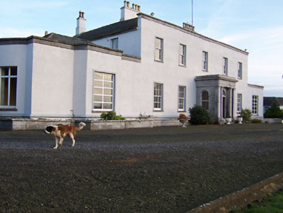
| Dysart | Dysart, located south of Delvin, is a three-bay two-storey over basement Palladian house built about 1757, for the Ogle family to designs by George Pentland. In 1814 and 1837 Nicholas Ogle was resident. By the time of Griffith’s Valuation (publ. 1854) Henry Ogle was the occupant holding the house valued at £25 in fee. The Ogle family still live here. |
|
| Gigginstown House | The original house, Gigginstown Lodge, was a Dardis home and is marked on the first edition OS map. It was occupied by Christopher Dardis in 1814 and Captain Brabazon O’Connor in 1837, who had married the widow of Michael Dardis. It is no longer extant (N528 615). Gigginstown House is described by O’Brien as ‘a two-storey, three-bay classical house designed by John S Mulvany’ built in the mid-1850s on a new site and recorded as unfinished at the time of Griffith’s Valuation (publ. 1854). Valued at £40, Elizabeth Busby was the occupant holding the house in fee. The property had been bought on her behalf and that of her sister in 1828. Alphonso Busby owned 1,408 at Gigginstown in the 1870s. James Taylor, farmer and his wife Kate were resident in the early 20th century. A stud and farm are now located at Gigginstown House, owned by Michael O’Leary, see https://www.gigginstownhouse.com/wp/ |
|