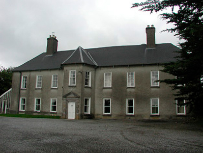
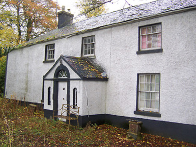
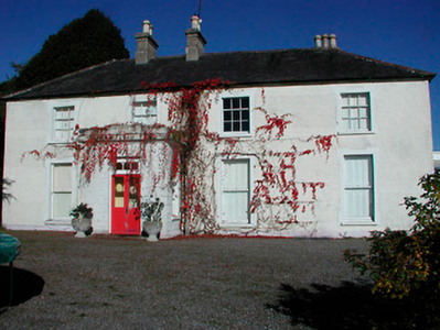
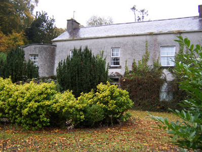
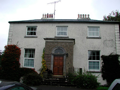
Dunboden Park
Houses within 5km of this house
Displaying 23 houses.
Houses within 5km of Dunboden Park
Displaying 23 houses.
| House name | Description | |
|---|---|---|
| Carrick | Carrick House located near the eastern shore of Lough Ennell, named on the first edition OS map, this is an eight-bay two-storey house, built c.1740. It is recorded on the Taylor and Skinner maps of the late 1770s and was the home of the Fetherstonhaugh family. It was the residence of William Fetherstonhaugh (died 1851) in 1837 and held by his son, another William, in fee at the time of Griffith’s Valuation (publ. 1854) when the house was valued at £29. He married Alicia daughter of Thomas Berry and they had a son Francis Berry Fetherstonhaugh who married Elizabeth Hornidge of Calverstown. Their descendants were still living at Carrick in the 1920s. |
|
| Far View House | Far View House, an early 19th century two-bay, three storey house, originally a home of the North family. David North who married Catherine Pim was resident in 1837 and at the time of Griffith’s Valuation (publ. 1854), when the house was valued at £15 and held from Catherine Reynolds. The house was occupied by the Gavin family in the early 20th century. |
|
| West House | West House is a five-bay two-storey over a basement country, built about 1760, having projecting single-bay wings. O’Brien states that it was built by a family named West and that it was sold to Patrick Gavin in 1822 and that this family still live there. In 1814 it was the residence of Robert Johnston. At the time of Griffith’s Valuation (publ. 1854) it was valued at £9.10, occupied by Patrick Gavin and held from Catherine Reynolds. |
|
| The Cottage | The Cottage, Gallstown, is named on both the first edition OS map and the 25 inch. This was the seat of the North family at the end of the 18th century (O’Brien). By 1814 Hugh Sheil was resident and Lewis records Mrs Sheil of The Cottage. This family was related to the Sheils of Gortlumly. The house was occupied by Margaret Sheil at the time of Griffith’s Valuation (publ. 1854), valued at £10 and held from Lord Kilmaine. Home of employees of Lord Kilmaine in the early 20th century. The house is no longer extant. | |
| Gortumly | Lewis refers to John Sheil of Gortumly and a long building is evident in this townland on the first edition OS map. O’Brien writes that the Sheils were resident at Gortumly from the mid-18th century. Gortumly house is named on the 25 inch map and is located just south of the long building on the first edition map. O’Brien writes that the Sheils bequeathed the house to a Mr O’Neill about 1910. Patrick O’Neill, a farmer and clerk to the County Council, was resident with his family in 1911. The lands were later sold to the Land Commission and the house demolished. | |
| Calverstown | Named on the first edition OS map, Calverstown House is a three-bay two-storey over basement house, built about 1800. Originally a Rochfort home it was occupied by Charles Rochfort in 1814. Calverstown House was the home of J. Hornidge in 1837. At the time of Griffith’s Valuation (publ. 1854) it was valued at £10, occupied by George Hornidge and held from Pilkington. Hornidge family members continued to live here until the mid-20th century. |
|
| Dalystown | Dalystown, marked on the first edition OS map and named on the 25 inch map, a three-bay two-storey house, built about 1810. It was the home of Charles Pilkington in 1837 and at the time of Griffith’s Valuation (publ. 1854). Valued at £11 the house was held from James W Berry with 189 acres. |
|
| Dalystown House | Dalystown House, marked on the first edition OS map and named on the 25 inch map. According to the Griffith’s Valuation map this was the house valued at £9 occupied by Samuel Cantrell who held it and 218 acres from James M Berry. This house was demolished. | |
| Gaybrook House | This house was built on land originally belonging to the Gay family who sold it to Ralph Smyth before the end of the 18th century. Smyth built the three-storey three-bay house which had extensive outbuildings and pleasure grounds as shown on the first edition OS map. Leet records him as the occupant in 1814 and his widow Mrs A Smyth was resident in 1837. Their son Robert was the occupant at the time of Griffith’s Valuation (publ. 1854) holding the house valued at £95 in fee. Col James Smyth and family were resident at the beginning of the 20th century. The house was demolished by the Land Commission about 1960 (boi). | |
| Rathcam or Lemongrove House | Rathcam House, previously known as Lemongrove, is a four-bay two-storey house, built about 1830 to replace an earlier house. Lemmongrove is marked on the Taylor and Skinner maps of the late 1770s occupied by Wilton Esq. Joseph Lemmon of Lemmongrove is mentioned in a deed of assignment dated 1771. Leet records Joseph Lemon of Lemongrove in 1814. Valued at £18, it was occupied by John ‘Lennon’ at the time of Griffith’s Valuation (publ. 1854) and held from Christopher Wilson [Wilton?]. The Lemons were still resident at the beginning of the 20th century. John D Lemon was the occupant in 1906 when the mansion house was valued at £23 and held with 262 acres of untenanted land. |
|
| Kilbride | Kilbride House is a three-bay two-storey house, built about 1810 to the north of Kilbride Castle. The Norths were in possession of Kilbride in the 18th century and Mrs North was resident in Kilbride House in 1814. The list of subscribers to Lewis’ Topographical Dictionary in 1837 includes A J Pilkington of Kilbride Castle. He was married to Mary daughter of Roger North. At the time of Griffith’s Valuation (publ. 1854) the house valued at £9 was occupied by Abraham Pilkington who held it from the representatives of R W Cooper. James King and family were resident at Kilbride in 1901 and 1911. |
|
| Whitewell House | Originally a home of the North family and occupied by Arthur Grose in 1837. At the time of Griffith's Valuation (publ. 1854) Whitewell was the residence of John G Battersby MD, valued at £9.10 and held from John North. O'Brien records that Elinor widow of John Roger North died here in 1858 and that the lands and house were leased to Laurence and Michael Gavin in 1859. The Gavins still own the lands but the house is a ruin. | |
| La Mancha | La Mancha is situated facing Lough Ennell and named on the first edition OS map. This house was occupied by William Wynne in 1814 and was the property of Richard Swift in 1837, who held it in fee and valued at £18 at the time of Griffith’s Valuation (publ. 1854). This house is still extant. |
|
| Bloomfield | Bloomfield is named on the first edition OS map, situated close to the shore of Lough Ennell, it is now a hotel and leisure centre. O’Brien writes that the house was a long low two-storey nine-bay building now greatly altered. It was most likely built by the widow of the 2nd Earl of Belvedere after her marriage to Abraham Boyd in 1815. In 1837 Lewis records the Countess of Belvedere as the proprietor. Purchased [or leased] by Col John Caulfield of Benown/Harmony Hall in 1842 from George A Boyd who had inherited it from his mother. At the time of Griffith’s Valuation (publ. 1854) Col Caulfeild was the occupant holding the house valued at £40 from George A Boyd. Purchased by Charles B Marlay later in the 19th century. Functioned as a military hospital and convent in the 20th century until it became a hotel in the 1980s. | |
| Ennel Lodge/Fort William | Ennell Lodge, previously known as Fort William as shown on the first edition OS map. This is a three-bay two-storey over basement house, built about 1800. It was valued at £13 but unoccupied at the time of Griffith’s Valuation (publ. 1854). Eliza Dennis was the immediate lessor. |
|
| Belville Cottage | Belville Cottage, five-bay single-storey house, built about 1820, marked on the first edition OS map and named on the 25 inch map. At the time of Griffith’s Valuation (publ. 1854) it was occupied by Florence Mahony, held from Eliza Dennis and valued at £10. |
|
| Clonmoyle House | Clonmoyle House, Tullanisky, is a two-storey, three-bay over basement house. The present house was built after 1838 and replaced an earlier house as recorded on the first edition OS map. In 1814 the older house was the home of David Jones. O’Brien writes that David Jones married Frances, daughter of Alexander Swift of Lynn in 1771. By the time of Griffith’s Valuation (publ. 1854) Charles Joley or Joly was resident holding the house valued at £35 from Thomas Walsh. Henry E Joly was in possession in the 1870s. |
|
| Anneville | Anneville is named on the first edition OS map with a threshing mill nearby. It is a three-bay two-storey over basement country house, built about 1745. An early occupant was Isaac Smith who married Anne, daughter of John Lyons of Ladestown and the house was named after his wife. Anneville House was the home of the Rev. Thomas Robinson in 1814 and of William Robinson in 1837. The Hon Henry William Parnell, later 3rd Baron Congleton, was residing at Anneville at the time of Griffith’s Valuation (publ. 1854) when the house was valued at £23 and held from George A Boyd. He was still living there in 1876. He died in 1890. Robert McKenna, a farmer, and his siblings were living in the house as recorded in the censuses of 1901 and 1911. This house has been the home of the Walsh family in more recent times. |
|
| Belvidere/Belvedere | Belvidere is situated close to the shore of Lough Ennell with a ruined castle to the north west. It is a five-bay two-storey over basement former country house or fishing lodge built in the mid-18th century to designs by Richard Castle for Robert Rochfort, who became 1st Earl of Belvedere in 1757. Not long afterwards Rochfort made Belvedere his main home in preference to Gaulstown. Belvedere later passed on to the Marlay Family and then to Lt Col Howard-Bury. This house is very much associated with the Jealous wall, a sham folly, built to the south about 1760 to block out the view of Rochfort or Tudenham, the home of the 1st Earl’s brother George. Following the death of the 2nd Earl of Belvedere in 1814 Belvedere was inherited by his sister Jane, Countess of Lanesborough and descended to her great grandson Charles Brinsley Marlay. It was valued at £37 at the time of Griffith’s Valuation (publ. 1854) when he was resident. It’s valuation had increased to £47 by 1906. Following his death in 1912 he left Belvedere to his cousin, leader of the 1921 Mount Everest expedition Col Charles Howard Bury. When he died in 1963 he left Belvedere to a friend Rex Beaumont who sold the house in 1981 to Westmeath County Council who have restored the house and demesne in recent times. The house and gardens are open to the public and have become a major visitor attraction. |
|
| Tudenham Park/Rochfort | Rochfort later known as Tudenham Park was a seven-bay three-storey over basement country house, built in the early 1740s for George Rochfort, a brother of Robert Rochfort of Belvedere House 1st Earl. Like Belvedere it was designed by Richard Castle but was a much larger edifice. In 1837 Lewis describes Col Rochfort seat as ‘one of the finest mansions in the county’. The house was sold about this time to Sir Francis Hopkins Bt. He was resident at the time of Griffith’s Valuation (publ. 1854) when the house was valued at £90. Following his death in 1860 the property passed to his sister Anna Maria Tottenham who changed its name to Tudenham. It remained in Tottenham ownership into the 20th century, Charles Loftus Tottenham being the occupant in 1906, holding it with 440 acres of untenanted land. Deroofed in the 1950s it is now a fine ruin. |
|
| Tallyho | Tallyho is a five-bay two-storey country house, built in the late 18th century by Thomas Gerard or possibly the Hon R Rochfort as Taylor and Skinner’s map of the late 1770s indicates he was resident there. Thomas Gerrard was resident in 1814 and it was the residence of Mrs. Gerard in 1837. Valued at £15 it was occupied by Michael Hevey who held it in fee. Agnes Duthie, a dairy teacher, lived here in 1901 and George Orr, a land steward and family in 1911 holding the property from J B Marley. This house is now the centre of a stud farm. |
|
| Tyrrellstown | Tyrrellstown House, named on the first edition OS map, was a five-bay two-storey house, built c.1790, against the side of a Tyrrell tower house, probably by the Bomford family. Tyrrellstown House was the home of Benjamin Briggs in 1814 and of a Mr Briggs in 1837. At the time of Griffith’s Valuation (publ. 1854) John McCulloch held the house valued at £12 from David North, a nephew of Isaac Bomford. Purchased by the Ronan family in the 20th century. It is now demolished. |
|
| Gallstown | Gallstown/Gaulstown House was a large country house with extensive grounds as shown on the first edition OS map on which the house is named as Castletown, although the Taylor and Skinner map of the late 1770s refer to the house as Gaulstown Park. Its name changed to Gallstown House on the 25 inch map. It was an 18th century, three storey, seven-bay Palladian style house built by the 2nd Earl of Belvedere to replace the house in which his mother was imprisoned for over thirty years. In 1784 Sir John Browne of The Neale, Co Mayo, later 1st Baron Kilmaine, purchased the house from the 2nd Earl of Belvedere. Lord Kilmaine was recorded as resident in 1814, 1837 and at the time of Griffith’s Valuation (publ. 1854). Lewis refers to Gaulstown Park as the ‘splendid seat of Lord Kilmaine in the grounds of which is a very large larch tree, planted by Dean Swift’. The house was valued at £66 in the mid-19th century. O’Brien writes that the 5th Baron Kilmaine sold the house at Gallstown in 1918 and it was burnt in 1921 and the ruins demolished in the 1950s. |