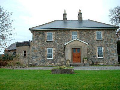
Mount Murray
Houses within 5km of this house
Displaying 10 houses.
Houses within 5km of Mount Murray
Displaying 10 houses.
| House name | Description | |
|---|---|---|
| Grange Hall | The building at this site on the first edition OS map is named Orange Hall and Grange Hall on the 25 inch map with a courtyard and laid out gardens. At the time of Griffith’s Valuation (publ. 1854) Owen Evers or Eivers owned and occupied the house, valued at £16. This property belong to Eugene Eivers in 1870, who owned 107 acres of land in the area at the time. The Eivers were still resident in 1906 and 1911 and the house remains a well maintained residence. |
|
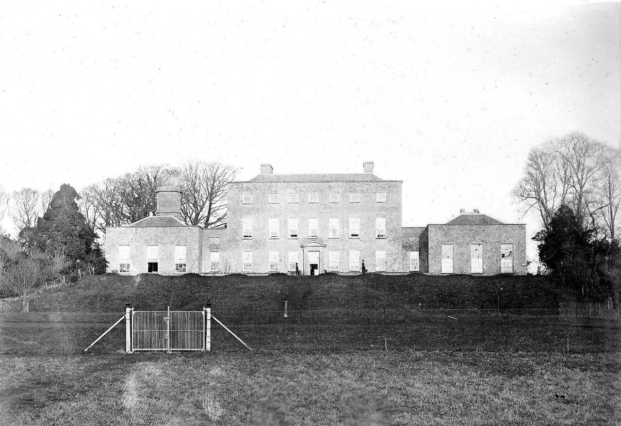
| Sonna | Set in a substantial demesne as shown of the first edition OS map, the building is slightly altered in shape from this map to the 25 inch map. The house was a three-storey, seven-bay mid-18th century Palladian style mansion. It was the home of the Tuite family and remained as such until it was burnt in 1921. Described in 1837 by Lewis - ‘Sonna for upwards of six centuries, the seat of the Tuite family, is at present the residence of Hugh Morgan Tuite… the house is a light and elegant building, in a well planted demesne’. O’Brien gives a detailed account of the family. The estate consisting of 638 acres was sold to the Land Commission in 1928. See https://www.tuites1.com/424198848.html |
|
| Wilson's Hospital | Wilson's Hospital School erected on the summit of a hill, was founded by a trust set up by Andrew Wilson of Piersfield [Piercefield]. The National Built Heritage Service records that Wilson stated in his will of 1724 that in the event of there being no direct male heirs to his estate that it, and all its profits, be transferred to the Church of Ireland hierarchy and used to build a hospital for aged Protestant men and a school for poor Protestant boys. This was the case by 1743 and the school was completed in 1761. ‘Wilson's Hospital is one of the finest and most sophisticated mid-Georgian buildings constructed outside of Dublin. Its design has been attributed John Pentland, a noted architect of his day, and it is built in the style of a Palladian country house’ (boi). It is a seven-bay two-storey building which was valued at £90 at the time of Griffith’s Valuation (publ. 1854) and continues to function as a secondary co-educational boarding school today. | |
| Lackan | Lackan house is marked but not named on the first edition OS map. It was a two-storey, three-bay house, the home of the Delamare family, long associated with the Multyfarnham area. The Taylor and Skinner maps of the late 1770s include reference to Delamar at Lacken. In 1837 Lackan was the seat of Mrs Delamere. It was unoccupied at the time of Griffith’s Valuation (publ. 1854) when valued at £17. The immediate lessor was Patrick J Murphy. A number of Delemere families were still resident in the townland in 1901. This house has been demolished. | |
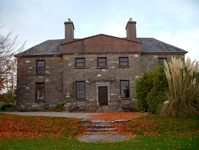
| Clanhugh | Named on the first edition OS map as Clanhugh Lodge overlooking Lough Owel, later rebuilt as shown on the 25 inch map when it is named Clonhugh. The earlier house Clanhugh Lodge was the residence of the Earl of Granard in 1814 and in 1837 described as a lodge belonging to Lord Forbes. Valued at £12 the building was occupied by James Lugden who held it from the Earl at the time of Griffith’s Valuation (publ. 1854). The present five-bay two-storey Italianate country house, was built in 1867, to the design of William Caldbeck (1824-1872), for Colonel F.S. Greville, later Lord Greville, who purchased much of the Forbes lands in this area in 1859. Francis Nulty of Kells was the builder. Occupied by the Harvey-Kelly and Beirne families in the 20th century. | |
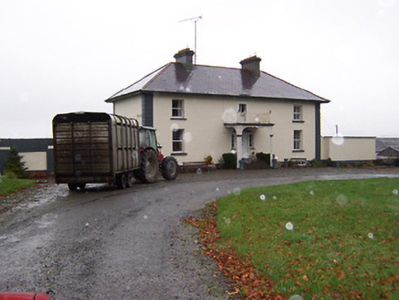
| Rathbennett House | Rathbennett House, formerly known as Farra House, originally functioned as Bunbrosna Charter School. Built c.1758 with a bequest from the will of the Rev. William Wilson, the nephew and heir of Andrew Wilson, the benefactor of Wilson's Hospital. Farra Charter School is recorded by Lewis in 1837 and was still recorded as a charter school with offices at the time of Griffith’s Valuation (publ. 1854) when the building was valued at £30. It was held by the trustees of Wilson’s Hospital in fee. Sometime later it became a private residence. Occupied by Thomas Cartret Foster in 1901 and 1911, this house remains a family home. |
|
| Ballinacloon | Ballynaclonagh, named on the first edition OS map as Ballynaclonagh and on the 25 inch map as Ballinacloon and extended. No longer extant, demolished c 1930. Complex of single and two-storey outbuildings on L-shaped plan survive. Ballynaclonagh was the residence of Edward Murphy in 1814 and P. E. Murphy in 1837. Griffith’s Valuation (publ. 1854) records Patrick E Murphy as the occupier holding the property valued at £33.5 in fee. Patrick Delamere, coachman to Captain Murphy, was resident with his wife in 1901. Valued at £45.5 in 1906 and in the possession of Captain Laurence Murphy. The Delameres had three children by 1911 and were resident holding the property from Mrs Sarah Murphy. | |
| Soho (Multyfarnham) | Soho, an early 19th century three-bay two-storey house, is named on the first edition OS map. Inherited by Lattin Fitzgerald, a younger son of Catherine Nugent of Donore and her husband Pierce Fitzgerald, who occupied the house in 1814. At the time of Griffith’s Valuation (publ. 1854) it was the residence of Peter Nugent Fitzgerald, valued at £15.15 and held from Sir Percy Nugent of Donore. The house was occupied by Mrs Margaret Fitzgerald’s gardener Edward Fay in 1901 and by Colonel Edward Irwin and family in 1911. Soho is still a family home. |
|
| Portloman | Portloman, situated on the shore of Lough Owel, is named on the first edition OS map and the 25 inch map. Home of the de Blaquiere family from the mid-18th to the mid-19th centuries. Both Leet (1814) and Lewis (1837) record Portloman as the seat of Lord de Blaquiere. At the time of Griffith’s Valuation John de Blaquiere held the house valued at £18 in fee. When the estate was for sale in June 1866 the mansion house was described as been ‘beautifully situated on the margin of Lough Owel and stands upon a demesne containing about 200 acres Statute measure, handsomely planted, to which is attached a large garden, containing over three acres well stocked, walled in and lined with Brick; Hot Houses, Conservatories etc’. In 1906 the house was in the possession of Colonel David W Stevenson [of Derry]. The buildings had increased in value to £33.10 and were held with 142 acres of untenanted land. This house was destroyed in 1921. | |
| Woodland | Woodland overlooking Lough Owel, named on the first edition OS map and 25 inch map, still extant but now known as Ardilaun House. Lewis records W Moxton, agent to Lord Forbes, as the occupant in 1837 and at the time of Griffith’s Valuation (publ. 1854) Edward Maxton was resident holding the property valued at £14 from Lord Forbes. In 1901 occupied by race horse trainer Alexander Pilkington and his wife and by the Brabazon family, horse trainers in 1911. |