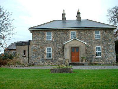
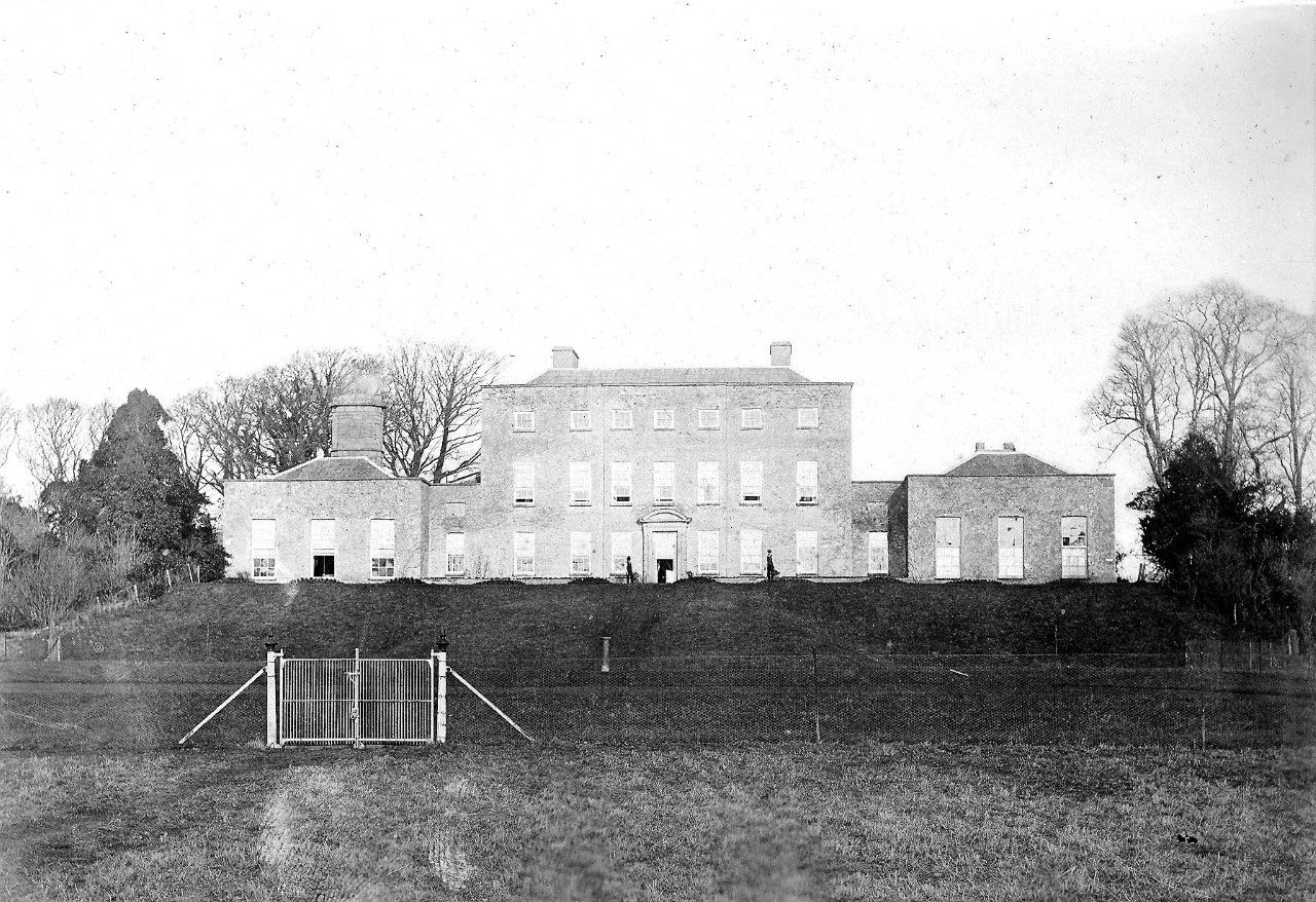
Tristernagh House
Houses within 5km of this house
Displaying 12 houses.
Houses within 5km of Tristernagh House
Displaying 12 houses.
| House name | Description | |
|---|---|---|
| Grange Hall | The building at this site on the first edition OS map is named Orange Hall and Grange Hall on the 25 inch map with a courtyard and laid out gardens. At the time of Griffith’s Valuation (publ. 1854) Owen Evers or Eivers owned and occupied the house, valued at £16. This property belong to Eugene Eivers in 1870, who owned 107 acres of land in the area at the time. The Eivers were still resident in 1906 and 1911 and the house remains a well maintained residence. |
|
| Ballysallagh House | Ballysallagh house is not marked on first edition OS map. It is a three-bay two-storey late-Georgian-style farm house, built about 1850. At the time of Griffith’s Valuation (publ. 1854) it was occupied by Christina McCormick, who held the house valued at £11 from William Longworth. It is still in use as a residence. |
|
| Baronstown | Baronstown was a large mansion in an extensive demesne on the western shore of Lough Iron, as shown on the first OS map, with many features such as a temple, summer house etc. Described by the National Built Heritage Service as an important late eighteenth-century Palladian villa with two storey wings, it was associated with the Malone Family/Lord Sunderlin. Taylor and Skinner noted it as a Malone property in 1777. Lord Sunderlin was resident in 1814. Following the death of Richard Malone in 1837 his sister Alicia who had married Henry O’Connor of Mount Pleasant, King’s County (Offaly) succeeded to the Baronstown and Shinglis estates. O’Brien writes that the building was burnt twice and rebuilt. The first time in 1889 and the second time in 1903 when it was replaced by a large Tudor villa to designs by James Franklin Fuller. In 1906 it was valued at £70 and was occupied by Colonel John R Malone who held it with 943 acres of untenanted land. Demolished by the Land Commission in the 1920s, it is now a greenfield site. |
|
| Oran Vale | Located directly north of Ballynacarrigy, Oran Vale is named on the first edition OS map and was occupied by J Irwin in 1837. Valued at £15 it was unoccupied at the time of Griffith’s Valuation (publ. 1854) while the immediate lessor was Thomas William West who held the property from Alicia O’Connor Malone. The house is not named on the 25 inch map and is now a ruin. | |
| Willybrook/Willifield | This house is named Willybrook on the first edition OS map and as Willifield on the 25 inch map. Valued at £12 at the time of Griffith’s Valuation (publ. 1854), it was occupied by Joseph Evers who held it from Alicia O’Connor Malone (in Chancery) and remains a well maintained residence. |
|
| Kill House | Kill house marked on first edition OS map and the 25 inch map is located a short distance west of Sonna. At the time of Griffith’s Valuation (publ. 1854) it was valued at £17, occupied by Maria McCormick and held from George Thompson. It appears to be still extant with courtyard outbuildings. | |
| Rath House | Rath House, was the home of J West in 1837 and of Thomas West at the time of Griffith’s Valuation (publ. 1854), when the buildings, including a corn mill, were valued at £34 and held from Alicia O’Connor Malone. In 1906 the mansion house of Rath valued at £30 was in the occupation of Colonel John R Malone and was held with 62 acres of untenanted land. The census records would suggest that the local rector Rev Venn was actually resident. The house is now demolished. | |
| Ardglass House | This house was rebuilt in the style of an Italianate Villa post Griffith’s Valuation, possibly incorporating the fabric of an earlier house on the same site. The original Ardglass House was the home of a Major A. P. Bond in 1837. Valued at £13.15 at the time of Griffith’s Valuation (publ. 1854), it was occupied by the representatives of A P Bond who held it in fee. The present house was in the ownership of William Perry Bond JP, in the 1880s. The house has had various owners in the 20th century and was for sale in 2017, see https://www.businesspost.ie/article/high-class-at-ardglass-co-westmeath/ | |
| Newpark Lodge | Newpark Lodge named on both the first edition OS map and the 25 inch map. Occupied by James Auchmuty JP in 1837 and at the time of Griffith’s Valuation (publ. 1854) when he held the house valued at £10 from the representative of A P Boyd. Now a modern building located at the site situated on the main road from Mullingar to Edgeworthstown. Newpark Lodge was for sale in 2021. | |
| Sonna | Set in a substantial demesne as shown of the first edition OS map, the building is slightly altered in shape from this map to the 25 inch map. The house was a three-storey, seven-bay mid-18th century Palladian style mansion. It was the home of the Tuite family and remained as such until it was burnt in 1921. Described in 1837 by Lewis - ‘Sonna for upwards of six centuries, the seat of the Tuite family, is at present the residence of Hugh Morgan Tuite… the house is a light and elegant building, in a well planted demesne’. O’Brien gives a detailed account of the family. The estate consisting of 638 acres was sold to the Land Commission in 1928. See https://www.tuites1.com/424198848.html |
|
| Rathbennett House | Rathbennett House, formerly known as Farra House, originally functioned as Bunbrosna Charter School. Built c.1758 with a bequest from the will of the Rev. William Wilson, the nephew and heir of Andrew Wilson, the benefactor of Wilson's Hospital. Farra Charter School is recorded by Lewis in 1837 and was still recorded as a charter school with offices at the time of Griffith’s Valuation (publ. 1854) when the building was valued at £30. It was held by the trustees of Wilson’s Hospital in fee. Sometime later it became a private residence. Occupied by Thomas Cartret Foster in 1901 and 1911, this house remains a family home. |
|
| New Port (Ballymahon) | At the time of Griffiths Valuation in the early 1850s, Patrick Ross was leasing this property from the Fox estate, when it was valued at almost £9. In 1814 Leet referred to it as the residence of J, Molloy. The Ordnance Survey Name Books mention it as a gentleman's residence belonging to Mr. Fox. The house is labelled New Port on the 1st edition Ordnance Survey map but does not appear on subsequent maps and is no longer extant. |