Mount Temple House
Houses within 5km of this house
Displaying 14 houses.
Houses within 5km of Mount Temple House
Displaying 14 houses.
| House name | Description | |
|---|---|---|
| Bellanalack | Bellanalack is marked on the first edition OS map and the later 25 inch map but a much smaller building is now located on the site. The house was occupied by Christopher Adamson in 1837 and at the time of Griffith’s Valuation (publ. 1854). He held the property valued at £13 from Lord Castlemaine. | |
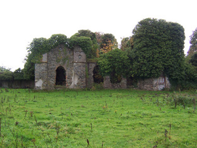
| Belville | O’Brien writes that Belville was built about 1775 for Richard Cuppaidge and by the early 1780s was occupied by the Jones family. It remained the Jones family home until at least the time of Griffith’s Valuation (publ. 1854) when Gustavus Jones Junior was resident. The house was valued at £23. It is now a ruin. | |
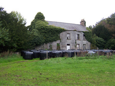
| Carn Park | Carn Park was built by the Adamson family in the late 18th century. Travers Adamson, son of William Gustavus Adamson was resident in 1814 and W G Adamson in 1837. At the time of Griffith’s Valuation (publ. 1854) the property was in Chancery, Robert Adamson was the occupant and the buildings were valued at £24. On 17 June 1870 when the house and lands were advertised for sale in the Land Court the house was described as a ‘commodious dwelling house (with suitable out offices) on Lot 1, which, although somewhat out of repair, is capable (at a moderate outlay) of being made a comfortable residence for a gentleman and his family. The house is prettily situated on the slope of a hill, commanding an extensive view’. It was bought by the Rev Thomas Thompson Gray of Dorrington, Drumraney, who was Vice Provost of Trinity College, Dublin, 1916-1924. The house was demolished in the mid-20th century. | |
| Coolvuck House | O’Brien writes that this early 19th century house was probably built by Francis Dillon, who was recorded as the occupant in 1814. Valued at £13 at the time of Griffith’s Valuation (publ. 1854), it was occupied by Eneas McDonnell who held the property from James George Murphy. Occupied by Thomas Groarke, a farmer and his sister in 1901 and by Thomas Killoughy, a shepherd who held it from Thomas Groarke in 1911. | |
| Nahodmore House | This building is marked on the first edition OS map, altered and expanded on the 25 inch map. O’Brien states that it was built by the Adamson family. Leet records William Marsh as resident at Nahad in 1814. Valued at £11 Nahodmore House was occupied by Thomas Russell and held from John Trench at the time of Griffith’s Valuation (publ. 1854). William Woods Russell son of Mark Goodbody Russell and his wife Mary was born at Nahodmore in July 1855 (The British Friend, 9th month 1855, p 227). Mark Goodbody Russell and his daughter Mary were both living there in 1901. They were members of the Society of Friends while caretakers Alexander and Jane Elder for William W Russell were living there in 1911. This house, a short distance north west of Moate, is still extant. | |
| Shurock | The Homan family appear to have settled at Shurock in the early 18th century. The original house at Shurock was built sometime in the eighteenth century, with a later single-storey Gothic wing added at the end of the eighteenth century. This house was the home of Captain Homan, about 1760 and of Sir W Jackson-Homan (barrister) in 1837. Sir William was created a baronet in 1801. The house is marked but not named on the first edition OS map and the building later expanded as shown on the 25 inch map. O’Brien states that the house was sold in the Encumbered Estates Court and it must have been purchased by George Fleming as he was the occupant at the time of Griffith’s Valuation (publ. 1854) holding it in fee. It was valued at £23. The house is now a ruin. |
|
| Twyford | Twyford House was originally built about 1760 by the Handcock Family of Waterstown House, Glassan, but passed into the ownership of the Hodson Family, at the end of the 18th century. In 1814 John Hodson was resident and E Hodson in 1837. Valued at £24 John Hodson was the occupant at the time of Griffith’s Valuation (publ. 1854), holding the property from John Longsworth. The Hodsons continued to reside at Twyford until it was sold about 1960. The house is now derelict. |
|
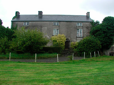
| Moate Castle | A complex structure, of at least three periods of construction, which dominates the centre of the town. It is a two-bay three-storey former fortified house/tower house, built 1550, having a three-bay three-storey wing to the west end, built c.1720 and a two-storey bowed extension to the east end, built c.1760, acquired by Captain John Clibborn in 1659 (boi). In 1814 Thomas C Clibborn occupied Moate-castle and in 1837 Moate Castle was the seat of Cuthbert J Clibborn. At the time of Griffith’s Valuation (publ. 1854) Gilbert Nugent was resident holding the property valued at £23 from the representatives of Cuthbert J Clibborn. Moate Castle has remained a private residence and was for sale in 2023. |
|
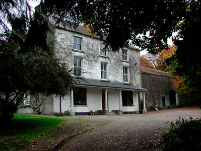
| Farnagh | Buildings are marked at this site on the first edition OS map and the house is named on the 25 inch map. It was built in the early 19th century and a Mr Benjamin Wynne was resident in 1814. The house was extended about 1850 according to the National Built Heritage Service. This house was the residence of R. Adamson in 1837 (Lewis) and of Hannah Wynne who held it from Edward Digges La Touche, valued at £14.5 at the time of Griffith’s Valuation (publ. 1854). Edward Wakefield, a ‘gentleman farmer’ and his family were resident in the early 20th century. This house remains a family home. |
|
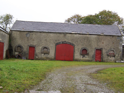
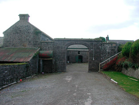
| Moyvoughly | Moyvoughly named Moyvoughly Lodge on the first edition OS map and Moyvoughly House on the 25 inch map. O’Brien writes that this was originally Arabin land purchased towards the end of the 18th century by the Grogans. This house was constructed by 1837 as C Arabin was resident, who was probably leasing it from the Grogans. By the time of Griffith’s Valuation (publ. 1854) John Ennis had acquired the house and lands as he is recorded as holding the property in fee . O’Brien writes that he rented the house to William Dargan, the railway entrepreneur, who was building the Mullingar to Dublin railway line and that the land was used to graze and accommodate the horses used in this work. In the mid-1850s Moyvougly was leased to Thomas Maher who eventually purchased the estate. Bought by the Fallon family in the 20th century, the house is now demolished but some outbuildings and stables survive. |
|
| Dorrington House | At the time of Griffiths Valuation St. George Gray held this property in fee when it was valued at £32. It is labelled Dorrington House on all editions of the Ordnance Survey maps. In 1906 it was the property of Wellington Gray and valued at £44. O'Brien writes that the house was demolished during the twentieth century and a newer house constructed at the site but extensive estate architecture survives. |
|
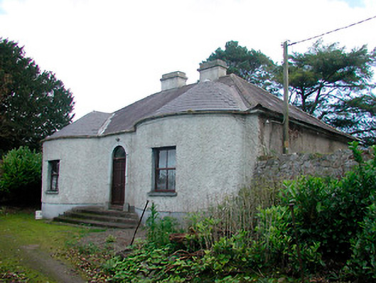
| Walderstown Lodge | William Potts was leasing this property from the Gray estate at the time of Griffiths Valuation in the early 1850s, when it was valued at £12. O'Brien writes that it was possibly built by the Dorrington Hackett family of nearby Dorrington House. It was acquired by the Gray family by inheritance and became a dower house. It is still extant. |
|
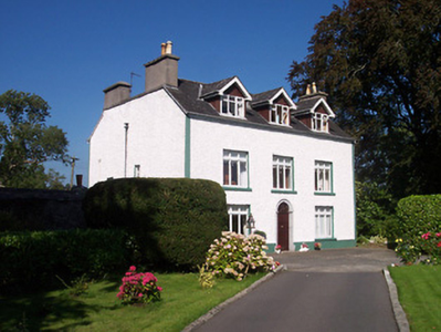
| Lissanode House | O'Brien writes that this house was occupied by the Russell family, probably from the early part of the eighteenth century. At the time of Griffiths Valuation, in 1854, it was occupied by Frederick W. Russell, leasing from the Boyd estate, when it had a valuation of £7. It was replaced by a more substantial house in the late nineteenth century following a fire. It is still extant. | |
| Jones Lake | A house south of the railway line and a short distance west of Moate in the mid-19th century. O'Brien writes that it was built by the Jones family in the mid-18th century as a two storey, three bay building. Leet records William Gustavus Jones as resident in 1814. Occupied by John Sills at the time of Griffith's Valuation (publ. 1854) and held from Patrick Dillon Irwin with about 50 acres, when it was valued at £13. |
|