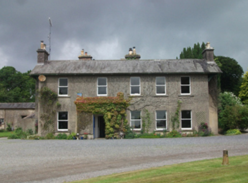
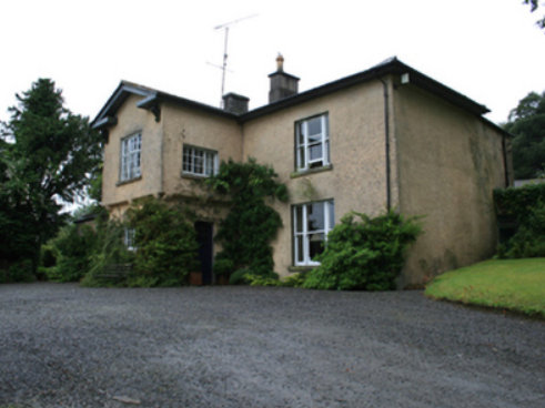
The Lodge
Houses within 15km of this house
Displaying 27 houses.
Houses within 15km of The Lodge
Displaying 27 houses.
| House name | Description | |
|---|---|---|
| Bailieborough Castle/Lisgar Castle | A Scottish planter named William Bailie built a castle here in the early 17th century. It passed into the possession of a number of prominent families Hamilton, Stewart and Corry until it was sold to Colonel William Young in 1814. His son, Sir John Young, later created 1st Baron Lisgar, built a new house on the site in the 1860s. At the end of the 19th century the house was sold to Sir Henry Cochrane and in 1915 to the Marist Brothers of Athlone. Badly damaged by fire in 1918 but reconstructed, the house was eventually demolished in 1942. For image see https://www.archiseek.com/ | |
| Beckscourt House | Becks Court, located just outside the town of Bailieborough on the Young estate, was occupied by the Reverend Arnold Cosby in 1814. Lewis records the Reverend E. Mahaffy as resident. By the mid-19th century it was occupied by Sarah Mahaffy who held the property from Sir John Young of Bailieborough Castle. The buildings were valued at £12. | |
| Spear Vale/Vale House | In 1814, Ambrose Leet refers to William Spear of Spear Vale, Bailieborough. In 1837, Lewis described the home of W. Spear as comfortable with an extensive bleach green about one mile from the town. The Reverend Frederick FitzPatrick occupied the house in the mid-19th century holding it from William Spear. The buildings had a rateable valuation of £12. This house is no longer extant. | |
| Spear Vale/Vale House | In 1814, Ambrose Leet refers to William Spear of Spear Vale, Bailieborough. In 1837, Lewis described the home of W. Spear as comfortable with an extensive bleach green about one mile from the town. The Reverend Frederick FitzPatrick occupied the house in the mid-19th century holding it from William Spear. The buildings had a rateable valuation of £12. This house is no longer extant. | |
| Fortland | Leet records Fort-land, Mount Nugent, as the home of the Reverend H. Maxwell in 1814. Lewis records W. Gosling as the occupant of Fortland in 1837. The first edition Ordnance Survey map (publ. 1837) shows Fortland to have been a substantial property with laid out gardens and plantations and a demesne of over 300 acres. It was the home of the Hon Somerset Maxwell at the time of Griffith’s Valuation. He held the property in fee and the buildings were valued at £27. By 1906 this valuation had increased to £52.10.0. and the house was the home of Mrs Maxwell. The house is demolished and the site now a green field. | |
| Arley Cottage | A graphic of Arley Cottage ‘belonging to Colonel Barry’ in the National Library is dated circa 1820s, see http://catalogue.nli.ie/Record/vtls000550550. The Farnham Papers also refer to Arley Cottage in 1822. Lewis records Arley as the property of Lord Farnham and it was occupied by the Hon Somerset Maxwell in the mid-1840s and by the Hon Richard Maxwell in the mid-1850s when it had a rateable valuation of £20. The Hon. Henry Maxwell was the occupier in 1906. This building is no longer extant. | |
| Cornashesk House | This house was not built at the time of the first Ordnance Survey in the 1830s. It was erected within the demesne of Fort William and was occupied in the 1850s by David Kellett and held from the trustees of the Marquess of Headfort. It was valued at £10. Home of the Farrelly family at the beginning of the 20th century. | |
| Fort William (Cornashesk) | A house and outbuildings are marked on the first edition six inch Ordnance Survey map (publ. 1837). Leet records Charles Kellett as the occupant of Corna-sesk in 1814. The house, which had expanded, is named on the 25 inch map. Fort William was the home of Robert Kellett in the 1850s, held from the Marquess of Headfort and valued at £14. Fortwilliam, Virginia, was the home of Ralph Harman in 1876. It is still extant. | |
| Lurgan Lodge | Lurgan Lodge was the residence of a branch of the Nixon family from the late 18th century. George Nixon of Lurgan Lodge was the fourth son of the Reverend Andrew Nixon of Nixon Lodge. George’s son, Andrew Nixon, lived here in 1814. Lurgan Lodge is named on the first edition six inch Ordnance Survey map (publ. 1837). There was a corn mill nearby. The estate of Eliza Nixon of Lurgan Lodge was advertised for sale in the Encumbered Estates Court in March 1852. Her estate was held on a 21 year lease from the Bishop of Kilmore, dated 1849. James Hunter was one of the plaintiffs. In the mid-19th century the house was occupied by John Jennings and held from James Hunter. The buildings had a rateable valuation of £15. John Jennings was described as a farmer and miller when he died in 1867 (NA, Wills and Administrations 1867, 105). In the early 20th century Lurgan Lodge was the home of Thomas Charles Kellett, a farmer and magistrate. It is still extant. | |
| Crover House | This house is located on the shore of Lough Sheelin and in the mid-19th century was valued at £21.5.0. for rates. It was occupied by Thomas Cummins and held from Lord Farnham’s son, the Hon Somerset Mawell. By 1876 Robert John Cuming was resident at Crover. He owned 1,118 acres in the county. In 1901 Julia Cuming, a widow, and her daughter Kate were still resident. This house became a hotel in 1957. http://www.croverhousehotel.ie/History | |
| Woodlawn | A two storey house, close to the shore of Lough Sheelin, built about 1800 and still occupied. It was vacant at the time of Griffith’s Valuation but held by William Mahaffey from the Hon S. Maxwell and valued at £16.10.0. |

|
| Cornahilt Lodge | Located on the outskirts of Ballyjamesduff, Cornahilt Lodge was occupied by Mary Skelton in the mid-19th century. She held the property with a rateable valuation of £12.10.0. from Robert J. Cuming. Cornahilt Lodge is now the address of a services company based in Ballyjamesduff. | |
| Fort Frederick | Fort Frederick situated close to the shore of Lough Ramor was described by Bence Jones as ‘a 2 storey mid-c18 house with a central 3 sided bow and 2 bays on either side of it’. In 1814 it was the home of Captain Sankey but by 1837 had been acquired by his relative R. Scott who was married to Eleanor Sankey. Griffith’s Valuation records Richard Scott as the occupier. The buildings were valued at £35 and were held in fee. By 1876 Alexander William Jackson Sankey owned the Fort Frederick estate, comprised of 1,324 acres. He died in 1903. His brother Harry Samuel Sankey is recorded as resident at Fort Frederic in 1910. This house continues to be a residence. |

|
| Mountprospect | A Nugent family home until the mid-19th century when it passed into the possession of Richard Dempsey. Eliza Dempsey, a widow, was resident in 1901. This house no longer exists. | |
| Drumroragh Lodge | In 1814, Thomas Goslin was recorded by Leet as the occupant of Dromroa, Mount Nugent. Named on the first edition 6 inch Ordnance Survey map (publ. 1837) Drumroragh Lodge was quite a substantial building. It was the home of Charles Carr Morton and his wife Charlotte Tatlow. The demesne and mansion house of Drumrora were advertised for sale on 21 June 1855 and appears to have been purchased by a relative of the Mortons’ John Tatlow. Griffith’s Valuation in the 1850s describes Drumroragh as a herd’s house with a rateable valuation of £12. It was occupied by John T. Tatlow, who held it in fee. Later maps show a smaller house slightly to the east of the original building, which was demolished. The house is extant but does not appear to be occupied. | |
| Kilnacrott Cottage/House | In 1837 Lewis records Pierce Morton as the proprietor of Kilnacrott. This was Kilnacrott Cottage as marked on the first edition 6 inch Ordnance Survey map (publ. 1837). Subsequently a Tudor Revival house was built very slightly to the north of the Cottage for Pierce Morton (National Inventory of Architectural Heritage). Morton sold the house in 1850 to Samuel Moor, who sold it on privately to William Hague. This house had a rateable valuation of £65 at the time of Griffith’s Valuation and was occupied by George H. L’Estrange who held the property from William Hague of Cavan, father of William Hague, architect of Cavan and Dublin. In 1876 William Hague held 459 acres in county Cavan. In the 1880s Kilnacrott became the home of the Lynch family. In 1906, Charles Lynch was resident. He died in 1913 (see will administrations in the National Archives). From 1930 the building was used as a school by the Holy Trinity Priory. In 1954 a grant of arms was issued to the Rt Reverend Felim Cornelius Colwell, Lord Abbot of the Abbey of the Holy Trinity of the Canons Regular of Premontre at Kilnacrott, Co Cavan, and to the Community, see National Library, GO MS 111H: 27-28. Kilnacrott is now known as the Cavan Centre, a ‘Residential Centre for Education and Community Development’, see http://www.cavancentre.ie/ | |
| Bob's Grove/Farren Connell | The Nugent home known as Bob’s Grove dates from the mid-18th century. It was later known as Farren Connell possibly after alterations were made in the mid-19th century. In 1814, Oliver Nugent was resident at Bob’s Grove. In 1837, Lewis records Christopher E.J. Nugent as proprietor. At the time of Griffith’s Valuation Christopher’s representatives held the property in fee. It was valued at £24 for rates. Emily Nugent, a widow, was resident in 1901 and her son Colonel Oliver Nugent and his wife in 1911. Farren Connell continues to be the home of this family. |
|
| Dungummin House | Dungummin House with a very small demesne is named on the first edition six inch Ordnance Survey map (publ. 1837). In 1814 Leet records John Ingham of Dungimmon, Mount Nugent. Joseph Lynch was the occupier recorded in Griffith’s Valuation. He held the property, described as a herd’s house and valued at £12.10.0., from Thomas Whitney. Michael Palles Lynch of Dungimon, county Cavan and of Coola, county Westmeath, sixth son of Joseph Lynch of Roebuck House, county Cavan, is recorded in Walford’s 1910. | |
| Lisnabrin | This house, located on the outskirts of Mount Nugent, was built after the first edition six inch Ordnance Survey map (publ. 1837) was compiled. John Love was the occupant in the 1850s, holding the property, valued at £13, from the Most Reverend J.G. Beresford. A Lynch family home at the beginning of the 20th century and still a residence. |
|
| Roebuck | Roebuck was a Lynch home from at least the early 19th century when Edward Lynch was recorded as resident in 1814. Lewis records W. Reilly as the proprietor of Roebuck. In the 1850s Joseph Lynch was the occupant recorded in Griffith’s Valuation, when the buildings were valued at £15 and held from the Representatives of William O’Reilly Adams. By 1906, Henry Galligan was occupying this 'mansion' house valued at £15 for rates and 365 acres of untenanted land. | |
| Billis Grange | A house built after the first edition six inch Ordnance Survey map (publ. 1837) was surveyed. Mrs D. Delap was the owner and occupier in the mid-19th century when the buildings were valued at £13. There is a reference to W.C. Peyton of Billis Grange in a document in the Farnham Papers, Ms 11,499 (NLI). The building was possibly extended towards the end of the 19th century. The National Inventory of Architectural Heritage dates the present house c. 1890. The 25 inch map shows a substantial house in parkland with a lodge at the entrance gate. In 1906, Henry Sankey held over 300 untenanted acres in this locality including a building with a rateable valuation of £16.10.0. This house continues to be a family residence. |
|
| Beehive | Marked on the first edition six inch Ordnance Survey map (publ. 1837), this was a single storey house with a small plantation nearby. It was owned and occupied by Charles C.H. Coote in the mid-19th century. It may have been built for the use of an employee of the Coote family. The house and its multi-bay farm yard are still extant. |
|
| Lakeview (Mullagh) | The nucleus of this house is believed to date back to the mid-17th century and since that time has remained in the possession of the Mortimer family and their descendants. Leet lists David Mortimer as resident and Lewis records Lakeview as a Mortimer home. Griffith’s Valuation names Charles Mortimer as the occupant and owner. The buildings were valued at £11. In 1906, David A Mortimer held about 500 acres of untenanted land and buildings valued at £11.15.0. Since the mid-1990s Lakeview has been the home of Jonathan and Daphne Shackleton and they have restored the gardens. |
|
| Rantavan | Rantavan is situated on the southern side of the village of Mullagh and is named on the first edition six inch Ordnance Survey map (publ. 1837). Throughout the 18th century it was the home of the Brookes, a literary family. By the time of Griffith’s Valuation in the mid-1850s Jane Kellett was resident. She held the property from the representatives of John Young. The rateable valuation was £13.10.0. Home of the Roundtree family in the early 20th century this house appears to be still extant. | |
| Quilca House | Quilca was associated with the Sheridan family. The Reverend Thomas Sheridan was a friend of Dean Swift. In 1725 the Dean wrote some of ‘Gulliver’s Travels’ while staying with the Sheridans at Quilca. In 1814 Robert Doughty was resident and the Reverend Luke O’Reilly in the 1830s. No occupant is given in Griffith’s Valuation when the building was described as a herd’s house and was valued at £5. Joseph Le Fanu was the immediate lessor. A mid-20th century house now occupies the site. | |
| Lake View (Munterconnaught) | In 1814 the Reverend Nicholas Goslin occupied Lake View, Mountnugent, close to the shore of Lough Ramor. The house is named on the first edition six inch Ordnance Survey map (publ. 1837). In August 1847 T. Drapes, a medical doctor, died at Lake View, Mountnugent, of typhus fever (The Medical Times, XVI, 542). James Blakely was the occupier in the mid-19th century holding the property from the trustees of the Marquess of Headfort. The buildings were valued at £12.10.0. for rates. This house is still extant with an extensive courtyard of outbuildings. | |
| Eighter | On the first edition six inch Ordnance Survey map (publ. 1837) Eighter House, part of the estate of the Marquess of Headfort, is shown as set in a small demesne close to the shore of Lough Ramor. Henry Sargent was the occupier in the mid-19th century when the buildings were valued at £16. In the 1870s Eighter was the home of John Alexander Johnston, who owned 111 acres in the county in 1876. He was medical doctor and his wife had a connection with the Sargent family. Home of Michael M’Enroe in the 1920s. It appears to be extant. References to Eighter in the Small Private Collections of Cavan Library's Archives Service, P017/0084, P017/0104, P017/0125 & P017/0166. |