Bruce Hall
Houses within 10km of this house
Displaying 26 houses.
Houses within 10km of Bruce Hall
Displaying 26 houses.
| House name | Description | |
|---|---|---|
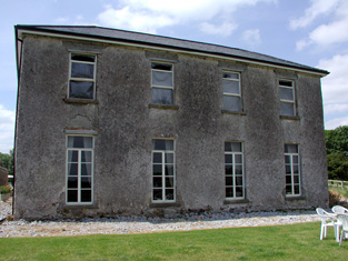
| Kilbracken | William Murray Hickson was leasing the house at Kilbracken, barony of Carrigallen, from Elizabeth Armstrong at the time of Griffith's Valuation when it was valued at £20. In 1814 a house at Kilbracken was recorded as the residence of Mr. Armstrong but it has been estimated that the present Kilbracken House was built around 1825. It is not named on the first edition Ordnance Survey map though there are buildings marked on the site. A poster in Leitrim County Library indicates that it was the property of Thomas S.Jones in 1905 when it was offered for sale. The house is still extant and undergoing restoration. |
|
| Cloghlough | At the time of Griffith's Valuation, William O'Brien was leasing a property valued at £8 at Cloghlough, barony of Carrigallen, from the estate of John King, which was in Chancery. Substantial farm buildings exist at this site. | |
| Kilmainham - The Cottage/Heath Lodge | Lewis refers to Kilmainham as the residence of A. Bell and the house is named as The Cottage on the first edition 6 inch Ordnance Survey map (publ. 1837). By the time of Griffith’s Valuation about 20 years later, Henry Montford was the occupier, holding the property from William Humphrys of Ballyhaise. The building would appear to have been extended by this time as its rateable valuation was £15. The house is named Heath Lodge on the 25 inch map. James Hartley and family were resident at Heath Lodge in 1901 while Hector John Atkinson and his wife Sybil were the occupants in 1911 holding the property from the representatives of James Harley. A building of similar shape still exists at this site. | |
| Riverview/Cloggy House | River View was situated on the bank of the River Erne. It was obviously associated with linen making in the early 19th century as beetling and bleaching mills are both marked near the house on the first edition six inch Ordnance Survey map (publ. 1837). A corn mill is also shown nearby. The Faris family were resident in Cloggy from at least 1832 when Alexander Faris is mentioned in the Tithe Applotment Books. In the mid-19th century William Faris was resident holding the buildings valued at £15 from Cosby Thomas Nesbitt. Alexander Faris/Ferris, a farmer and his family were living in Cloggy at the beginning of the 20th century. This house has been modernised and still retains a fine range of outbuildings. | |
| Drumgoon | The houses known as Drumgoon, Lahard, Gartinadress and Lakeville are in close proximity to one another and all at one time were homes of the Young family. Drumgoon is located just east of Lahard. In the mid-19th century it was the residence of James Robinson, who held it from Robert Hutton when it had a rateable valuation of £6.10.0. This house is still extant. | |
| Laurel Bank/Holly Bank | This house, originally known as Laurel Bank, is named on the first edition six inch Ordnance Survey map (publ. 1837). It is shown in a demesne which included an old bleach mill and a corn mill and kiln. It is believed to have been built by a mill owner in the 18th century. Griffith’s Valuation records William Norton as the occupant holding the property valued at £8.10.0. from the Earl of Gosford. The house is called Holly Bank on the 25 inch map. Altered and added to in the 20th century it continues to be a residence. | |
| Gartinadress House | In 1814, Charles Veaitch was the resident at Gortin-ardrass. This house is named on the first edition six inch Ordnance Survey map (publ. 1837). Although having advertised Gartinardress for sale in 1850 William Young was the owner and occupier at the time of Griffith’s Valuation when the property was valued at £15 for rates. By the early 20th century the Armstrong family were occupying Gartinardress, although in 1906 William A. K. Young is recorded as occupier of 228 acres of untenanted land and the mansion house. This house is no longer extant and the site is part of a forestry area. A house known as Lakeville was also located in the townland of Gartinardress. Leases in the National Library record Lakeville as the home of Richard Young in the 1820s. It was described as ‘in ruins’ on the 25 inch map. | |
| Lahard | Lahard was the home of the Young family in the 18th and 19th centuries. It is named on the first edition six inch Ordnance Survey map (publ. 1837) which shows a flower garden to the south of the house. Occupied by Cosby Young in 1814 and by John Lough in the 1850s, who held the property from the representatives of Cosby Young. The buildings were valued at £10. Inherited by one of Cosby Young’s daughters, Mrs Mackarness. The railway line was erected to the south west of this house. It is no longer extant. | |
| Tully House (Killashandra) | Richard Young of Tully 1808, see GO MS. Richard Young and his wife Bridget Nugent Reynolds later lived at Fort Lodge, on the outskirts of Cavan town. In 1814, Mr R.Y. Reynolds was resident at Tully, Crossdoney. Major Randal Stafford of Tully House, Crossdoney, is listed as a subscriber to Lewis ‘Topographical Dictionary’ (1837). In the 1850s this house was occupied by William Magee who held it from the representatives of Hugh Walsh. The Douglas family were resident at the beginning of the 20th century. | |
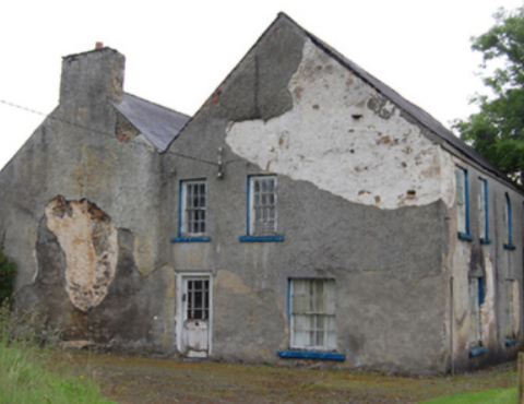
| Rockfield (Killashandra) | The National Inventory of Architectural Heritage dates this house to circa 1720. The Irish Genealogist Vol II refers to the will of F. Young of Rockfield, 1777. Situated close to Rockfield Lough it was a Berry home in the first half of the 19th century. Thomas Berry was resident in 1814 and in 1851 (Thom’s Directory). Rockfield was advertised for sale in the Encumbered Estates Court in November 1851. A few years later Griffith’s Valuation records Robert O’Brien as the occupant of Rockfield holding it from Oliver Sproul. It was valued at £17. The house is still extant but no longer in use. |
|
| Portaliff House | Portaliff House was located on the Castle Hamilton estate, north of Mill Lough and a little south of Killashandra. In the mid-19th century it was occupied by Captain F.H.B. Philips when it was valued at £12 for rates. Portaliff House is listed as a protected structure. | |
| Bellville | The Fleming family were known to be at Bellville from the early 18th century. The house is named on the first edition six inch Ordnance Survey map (publ. 1837) and located facing two forts in a sizable demesne. Belville was the home of A. Fleming in 1814 and of Captain A. Fleming in the 1830s. By the 1850s, the occupant was Jane Kenny who held the property valued at £7 from Major General Fleming. At the beginning of the 20th century Bellville was the home of the Meikle family, originally from Scotland. It is still extant. | |
| Corstruce House | A house located on the outskirts of Bellananagh and near a corn mill. It was situated on part of the Fleming estate and was occupied by William Pollock in the mid-19th century and was in the possession of Thomas Brady in the early 20th century. A modern house now occupies this site. | |
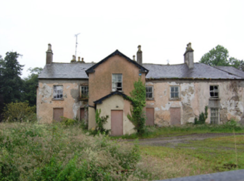
| Lismore Lodge | Built as the agent’s house in the Nesbitts’ Lismore Castle demesne close to the village of Crossdoney. Lismore Lodge is named on the first edition six inch Ordnance Survey map (publ. 1837). It was the home of William Tatlow in the mid-19th century, when the buildings were valued at £20. Occupied by the family of Thomas Cosby Burrowes at the beginning of the 20th century. His mother Mary Anne Burrowes had succeeded to the Lismore estate in 1886 following the death of her brother Alexander Nesbitt. Under boundary changes at the end of the 19th century the location of the Lodge was changed to the townland of Lismore Demesne and it was valued at £32 for rates in 1906. In the mid-20th century it was a Lucas-Clements home. This house is extant but unoccupied. |
|
| Drumcarban | Bence Jones describes Drumcarban as a late 18th century house of 3 storeys and 3 bays. It was the home of the Bell Booth family in the 19th century. George Thomas Bell Booth was resident in the 1830s and 1840s until he was murdered in 1845. Robert Booth Bell was the owner and occupant at the time of Griffith’s Valuation. This house was occupied by Annie Sheridan in 1901, in 1906 by Michael Sheridan when it had a rateable valuation of £22.5.0. and is still extant. | |
| Bingfield | A house built in the mid-18th century by the Venerable Joseph Story, Archdeacon of Kilmore. Occupied by Joseph Story in the mid-19th century, when the buildings were valued at £40. The property was held from Anthony O’Reilly. The Story family were still resident in 1901. Bingfield was sold by Arthur Patrick Story [sometime in mid-20th century, Irish Family Records (1976)]. Many of his siblings went to live in New Zealand. This house is still a fine residence. |

|
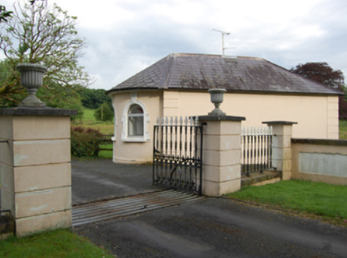
| Castle Cosby | Castle Cosby was situated close to a small lough of the same name. A number of other country houses were located in close proximity, such as Lismore. J. Whitethorne was resident at Castle Cosby in the 1830s and 1840s. By the mid-1850s Andrew Smith was the occupant holding the property from John E. Vernon. It was valued at £16. In 1876, Philip Smith of Castlecosby owned 77 acres in co Cavan. He married Delia Mary daughter of Corney Banahan of Renny, Co Roscommon and had a number of sons who became doctors. His third son Frederick Paul married in 1905 Isabella Ann daughter of Edward Smith of Bellamont Forest. Castlecosby was mainly known as Kevit Castle under Smith ownership. The house is now demolished but a gate lodge is still extant. |
|
| Lismore Castle | An early 18th century house, possibly designed by Sir Edward Lovett Pearce (Bence Jones). Named on the first edition six inch Ordnance Survey map (publ. 1837), it was valued at £12 for rates in the mid-1850s. It was a Nesbitt family home until the 1880s when inherited by the Burrowes family and passed from them by marriage to the Lucas Clements in the 1920s. However the house was marked as ‘in ruins’ on the 25 inch map. Bence Jones records that it was later demolished and that the Lucas-Clements resided in the agent’s house nearby Lismore Lodge. | |
| Rockville (Crossdoney) | Named on the first edition six inch Ordnance Survey map (publ. 1837), Rockville was located on the Nesbitt estate to the north east of Lismore Castle, on the outskirts of Crossdoney. In the 1830s it was the home of John C. Tatlow and in the 1850s of Samuel Moore, when the buildings were valued at £20 for rates. Occupied by Dr John Stirling Greer and his wife in 1901 and held from Thomas Cosby Burrowes. Another medical family named Hallowes was resident in 1911. Apparently still extant and occupied. | |
| Ricehill House | Rice Hill was built in the mid-18th century. It was the home of the Bredin family in the first half of the 19th century. It is named on the first edition six inch Ordnance Survey map (publ. 1837). Described by Mulligan as a ‘classic Georgian gentleman’s farmhouse in a small demesne.’ Occupied by Patrick Finnegan and held from the representatives of Sophia Wright in the 1850s, when the buildings were valued at £3.10.0. It was still the home of the Finnegan family at the beginning of the 20th century and continues to be a residence. |
|
| Drumheel House | A house named on the first edition six inch Ordnance Survey map (publ. 1837) with extensive outbuildings and occupied by R. Bell. Griffith’s Valuation records William Smith as owner and occupier in the 1850s, when the buildings were valued at £23.10.0. A building of different shape now occupies this site. | |
| Lisnamandra | Lisnamandra was a Sneyd family home in the 18th century. Frances Arabella Sneyd of Lisnamandra married Archdeacon Joseph Story (died 1767) of nearby Bingfield. One of their daughters Sophia married Robert Burrowes of Stradone House. Their grandson, James Edward Burrowes, was the occupant of Lisnamandra in the 1850s. He held the property valued at £20.10.0. from Earl Annesley. However previous to J.E. Burrowes’ occupation Lisnamandra had been the residence of Mrs Elliott in 1814 and of George Burdett L’Estrange in the 1830s. Hugh Hamilton Moore and his wife lived in Lisnamandra in the early 20th century. He was a barrister and Clerk of the Crown and Peace for county Cavan. | |
| Danesfort | The present house replaced that marked on the first edition six inch Ordnance Survey map (publ. 1837). Danesfort was the home of the Dean of Kilmore and is situated a short distance from Kilmore Cathedral. Mulligan refers to a Deanery House on the site in 1739. Dean Magenis was resident in 1814 and Lord Fitzgerald and Vesey, Dean of Kilmore, in the 1850s. The buildings were valued at £24 for rates. The building is still in use as the home of an ecclesiastic. |
|
| Lake View (Scrabby) | Lake View in the townland of Bernyhill (212 acres) was the home of the McManus family. In the mid-19th century Eugene McManus held the property, valued at £11.10.0. in fee. He owned the townland of Bernyhnill in 1876. Eugene Mc Manus, aged 39, was resident at Lake View in 1901 and in 1911. A house surrounded by farm building is still extant at this site. | |
| Cornadrung Cottage | In 1906 the report on Untenanted Demesnes notes a property at Cornadrung in the possession of Edward Fitzgerald and valued at over £10. This house is labelled Cornadrung Cottage on all editions of the Ordnance Survey map. It appears to have begun as a small property, possibly a hunting lodge on the shores of Lough Gowna which was enlarged in the latter part of the 19th century. In the 1870s Cornadrung was recorded as the address of Mrs. Sarah Hughes. Family history sources suggest it was later owned by the Cole family. The site is now occupied by a modern house. | |
| Woodville (Granard) | Richard Lambert held this property in fee at the time of Griffiths Valuation, when it was valued at £16. In 1839 the Valuation Office books also note Lambert as the occupier of the property which was then valued at £12. The house survived into the twentieth century but is no longer extant. |