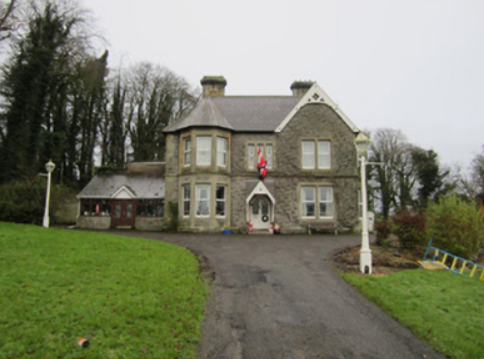
Etna Lodge
Houses within 5km of this house
Displaying 16 houses.
Houses within 5km of Etna Lodge
Displaying 16 houses.
| House name | Description | |
|---|---|---|
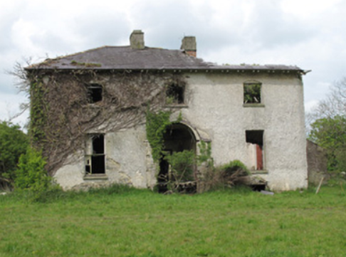
| Ballynure House | Built in the late 18th century, this house was originally the home of the Forster family. Described in the Ordnance Survey Field Name Book as a ‘handsome modern structure’. Griffith’s Valuation records William Forster as the occupant holding the property in fee. The buildings were valued at £50. The Haire Forsters lived here at the beginning of the 20th century but by 1911 were leasing Ballynure to William Maxwell Scott Moore, Resident Magistrate. This house is now a ruin. |
|
| Lisnaroe | This house was situated very close to the border with county Fermanagh. On the 1st edition Ordnance Survey map (1836) extensive gardens and some plantations are evident surrounding this house. It is described in the Ordnance Survey Field Name Book as ‘a good dwelling house’, the residence of Nicholas Ellis, agent to Sir Thomas Barrett Lennard. Ellis was still living there at the time of Griffith’s Valuation when the buildings were valued at £20. The Bamford family appear to be resident at the beginning of the 20th century. This house no longer exists. | |
| Mount Salem | Mount Salem situated on the Barrett-Lennard estate was marked on the 1st edition 6 inch Ordnance Survey map (1836) and on the later 25 inch map. It was located close to the border with county Fermanagh, just west of the town of Clones. The Reverend Adam Averell, a Methodist minister, died at Mount Salem on 10 January 1847, aged 93. Griffith’s Valuation records Amelia J. Conts as the occupant, holding the property from James Gregg. The buildings were valued at £13. In the early 20th century the McKenna family were resident but the house is now demolished. | |
| Salem Cottage | Located on the Barrett-Lennard estate, valued at £10 in the 1850s and occupied by James Gregg. James Gregg, farmer, of Clondregole, a townland adjacent to Mullanamoy, died on 15 September 1896 (NA, Wills and Administrations, 1897). A building is still extant at this site. | |
| Cloncurrin House | This house was not built at the time of the 1st edition 6 inch Ordnance Survey map published in 1836. At the time of Griffith’s Valuation in the 1850s it was occupied by Francis Fitzgerald who held the property from Sir Thomas Barrett-Lennard, when it was valued at £25. Occupied by John A. Moore in 1901 and still in use as a residence. |
|
| Drumard | The Ordnance Survey Field Name Book states that a house in Burdautien was the residence of Cockran, agent to the Madden estate. The National Inventory of Architectural Heritage dates the house circa 1810. Griffith’s Valuation records William Cochran as the occupier holding the property in fee. It was valued at £30. In the 1860s Drumard appears to be leased by William Cochran to a family named Elliott. Michael Elliott died at Drumard in 1872. The house is still a residence. |
|
| Ashfield | This house located on the Barrett-Lennard estate is marked on the 1st edition 6 inch Ordnance Survey map. James G. Smyth of Ashfield, Clones, was a subscriber to Lewis ‘Topographical Dictionary’ in the 1830s. Valued at £10 Jane Smith was the occupier at the time of Griffith’s Valuation. A house is still located at this site. | |
| Drumcru | A building was located at this site on the Barrett-Lennard estate at the time of the 1st edition Ordnance Survey map (1836). Griffith’s Valuation records the house valued at £11 and occupied by Mary Renwick. A house surrounded by a complex of outbuildings is still located at this site. | |
| Teehill Cottage | The National Inventory of Architectural Heritage dates this house circa 1820. It was built on the Barrett-Lennard estate before the nearby Ulster Canal was constructed. Valued at £10 at the time of Griffith’s Valuation it was occupied by Henry Brown who held it from Thomas Robinson. Home of Edward Scott at the beginning of the 20th century. |
|
| Clonboy | Located on the Barrett Lennard estate, on the outskirts of Clones, this house was built in the latter half of the 19th century. It is not mentioned in Griffith’s Valuation and was the home of the Pringle family. Many members of this family were solicitors. In the mid-20th century it became the home of the Bishop of Clogher. |
|
| Clonkeen Cottage | This house was not built at the time of the first Ordnance survey in the 1830s. It was located on the Lentaigne estate just north of the town of Clones. William Tugman was the occupant at the time of Griffith’s Valuation when the house was valued at £16 and held from Samuel Nicholl. A building still occupies this site. | |
| Killycoonagh House | Killycoonagh, located on the Forster of Ballynure estate, is marked but not named on the 1st edition 6 inch Ordnance Survey Map (1836). The Ordnance Survey Field Name Book records the house as the residence of the sister of the proprietor Forster of Ballynure. By about 1860 the buildings were valued at £20 and the occupant was Anne Forster. It appears to have been still in the possession of the Forster family in the first part of the 20th century, although it may have been leased out. |
|
| Anlore Cottage | In the mid-19th century Anlore Cottage, in the village of Anlore, was occupied by Jason Crawford and valued at £10. It was held from William Forster. A building is still located at this site. | |
| Gortgranard | This house is marked on the 1st edition 6 inch Ordnance Survey Map (1836) and is named on the 25 inch map (surveyed in 1908). It was the home of the Campbell family, Lewis records Mrs Graham as proprietor. The Ordnance Survey Field Name Book describes the residence of Mrs Graham, widow of Captain Campbell Graham as a ‘good building with large orchards, gardens, out houses etc’. In the mid-19th century it was valued at £20 and held by Samuel Campbell from Thomas de Burgh. Samuel Campbell of Gortgranagh died in 1879 and his wife Mary in 1913. Both are buried in Killeevan COI graveyard. Home of a farming family named Lee at the beginning of the 20th century. | |
| Aghafin House | Built close to the border with county Fermanagh in 1836 and extended in the early 20th century, this house valued at £24 was the home of a doctor, George Phillips, in the mid-19th century. George was a son of Thomas Phillips of Drumbrean House and held Aghafin from the Archbishop of Armagh. According to the ‘Northern Standard’ (2 January 1858) Thomas Phillips died at Aghafin on 28 December 1857, aged 82. George Phillips was living in Ontario, Canada, in 1875. In 1906, Mrs Madden was resident at Aghafin with a rateable valuation of £24. | |
| Loughoony | An elongated building facing the lake of the same name and marked on the 1st edition Ordnance Survey map (1836). The National Inventory of Architectural Heritage dates this house to circa 1790 and describes it as having a multiple-bay two-storey return. The Ordnance Survey Field Name Book records it as a good dwelling house the residence of Mrs Murray, widow of a Counsellor who was drowned in the lake nearby. In the mid-19th century the buildings were valued at £20 and the house was inhabited by Andrew Clarke who held it from William Ritchie. Loughoony was the home of Samuel Condell and family at the beginning of the 20th century |
|