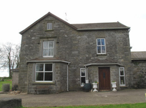
Kilcorran House
Houses within 5km of this house
Displaying 10 houses.
Houses within 5km of Kilcorran House
Displaying 10 houses.
| House name | Description | |
|---|---|---|
| Gola | Built in 1703 by Joseph Wright son of James Wright and his second wife Mary Slacke (www.thesilverbowl.com). It was the home of the Wright later Woodwright family in the 18th and 19th centuries. At the time of Griffith’s Valuation the Reverend William E. H. Woodwright was resident. The buildings were valued at £25. In 1901, Patrick Callaghan, steward, was resident in Gola. Sir John Banks (1815-1908) was the proprietor. He was a well-known Dublin physican who had married in 1848 Alice Woodwright. Their only child Mary married Willoughby Burrell 4th Baron Gwydyr in 1873. On 25 February 1921 Gola was burnt and subsequently demolished. | |
| Clonamully | This house, sometimes spelt Clenamully, was the home of the Fiddes family in the 19th century. Members of the Fiddes family were land agents. Located on the Lewis, formerly Scott estate, it was named on the 1st edition 6 inch Ordnance Survey map (1836) and had a walled garden. The Reverend James Fiddes was rector of the parish of Drumsnat. Edward Fiddes who inhabited the house in the 1830s and at the time of Griffith’s Valuation was the Reverend James’ son and agent to the Rose estate. Edward died in 1868, aged 78, and was buried in Drumsnat graveyard. In 1901, Joseph Fiddes, land agent, was the occupier and in 1911 four of his children were living in the house. The original house has had additions and alterations. |
|
| Slacksgrove/Hollywood House | Slacksgrove is marked as a long building close to the shore of Slacksgrove Lake on the 1st edition 6 inch Ordnance Survey map (1836). It was named after the family who lived there in the 18th century. John Slack of Slacksgrove was High Sheriff of county Monaghan in 1758. Lewis records R. Jackson as resident at Slacke’s Grove in the 1830s. A later square house on the same site, known as Hollywood House, was built before Griffith’s Valuation of the mid-19th century. This house with an extensive farmyard was valued at £36. It was occupied by James Fiddes who held the property from Thomas Coote. Edward Fiddes and his daughter lived in the house in the early 20th century. Only the outbuildings of Hollywood House still remain. | |
| Mont Louise | Home of the Evatt family in the 19th century, R. Evatt was resident in the 1830s. Samuel Evatt was the occupier circa 1860. He held the property in fee and the buildings were valued at £9. Home of George F. Evatt at the beginning of the 20th century. A building is still located at this site. | |
| Ashfield | This house located on the Barrett-Lennard estate is marked on the 1st edition 6 inch Ordnance Survey map. James G. Smyth of Ashfield, Clones, was a subscriber to Lewis ‘Topographical Dictionary’ in the 1830s. Valued at £10 Jane Smith was the occupier at the time of Griffith’s Valuation. A house is still located at this site. | |
| Drumcru | A building was located at this site on the Barrett-Lennard estate at the time of the 1st edition Ordnance Survey map (1836). Griffith’s Valuation records the house valued at £11 and occupied by Mary Renwick. A house surrounded by a complex of outbuildings is still located at this site. | |
| Selloo | A building at this site is marked on the 1st edition Ordnance Survey map (1836) and named on the 25 inch map. In 1853 Selloo described as a 'convenient residence, placed in an ornamentally planted demesne, and also a corn mill, kiln etc' was advertised for sale in the Encumbered Estates Court by Joseph Whitsitt. This was the home of the Pringle family in the mid-19th century, valued at £18 and held in fee by William Pringle. The Hunter and Deering families occupied the house in 1901 and 1911 while Thomas A. Pringle was the landholder. It appears to be currently extant. | |
| Thornhill (Drumsnat) | John Johnston is described in the Ordnance Survey Field Name Book as the only gentleman resident in the parish. He lived at Thornhill. On 13 June June 1854, this house and a demesne of about 40 acres was for sale in the Encumbered Estates Court. The owners and petitioners were Mary Johnson, widow, Maria and Jane Johnson and Martha Dudgeon, formerly Johnson. The property was held under a lease (1738) for 999 years. By the time of Griffith’s Valuation Robert Thomson was the occupant holding the property from Owen B. Cole & Olivia Lucas. The buildings were valued at £25. Home of Felix P. Smith and family in 1911. |

|
| Loughoony | An elongated building facing the lake of the same name and marked on the 1st edition Ordnance Survey map (1836). The National Inventory of Architectural Heritage dates this house to circa 1790 and describes it as having a multiple-bay two-storey return. The Ordnance Survey Field Name Book records it as a good dwelling house the residence of Mrs Murray, widow of a Counsellor who was drowned in the lake nearby. In the mid-19th century the buildings were valued at £20 and the house was inhabited by Andrew Clarke who held it from William Ritchie. Loughoony was the home of Samuel Condell and family at the beginning of the 20th century |
|
| Carrowbarra House | In 1798 ‘Carrowbarragh’ was associated with William Campbell an attorney-at-law who immigrated to Canada. In the 1830s Lewis records Carrowbarrow as the home of the Reverend Michael Fox Dudgeon who married Mary Moore of Moore Fort, Ballymoney, Co Antrim. Later he was vicar of Cratfield, Surrey. Henry Dudgeon occupied a house valued at £1.10.0. in Carrowbarra Island at the time of Griffith’s Valuation. He held the property from Owen B. Cole and Olivia Lucas. Owen B. Cole and Olivia Lucas were the lessor of the townlands of Carrowbarra and Carrowbarra Island. Mary Johnston occupied a house valued at £6 in Carrowbarra townland in the 1850s. A substantial house named Carrowbarra House is marked on the 25 inch map in Carrowbarra Island. |