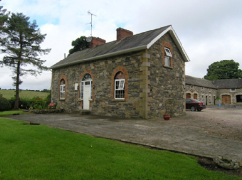
Corraneary House
Houses within 10km of this house
Displaying 14 houses.
Houses within 10km of Corraneary House
Displaying 14 houses.
| House name | Description | |
|---|---|---|
| Mountain Lodge/Farmoyle House | This house was originally known as Mountain Lodge but in more recent times the name Farmoyle House has been used. In the 1830s it was the residence of Colonel John Ker, who was succeeded by his nephew William Alexander Williams. In January 1851 the Mountain Lodge estate of W. A. Williams Ker was advertised for sale in the Encumbered Estates Court, with an estate in county Meath. The mansion house was at the time occupied by Mrs Ann Ker, aged 83 years, widow of the Colonel. It was purchased by George Bennie, who held it in fee at the time of Griffith’s Valuation but was selling it in 1865. By the time the 25 inch Ordnance Survey map was compiled the building was reduced in size and has been further altered in more recent times. The National Inventory of Architectural Heritage records the building as unoccupied. |

|
| Lough Bawn House | Situated close to the shore of Lough Bawn a building at this location has been home to the Tenison family for three centuries. A family member now runs a forestry farm at Lough Bawn. Much of the original house built circa 1760 was destroyed by fire in the late 18th century. The present house dates from the early 19th century and incorporates some of the earlier building with subsequent enlargements. Lewis records the occupant as W. Tenison and Griffith’s records the house, valued at £30, as unoccupied. Still valued at £30 in 1906 when this house was occupied by Major William Tenison. |

|
| Derrygoony | A house associated with the milling business of Richard Allen Minnett who held the property in fee. It is mentioned by Samuel Lewis in his topographical dictionary of 1837. The buildings, which included a house, offices and flax mill, were valued at £35 in the mid-19th century. The house is named on the 25 inch Ordnance Survey map. In 1901 and 1911, the house was occupied by Patrick Connolly, a farmer and mill proprietor and his family. The site is now planted with trees. | |
| Bailieborough Castle/Lisgar Castle | A Scottish planter named William Bailie built a castle here in the early 17th century. It passed into the possession of a number of prominent families Hamilton, Stewart and Corry until it was sold to Colonel William Young in 1814. His son, Sir John Young, later created 1st Baron Lisgar, built a new house on the site in the 1860s. At the end of the 19th century the house was sold to Sir Henry Cochrane and in 1915 to the Marist Brothers of Athlone. Badly damaged by fire in 1918 but reconstructed, the house was eventually demolished in 1942. For image see https://www.archiseek.com/ | |
| Beckscourt House | Becks Court, located just outside the town of Bailieborough on the Young estate, was occupied by the Reverend Arnold Cosby in 1814. Lewis records the Reverend E. Mahaffy as resident. By the mid-19th century it was occupied by Sarah Mahaffy who held the property from Sir John Young of Bailieborough Castle. The buildings were valued at £12. | |
| Spear Vale/Vale House | In 1814, Ambrose Leet refers to William Spear of Spear Vale, Bailieborough. In 1837, Lewis described the home of W. Spear as comfortable with an extensive bleach green about one mile from the town. The Reverend Frederick FitzPatrick occupied the house in the mid-19th century holding it from William Spear. The buildings had a rateable valuation of £12. This house is no longer extant. | |
| Spear Vale/Vale House | In 1814, Ambrose Leet refers to William Spear of Spear Vale, Bailieborough. In 1837, Lewis described the home of W. Spear as comfortable with an extensive bleach green about one mile from the town. The Reverend Frederick FitzPatrick occupied the house in the mid-19th century holding it from William Spear. The buildings had a rateable valuation of £12. This house is no longer extant. | |
| New Grove House | New Grove House and mill with a rateable valuation of £70 were in the possession of Charles Murphy in the 1850s. He held the property from Richard Coote of Bellamont Forest. A building still exists at this site but the mill is now a ruin. | |
| Ann's Fort | Located on the Coote of Bellamont Forest estate and named on the first edition 6 inch Ordnance Survey map (publ. 1837) Ann’s Fort was located in a demesne with bleaching mills ‘in ruins’ nearby. Corn and flax mills are marked on the 25 inch map at these ruins. William Worthy was the occupier of Ann’s Fort and mills in the mid-19th century when the rateable valuation of the buildings was £50. He held the property from James T. Tennant. | |
| Annaghlee House | This house faced the nearby Annalee River. Described by Bence Jones as a ‘mid-c18th red-brick house attributed to Richard Castle’. It is named on the first edition six inch Ordnance Survey map (publ. 1837). In 1806 occupied by Mr Willis (Matthew Sleater) and in 1814 ‘Annalea, Coothill’ was the home of Michael Murphy. Lewis in the 1830s also records ‘Annilea’ as the residence of M. Murphy. John Marsden held the property valued at £12.10.0. from Robert Burrowes in the 1850s. A large B & B complex now occupies the site. | |
| Drumeltan House | Drumeltan is named on the first edition six inch Ordnance Survey map (publ. 1837) when it had a walled garden. It was situated on the estate of the Bishop of Kilmore and was held by Isabella Cooney in the 1850s when the buildings had a rateable valuation of £9.10.0. It passed from the Cooneys to the Adams family. In 1884 Drumelton House was rebuilt by William Adams (1837-1908) to the design of James Franklin Fuller. William’s mother was a Cooney. In 1906, it had a rateable valuation of £30. It remains the home of the Adams family well into the 20th century. See http://landedfamilies.blogspot.ie/2013/04/31-adams-of-drumelton-house-and.html for image and family history. | |
| Fort William/Errigal | Situated on the north side of the Annalee River, Fort William is named on the first edition six inch Ordnance Survey map (publ. 1837). By the time of Griffith’s Valuation it was owned and occupied by Samuel Moorhead. The rateable valuation was £25. The house was extended and renamed ‘Errigle’ as shown on the 25 inch map. In 1906, it had a rateable valuation of £40 and was occupied by Thomas H. Moorhead MD. It now functions as the Errigal Country Hotel. | |
| Beehive | Marked on the first edition six inch Ordnance Survey map (publ. 1837), this was a single storey house with a small plantation nearby. It was owned and occupied by Charles C.H. Coote in the mid-19th century. It may have been built for the use of an employee of the Coote family. The house and its multi-bay farm yard are still extant. |
|
| Shinan House | Shinan House was the home of a branch of the Adams family from the early 19th century. Lewis records ‘Shenan’ as the residence of E. Wilson. By the mid-19th century it was valued at £50 and was owned and occupied by Captain Benjamin Adams. Charles Adams was in possession of Shinan House in the early 20th century. It was later demolished. |