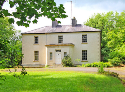
Glendoon
Houses within 5km of this house
Displaying 11 houses.
Houses within 5km of Glendoon
Displaying 11 houses.
| House name | Description | |
|---|---|---|
| Ardue House | Ardue House was the home of the Clemengers, a family of German origin, throughout the 19th century. Mr Clemenger was resident in 1814 and Alexander Clemenger in the 1850s when the house was valued at £13 and held from James H. Story. Henry Taunt Clemenger and his unmarried son John James were resident in 1911. The house was located between Killywilly Lough and Tomkinroad Lough. The site is now a green field. | |
| Killywilly House | Killywilly House located between Loughs Killywilly and Cuillaghan is named on the first edition six inch Ordnance Survey map (publ. 1837). A corn mill and bleach mill were nearby in the townland of Ardue. James Berry was the occupier in the 1850s. He held the property from James H. Story and the buildings had a rateable valuation of £18. There is still an extant house at the site. | |
| Glenview (Drumlane) | Glenview House was built in the 1840s or 1850s. Captain Michael Phillips owned and occupied it and it had a rateable valuation of £11.10.0. Home of the Ebbitt family at the beginning of the 20th century but no longer extant. | |
| Ture Lodge | Ture Lodge, facing east onto Clonamullig Lough, was the home of John Mont. Jones in 1814. Cavan newspapers refer to David Griffith as the occupier in 1847 and Joseph Knight in 1850. The house was vacant when surveyed for Griffith’s Valuation. Myles Reilly was the immediate lessor holding from James H. Story. The buildings were valued at £18. In 1876 Mrs Sarah Story owned 814 acres in county Cavan, while James Story of the same address owned 405 acres. This house was marked ‘in ruins’ on the 25 inch map of the early 20th century. | |
| Corville | The Lawder family may have lived in this townland in the early 18th century. Described by the National Inventory of Architectural Heritage as a late Georgian house, Corville is named on the first edition six inch Ordnance Survey map (publ. 1837), located in a small demesne. Like Brackley Lodge it was the home of members of the Finlay family. It was valued at £23.5.0. in the mid-19th century and was occupied by George Finlay who held the property from Sir Thomas Finlay. Francis Finlay, minor, of Corville is listed in the landowners of 1876. By the beginning of the 20th century Corville was the property of Robert Henry Johnston. Thomas Flynn and family were caretaking the house for him in 1901. This house is still well maintained and occupied. |
|
| Woodville (Templeport) | Woodville was another Finlay home, built to the north east of Corville circa 1840s. At the time of Griffith’s Valuation it was valued at £12 and was occupied by Francis Finlay who held it from George Finlay. A building still stands on this site. | |
| Lissanover | Members of the Hume family of Lisanober or Lissanover, Co Cavan (and of Castle Irvine, Co Fermanagh) are recorded in the 18th century, see GO MS 141: 102-104. Robert Hume of Linover died in 1777 and was buried in Templeport graveyard. In the 1830s J. Roycroft was resident at Lisnover and in the 1850s Robert Roycroft held the property from William Blachford. It was valued at £12.10.0. for rates. This house was demolished by the early 20th century. | |
| Ballyconnell Castle/House | Ballyconnell Castle was built in 1764 by George Leslie Montgomery to replace a former early 18th century building which was accidently burnt down. Leet records Mrs Storey as resident in 1814 and Lewis records John Enery as the occupier of Ballyconnell House in the 1830s. The Enerys and Montgomerys were related. In the mid-19th century George Roe, a medical doctor, was the owner and occupier, having purchased the property valued at £40 for rates, from the Enerys, when it was described as a ‘spacious and comfortable mansion, with suitable out-offices’. In 1906, Samuel B. Roe was recorded as the occupier when the buildings were valued at £32.10.0. for rates. It is now located in the middle of a housing estate. |

|
| Slieve Russell House | Slieve Russell House was a two storey Victorian lodge, built about 1880 for the Benison family. John Joseph Benison and family were resident in the early years of the 20th century. The house is now derelict. | |
| Berrymount | Berrymount House is named on the first edition six inch Ordnance Survey map (publ. 1837). James Berry was resident in the first half of the 19th century. He held the house and outbuildings valued at £7 from the representatives of John C. Jones. William Berry of Berrymount owned 134 acres in co Cavan in 1876. The Berrys were selling Berrymount in the early 1890s (Irish Law Times and Solicitors Journal, Vol 27, 615). Alexander Morton and family were living at Berrymount in the early 20th century. The house appears to be still extant. | |
| Cranaghan House | Cranaghan House is marked on the first edition six inch Ordnance Survey map (publ. 1837). The 25 inch map of the early 20th century records it as a rectory. The Reverend J. Story of Cranaghan is named on the list of subscribers to Lewis’ ‘Topographical Dictionary’ in 1837. The Reverend Henry Erskine held the house valued at £25 in fee at the time of Griffith’s Valuation. The Reverend Charles Sinclair and the Reverend Mervyn Rogers were the occupants in 1901 and 1911. This building is now the core of the Slieve Russell Hotel. |