Annaghmakerrig
Houses within 5km of this house
Displaying 11 houses.
Houses within 5km of Annaghmakerrig
Displaying 11 houses.
| House name | Description | |
|---|---|---|
| Freame Mount | This house was built in 1772 (date stone confirms this) for Charles Mayne, land agent, on the Cremorne estate. According to a website dedicated to the history of the Mayne family, it was named after the second wife of Thomas Dawson, Hannah Freame, granddaughter of William Penn. The house was occupied by William Douglas in the mid-19th century and valued at £24. It was occupied by George John Levis, a bank official, and family in the early 20th century. |

|
| Newbliss | This house, now demolished, on the outskirts of the town of Newbliss was the home of the Ker family who held it in fee. Built in 1814, Andre A. M. Ker was the proprietor in the mid-19th century when the buildings were valued at £70. Mary Isabella Murray Ker was the occupant in the early 20th century with over 200 acres of untenanted land. | |
| Tonnagh House | Lewis records Captain C. Dawson as the proprietor of ‘Tanagh’ in the 1830s. Charles Boyle held the property in fee at the time of Griffith’s Valuation when the buildings were valued at £17.5.0. Home of a branch of the Lucas Clements family in 1901 and of Dr Arthur Robert Moore and family in 1911. The National Inventory of Architectural Heritage states that this house has also been an army barracks and seminary (1948) and that it is now used as an outdoor education centre. http://www.tanaghoutdooreducation.com/ |
|
| Glynch/Glinch House | Glinch Lodge is marked on the 1st edition Ordnance Survey map (1836). Sources in the National Library record the will of J. Rogers of Glinch Lodge, 1827. Lewis records J. Thompson as the occupant in the late 1830s. A new house with portico entrance was built slightly to the south in the mid-19th century and valued at £50 in Griffith’s Valuation. It was occupied by Robert Lowry and held from Richard Mayne. At some time in the mid-19th century ‘Glynch’ House was the residence of Charles Stuart Adams who married Eliza McMahon of Rockfield, county Monaghan in 1850. Home of Felix Keirns and his family in 1911. |

|
| New Park | A house named on the 1st edition 6 inch Ordnance Survey Map (1836), it was occupied by Dacre Hamilton in the 1830s. Home of Thomas Atkinson in the 1850s, valued at £10 and held from Mary Elizabeth and Charlotte O’Brien. Home of the Carleton family in the early 20th century. | |
| Forest View | This house is named on the 1st edition 6 inch Ordnance Survey Map (1836). In the mid-19th century it was occupied by Thomas Dawson and held from Lord Cremorne. The buildings were valued at £12. Partial remains are still visible at this site. | |
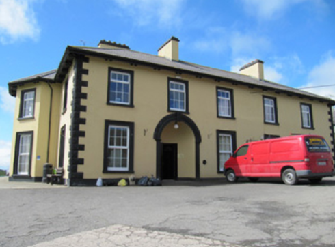
| Drumbrean Cottage | A late 18th century building, still in use as a residence. Possibly used as a manse house in the mid-19th century when it was the occupied by the Reverend Richard Ross, who held it from the Murray Ker family. |

|
| Drumbrean | This house no longer exists. Lewis records it as the property of T. Phillips and Griffith’s Valuation records Thomas Wright as the occupier, holding from Thomas Phillips. Phillips held the property on a lease renewable for ever from Andre Murray Ker (OS Field Name Book). Thomas Phillips married Mary Martha Emma Whitcombe. | |
| Minore | Named on the 1st edition 6 inch Ordnance Survey map (1836), Lewis records Minore as the residence of Captain ‘Cottnam’. The Encumbered Estates sale rental of 2 June 1853 states that the house was erected by Thomas Cottnam, deceased. The owner at the time of the sale was Mrs Grace Cottnam, widow and she was entitled to a jointure out of the lands. The petitioners were Rutherfords and Brunkers. By the time of Griffith’s Valuation it was occupied by Thomas Leary who held it from Dr Brunker. Home of Hester Parkhill in 1901 and of the Reverend Thomas Brennan, parish priest, in 1911. In more recent times the home of the Clegg family. | |
| Dartrey House/Dawson's Grove | Dawson Grove, later known as Dartrey House, is marked on the 1st edition 6 inch Ordnance Survey Map (1836). It was built about 1770. Lewis refers to it as a ‘noble mansion’. In 1846, the 3rd Lord Cremorne/1st Earl of Dartrey replaced this house with a large Elizabethan-Revival mansion designed by William Burn. A fire in 1856 destroyed part of the house. At the time of Griffith’s Valuation, circa 1860, the buildings were valued at £105 and still valued at the same in 1906. The family honours became extinct in 1933 following the death of the 3rd Earl and the house was demolished in 1946. |

|
| Lisalea | A house built after the first Ordnance Survey and before Griffith’s Valuation, when the buildings including herds’ houses were valued at £32. It was located on the estate of Andre M. Ker and Richard Wilson was the occupant. In 1901, George Fitzgerald was living in this house with his family as the caretaker for William Edward Ryan. This house is still maintained and occupied. |

|