Killygordon A
Houses within 5km of this house
Displaying 9 houses.
Houses within 5km of Killygordon A
Displaying 9 houses.
| House name | Description | |
|---|---|---|
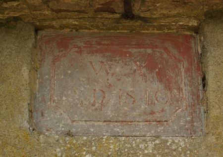
| Mount Hall (Raphoe South) | Reverend William Young held this property in fee at the time of Griffiths Valuation in the 1850 when it was valued at £28. The National Inventory of Architectural Heritage suggests it remained in the Young family until the 1890s. The buildings are now ruinous but a foundation stone, dated 1840, survives. |
|
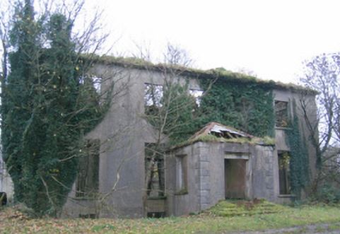
| Woodlands (Raphoe South) | James Johnston was leasing this property from Samuel Calhoun, at the time of Griffiths Valuation in the 1850s, when it was valued at £40. The National Inventory of Architectural Heritage suggests the original buildings at the Woodlands site were constructed in the early years of the nineteenth century but modified later. They are now ruinous. |
|
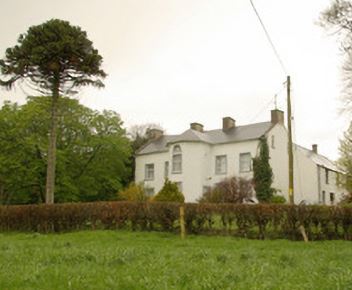
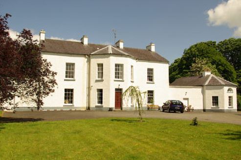
| Killygordon House | Joseph Johnston was leasing this property from James Johnston at the time of Griffiths Valuation in the 1850s, when it was valued at £20. The site is labelled Killygordan Demesne or Weddingtown, on the first edition Ordnance Survey map of the 1830s. It is labelled Killygordan House on subsequent editions. The National Inventory of Architectural Heritage suggests the original house was built in the later eighteenth century but subsequently modified. It was associated with the Mansfield family originally but with the Johnstons by the latter half of the nineteenth century. It is still extant and occupied. |
|
| Kilcaddan House | William Walker was leasing this property from the Diocese of Derry and Raphoe at the time of Griffiths Valuation, when it was valued at £16. An adjacent mill complex was valued at £18. The National Inventory of Architectural Heritage suggests the current house was built in the 1860s, possibly on the site of an earlier house. |
|
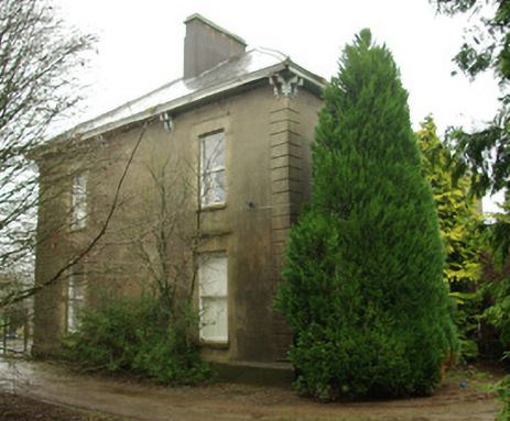
| Edenmore House | John Cochrane was holding this property in fee at the time of Griffiths Valuation when it was valued at £28. In 1906 it was also owned by John Cochrane and valued at £26. The National Inventory of Architectural Heritage suggests it was built c.1790 and offers a detailed outline of its occupancy. It is still extant. |
|
| Monellan | A house described as "unfinished" was held in fee at Monellan by Robert Delap at the time of Griffiths Valuation in the 1850s. The buildings were valued at £45. A house is shown at this location on the 1st edition Ordnance Survey map of the 1830s but has been greatly extended by the early twentieth century. In 1906 it was owned by James B. Delap and valued at £56. It appears to have been demolished by the mid-twentieth century and the site is now occupied by forestry. | |
| Cavan (Raphoe) | The representatives of John Wilson were leasing this property from Alexander Stewart's estate at the time of Griffiths Valuation, when it was valued at almost £13. A house and substantial farm are still extant at the site. | |
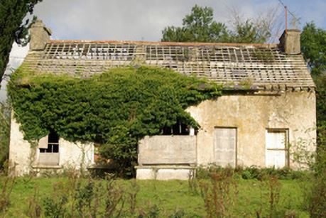
| Tyrcallan/The Nursery (Raphoe) | At the time of Griffiths Valuation in the 1850s, Reverend William Stewart was leasing this property from the Conyngham estate when it was valued at £18. It is labelled as The Nursery on the 1st edition Ordnance Survey map but as Tyrcallan on the later 25-inch edition. In 1837 Lewis referred to it as Tyrcallan, the seat of H. Steevens and as having an observatory on the grounds. In 1906 it was recorded as part of the estate of the Marquis of Conyngham with a valuation of over £10. The National Inventory of Architectural Heritage suggests it was originally built as a hunting lodge. It is now derelict. |
|
| Corcam | Henry Stewart held this property in fee at the time of Griffiths Valuation in the 1850s, when it was valued at £22. It is labelled Corcam on both the 25-inch and last edition 6-inch Ordnance Survey maps but is not extant now. |