Clover Hill
Houses within 5km of this house
Displaying 6 houses.
Houses within 5km of Clover Hill
Displaying 6 houses.
| House name | Description | |
|---|---|---|
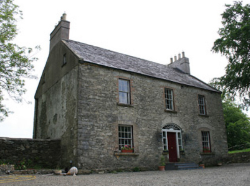
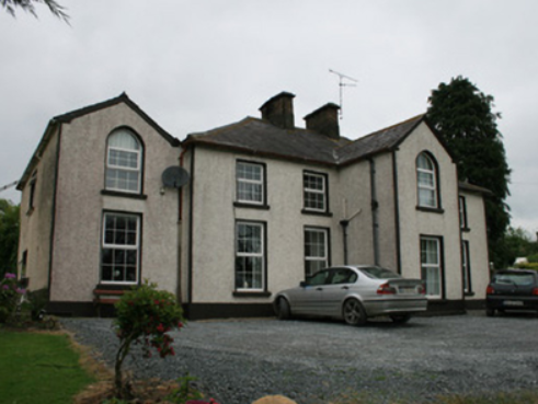
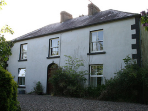
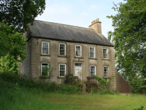
| Derryvally | An early 19th century house on the Leslie estate, occupied by Thomas McCullagh, held from Emily Leslie and valued at £16 in Griffith’s Valuation. It was located near a Presbyterian complex comprised of two churches and a school. The house continues to be a residence. |
|
| Lisnaveane House | Home of the Waddell family, it is named on the 1st edition 6 inch Ordnance Survey map (1836) and possibly dates from the late 18th century. It was altered in the 19th century and the yard buildings were extensively extended. At the time of Griffith’s Valuation the buildings were valued at £16. William and Charles Waddell were recorded as the occupants holding the property in fee. Home of Alfred Waddell and family in the early 20th century. |
|
| Fairview | Part of this house, situated on the Verner estate, dates from the late 18th century. Fairview is named on the first edition 6 inch Ordnance Survey map. The building was only valued at £4 in Griffith’s Valuation, when it was occupied by William Lockart. It was considerably added to sometime in the mid-19th century. James Lockart occupied the house in 1910 (Ulster Towns Directory 1910). |
|
| Dunraymond | This house with extensive outbuildings and walled garden is named on the 1st edition 6 inch Ordnance Survey Map (1836). Documents in PRONI (D991/1/A/3) record the interest of the Bartley family of nearby Bartley’s Grove in Dunraymond in the early 19th century. Described in the Ordnance Survey Field Name Book as having ‘been greatly improved of late both as to additions being made to the buildings and the formation of plantings’. By the time of Griffith’s Valuation David Ross was resident. He held the property from Newell Atkinson. The buildings were valued at £34. A large complex of farm buildings is now located at this site. | |
| Rockmullan House | Marked on the first edition Ordnance Survey Map (1836). In the mid-19th century occupied by the Rev James J. Rowley and held from Thomas T. Rowley, when the rateable valuation was £12. The home of the Lavelles in the 20th century. | |
| Craig's Castle | This five bay two storied house was built on the Leslie estate in the late 18th century. Occupied by John Carlisle and valued at £14 at the time of Griffith’s Valuation. This house is still extant and known as Hillcrest. |
|