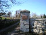
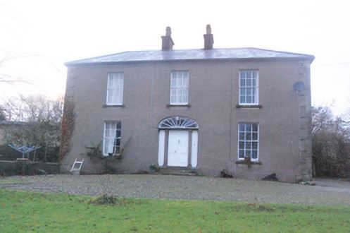
Tullyrap
Houses within 5km of this house
Displaying 10 houses.
Houses within 5km of Tullyrap
Displaying 10 houses.
| House name | Description | |
|---|---|---|
| Oldcastle | Built by the McJordans of Ballylahan in the late 18th century. Slater refers to it as the seat of John Bolingbroke in 1846. There are modern buildings at the site now. |
|
| Dove Hall | This house is labelled Dove Hall on the 1st edition Ordnance Survey map. A larger house, named Belgarrow House, is shown at the site on the 25-inch edition of the 1890s. It was occupied by Courtney Strogen and his descendants during the 19th century, held on lease from the Evans family. Occupied by John A. Knox in 1906. Belgarrow is now a ruin. | |
| Moorbrook | In 1786 Wilson refers to "Moore-field" as the seat of Mr. Moore. Leet's Directory records 'Moorfield' as an 'unoccupied seat' in 1814. The house appears, however, to have become known as Moorbrook as it is thus labelled on the Ordnance Survey maps. Henry Wills held Moorbrook at the time of the sale in 1854. At the time of Griffith's Valuation, it is described as a "herd's house" and occupied by Francis O'Grady. It is labelled as "in ruins" on the 25-inch Ordnance survey map of the 1890s. A modern house has been constructed near the site. | |
| Cloongee | Originally a Moore home which was sold by Harloe Phibbs Baker to the McDermotts who lived there until the 20th century. At the time of Griffith's Valuation it was held in fee by Owen McDermott and valued at £7. The National Inventory of Architectural Heritage notes Cloongee as a rare survivor of a late-seventeenth century house in county Mayo. It is still extant and occupied. |

|
| Ballylahan | A property held by Pat McLaughlin from Sir William H Palmer in the early 19th century and by the Atkinsons at the time of Griffith's Valuation. Quinn writes that it was repossessed at the time of the expiration of their lease. It was a ruin by the publication of the 25-inch Ordnance Survey map of the 1890s. | |
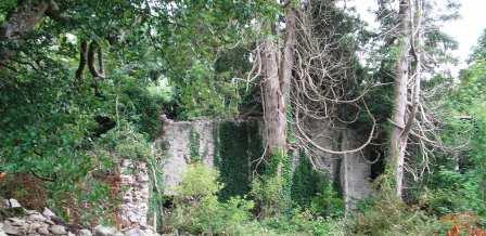
| Creggagh | The house valued at £6 was held by John Fair at the time of Griffith's Valuation but was unoccupied. In 1894 Slater noted it as the seat of Major D.R. Fair. It was occupied in the early decades of the twentieth century but is now a ruin surrounded by forestry. |
|
| Coolaghy Lower | Reverend George Hanson was leasing this property from the Abercorn estate at the time of Griffiths Valuation in the 1850s, when it was valued at £12. A substantial farm exists at the site. | |
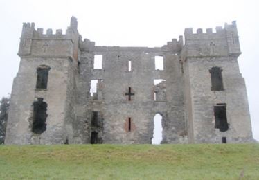
| Raphoe Bishop's Palace | William Ker was leasing this property from the Ecclesiastical Commissioners estate at the time of Griffiths Valuation in the 1850s, when the buildings were valued at £45. The Bishop's Palace was destroyed by fire in 1838 and has remained a ruin ever since. |
|
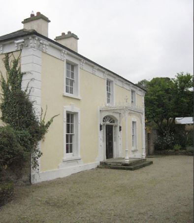
| Tops (Raphoe) | John Wilson was leasing this property from the Ecclesiastical Commissioners estate at the time of Griffiths Valuation in the 1850s, when it was valued at £18. The National Inventory of Architectural Heritage suggests the current house was built c.1852 possibly on the site of an earlier house. Eliza Wilson was also leasing property at this location in the 1850s. |
|
| Coolaghy (Raphoe) | William Hamilton was leasing this property from Reverend Lord Edward Chichester's estate at the time of Griffiths Valuation in the 1850s, when it was valued at £20. It appears to have been associated with the Hamilton family for much of the nineteenth and early twentieth centuries. It is still extant and occupied. |
|