Blayney/Hope Castle
Houses within 5km of this house
Displaying 9 houses.
Houses within 5km of Blayney/Hope Castle
Displaying 9 houses.
| House name | Description | |
|---|---|---|
| Drumcrew House | Drumcrew House located near a small lake of the same name and close to the town of Castleblayney. Valued at £10 at the time of Griffith’s Valuation, occupied by Henry Hunter and held from Henry T. Hope. Buildings are still located at this site. | |
| Castleblayney House | This house on the outskirts of Castleblayney, sometimes known as Connaberry House, is marked on the 1st edition 6 inch Ordnance Survey map (1836). Located on the Hope estate it was occupied in the mid-19th century by Hugh Swanzy. The buildings were valued at £25. This house continues to be a residence. | |
| Dromore | A house located a short distance from Muckno or Castle Blayney lake. It was valued at £10 at the time of Griffith’s Valuation and held by Robert Bailey from Henry T. Hope. Members of the Bailey family were still resident in this townland in the early 20th century. A building is still located at this site. | |
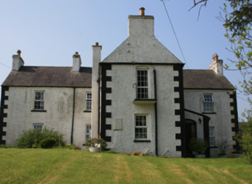
| Church Hill | This house with a view to Muckno Lake is marked on the 1st edition 6 inch Ordnance Survey Map (1836). It had quite extensive gardens and a block of outbuildings. It was the home of the Harrison family from at least the early 19th century as George Harrison is recorded in the Tithe Applotment Book (1827). The buildings were valued in the mid-19th century at £7.5.0. George Harrison was the occupier holding the property from Henry T. Hope. Another member of the Harrison family, Francis, occupied a herd’s house close by. Members of the Harrison family still lived in this townland in the early 20th century. | |
| Church Hill | This house, with a view to Muckno Lake, is marked on the 1st edition 6 inch Ordnance Survey Map (1836). It had quite extensive gardens and a block of outbuildings. It was the home of the Harrison family from at least the early 19th century as George Harrison is recorded in the Tithe Applotment Book (1827). The buildings were valued in the mid-19th century at £7.5.0. George Harrison was the occupier holding the property from Henry T. Hope. Another member of the Harrison family, Francis, occupied a herd’s house close by. Members of the Harrison family still lived in this townland in the early 20th century. | |
| Laurel Hill House | Another house on the outskirts of Castleblayney, occupied by Henderson Persse and held from Andrew M’Math circa 1860 when it was valued at £20. It was located on the Hope estate and is now part of the Convent of Mercy complex of buildings. | |
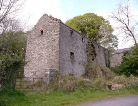
| Thornford | This house located on the estate of the Marquess of Bath was associated with the nearby mill complex. Hamilton McMath was the proprietor in the mid-19th century, when the house was valued at £26 and the mill buildings (corn and flax) at £60. Buildings are still extant at this site. |
|
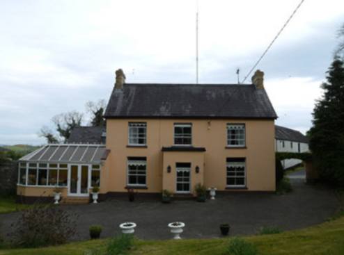
| Corratanty | An early 19th century house named on the 1st edition 6 inch Ordnance Survey map (1836) and located on the Templetown estate. A model farm was located here by the mid-19th century when the house was occupied by Andrew Hunter and the buildings valued at £23. David K. Hunter, farmer, was the occupier in the early 20th century. This house is still the centre of a working farm |
|
| Annevale House | The present house dates from the late 19th century while the extensive outbuildings date from the end of the 18th century. Annevale is built on the site of an earlier house which is marked on the 1st edition Ordnance Survey map (1836). Valued at £10 in the mid-19th century it was occupied by John Callan who held it from Henry T. Hope. |
|