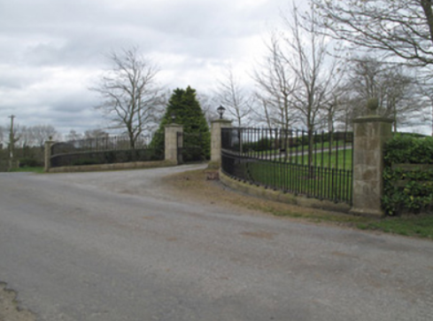
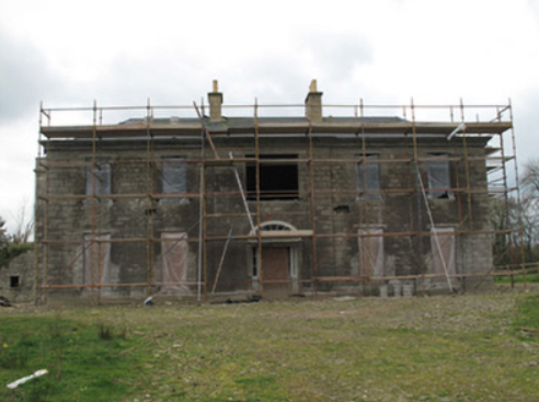
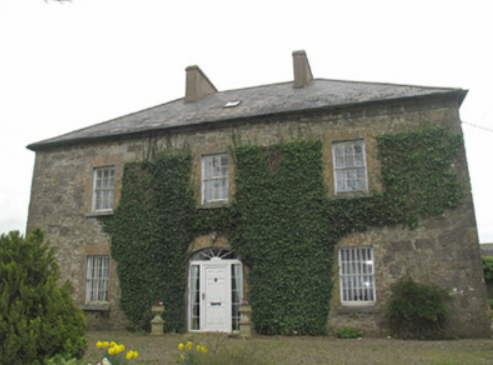
Dungillick House
Houses within 5km of this house
Displaying 6 houses.
Houses within 5km of Dungillick House
Displaying 6 houses.
| House name | Description | |
|---|---|---|
| Anketell Grove/Trough Lodge | Bence Jones writes that the Anketells have built three houses in this area but on different sites. The first house was constructed in the mid-17th century. The second one was built by Oliver Anketell and demolished in 1781. The third house was built in the 1780s and was remodelled in the mid-19th century. Andrew Crawford appears to have lived here in 1807 and James Mervyn B[unbury] Richardson between 1812 and 1827 (see Richardson Papers 1197 in the National Archives). On the 1st Ordnance Survey 6 inch map (1836) it is marked as Trough Lodge. It later became known as Anketell Grove. The Ordnance Survey Field Name Book describes Trough Lodge as ‘a very handsome house and has good office houses’. At the time of Griffith’s Valuation the buildings were valued at £50 and were held by Matthew J. Anketell in fee. In 1901, Samuel Griffen, land steward, and family were the occupants. Patrick McKenna bought Anketell Grove and 130 acres in 1928. |

|
| Mount Anketell/Spring Mount | Located on the Anketell estate and marked on the 1st edition 6 inch Ordnance Survey Map (1836), this house was the residence of George Olpherts and valued at £10 circa 1860. The house appears to have been unoccupied at the time of the censuses in 1901 and 1911 but was in the possession of the Moutray family of Fort Singleton. The 25 inch map (surveyed in 1908) records the name of this house as Spring Mount. It is no longer extant. | |
| Fort Johnston | The Johnstons were in possession of Stramore from about the mid-18th century and Fort Johnston appears to have been in existence from then. This long house is named on the 1st edition 6 inch Ordnance Survey map (1836). The Ordnance Survey Field Name Book describes Lieutenant Johnson’s house as ‘a pretty good house (cottage built)’ called Fort Johnson. On the 25 inch map (surveyed 1908) it appears as a square block so it may have been altered. In the mid-19th century it was the home of Henry G. Johnston held by him in fee. Burke’s ‘Landed Gentry of Ireland’ (1904) records Fort Johston as the family seat but their residence was in Bandon, county Cork |
|
| Fort Singleton | The 1st edition 6 inch Ordnance Survey Map (1836) names this house and shows its laid out gardens. The house was the home of the Singleton family, dating from about the mid-18th century. Lewis writes that the home of T. Singleton was ‘situated in a well wooded demesne of 200 acres’ while the Ordnance Survey Field Name Book refers to the ‘neat dwelling house and good office houses’ and that the demesne ‘contains a great deal of fine ash, elm and beech’. The buildings were valued at £60 in Griffith’s Valuation and Whitney Moutray was the occupant, holding from Thomas C. Singleton. Henry Abercrombie, land steward, and his wife were resident in 1901. In more recent times this building has undergone renovation. |
|
| Lough Emy | Lough Emy house on the Leslie estate was built in the mid-19th century. At the time of Griffith’s Valuation it was occupied by William V. Ryan and valued at £20. It retained this valuation in 1906. The 25 inch map (surveyed 1908) shows the house at the end of a long tree lined avenue with Emy corn mill close to the entrance. It was the home of the Kavanagh/Cavanagh family in the early decades of the 20th century. This house is completely demolished, the site is now a green area. | |
| Portinaghy House | Buildings are located at this site on the 1st edition 6 inch Ordnance Survey map (1836). In the mid-19th century the house was valued at £18 and inhabited by Mary Campbell, who held the property from Charles P. Leslie. In 1876, the representatives of Mrs Mary Campbell, Portinaghy, owned 211 acres in county Monaghan. Home of the Edwards family in the 20th century. |
|