Gola
Houses within 5km of this house
Displaying 12 houses.
Houses within 5km of Gola
Displaying 12 houses.
| House name | Description | |
|---|---|---|
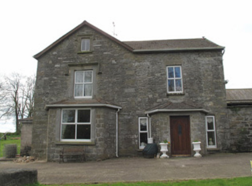
| Carrachor | Carrachor House is named on the 1st edition 6 inch Ordnance Survey map (1836) and Lewis records J. Wright as the proprietor. It was later expanded and by the mid-19th century was held by Joseph C. Wright in fee. The buildings were valued at £16. In the early 20th century Joseph Mitchell and his wife Elizabeth were resident. Joseph Mitchell may have been a relative of the Wrights. The house is still extant. | |
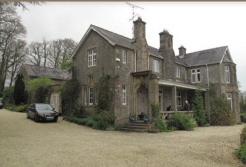
| Clonamully | This house, sometimes spelt Clenamully, was the home of the Fiddes family in the 19th century. Members of the Fiddes family were land agents. Located on the Lewis, formerly Scott estate, it was named on the 1st edition 6 inch Ordnance Survey map (1836) and had a walled garden. The Reverend James Fiddes was rector of the parish of Drumsnat. Edward Fiddes who inhabited the house in the 1830s and at the time of Griffith’s Valuation was the Reverend James’ son and agent to the Rose estate. Edward died in 1868, aged 78, and was buried in Drumsnat graveyard. In 1901, Joseph Fiddes, land agent, was the occupier and in 1911 four of his children were living in the house. The original house has had additions and alterations. |
|
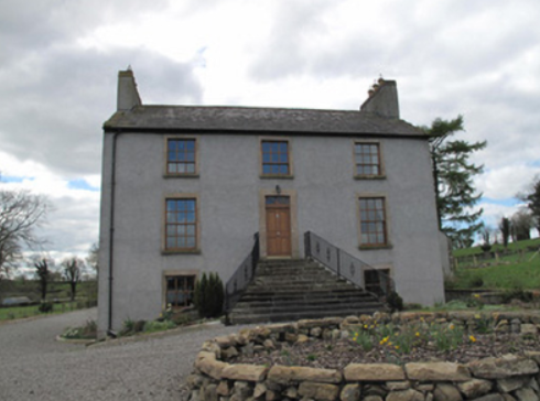
| Mullaghmore | This was the home of James Rose and after his death in 1841 of his niece Gertrude. It was described by Lewis in the 1830s as ‘greatly improved and extensively planted’. The buildings were valued at £38 at the time of Griffith’s Valuation circa 1860 but the house was unoccupied at the time. Gertrude Rose was, however, resident in 1901. Home of Sir Robert Anderson, Mayor of Belfast 1908, for a few years; his widow was living at Mullaghmore in 1911. The house was later the home of a Captain Taft and was destroyed by a fire in 1925 (New Zealand Tablet, 8 April 1925, 47). |
|
| Slacksgrove/Hollywood House | Slacksgrove is marked as a long building close to the shore of Slacksgrove Lake on the 1st edition 6 inch Ordnance Survey map (1836). It was named after the family who lived there in the 18th century. John Slack of Slacksgrove was High Sheriff of county Monaghan in 1758. Lewis records R. Jackson as resident at Slacke’s Grove in the 1830s. A later square house on the same site, known as Hollywood House, was built before Griffith’s Valuation of the mid-19th century. This house with an extensive farmyard was valued at £36. It was occupied by James Fiddes who held the property from Thomas Coote. Edward Fiddes and his daughter lived in the house in the early 20th century. Only the outbuildings of Hollywood House still remain. | |
| Mont Louise | Home of the Evatt family in the 19th century, R. Evatt was resident in the 1830s. Samuel Evatt was the occupier circa 1860. He held the property in fee and the buildings were valued at £9. Home of George F. Evatt at the beginning of the 20th century. A building is still located at this site. | |
| Selloo | A building at this site is marked on the 1st edition Ordnance Survey map (1836) and named on the 25 inch map. In 1853 Selloo described as a 'convenient residence, placed in an ornamentally planted demesne, and also a corn mill, kiln etc' was advertised for sale in the Encumbered Estates Court by Joseph Whitsitt. This was the home of the Pringle family in the mid-19th century, valued at £18 and held in fee by William Pringle. The Hunter and Deering families occupied the house in 1901 and 1911 while Thomas A. Pringle was the landholder. It appears to be currently extant. | |
| Cappog House | A house built in the mid-19th century, valued at £10 circa 1860 and occupied by Richard Blakely and held from Henry Mitchell. In the early 20th century home of Ernest Henry Greene, a distinguished Irish tennis player & his wife Georgiana, a painter. This house appears to be still extant. | |
| Clontoe | A house valued at £7 occupied and held in fee by John Wright at the time of Griffith’s Valuation (circa 1860). Still in the possession of the representatives of J. Wright at the beginning of the 20th century, it was occupied by the Humphries family. | |
| Kilcorran House | This 18th century house has a date stone over the door 1756. In the mid-19th century it was the residence of William Beatty held in fee. Kilcorran remained the home of the Beatty family until at least the mid-1940s when Rowland Beatty/Betty died there. |
|
| Aghnamallagh House | James A. Mayne lived in this house in the mid-19th century. He held it in fee and the buildings were valued at £22. This was the home of the Elliot family in the early 20th century. The house is still extant. see https://www.geograph.ie/photo/897268 | |
| Tullaghan | The ruins of Tullaghan House are marked on the 1st edition 6 inch Ordnance Survey map (1836). It was located on the estate of Lord Rossmore. Lewis writes in the 1830s that Tullaghan belonged to the Reverend Sir Thomas Forster Bart. ‘whose family formally resided here’. By the time of Griffith’s Valuation a herd’s house had been erected close by. It is named Tullaghan House on the 25 inch map (surveyed 1908). | |
| Riversdale (Tedavnet) | This house is marked on the 1st edition 6 inch Ordnance Survey map (1836) and on the 25 inch map (surveyed 1908) it is named. It was located on the outskirts of the village of Bellanode, close to the River Blackwater and to a number of mills. Occupied by Thomas Wright in the mid-19th century and held from Henry Mitchell, the buildings were valued at £6.10.0. A building is still extant at this site. |