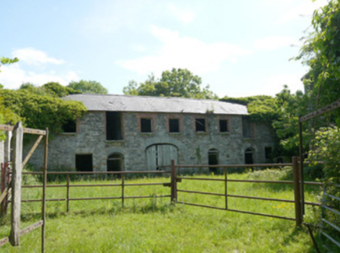
Rocksavage
Houses within 5km of this house
Displaying 6 houses.
Houses within 5km of Rocksavage
Displaying 6 houses.
| House name | Description | |
|---|---|---|
| Rahans | On the 1st edition 6 inch Ordnance Survey map (1836) Rahans is marked with a courtyard and pump at the back of the house. John Read or Reed was the occupant at this time and was still resident at the time of Griffith’s Valuation when the buildings were valued at £32. By the early 20th century Rahans was the home of Dr Peter McKenna. It is no longer extant. | |
| Cormoy House | There was a building located here and marked on the 1st edition 6 inch Ordnance Survey map (1836). Griffith’s Valuation records the house as located on the estate of the Marquess of Bath, valued at £28 and occupied by Peter McCaul. In 1901 it was the only house in the townland and Kate McCaul, a widow, was the head of the household. A building is still located at this site. | |
| Longfield House | Longfield House on the Marquess of Bath’s estate is marked on the 1st edition 6 inch Ordnance Survey map (1836). It was occupied at the time by the Johnston family. The Ordnance Survey Field Name Book describes the residence of W. Johnston as in the west of the townland. By the time of Griffith’s Valuation circa 1860 Thomas Johnston was resident and the buildings were valued at £30. Sidney Jackson and family were living in Longfield House at the beginning of the 20th century. This house no longer exists. | |
| Kiltybegs | Large complex of buildings marked on the 1st edition 6 inch Ordnance Survey map (1836). This was part of the estate of Major John Leslie who held it in fee. The buildings which included a house were valued at £15. Later the home of Charles J. Leslie (see building return 1901 census) and of the land steward, George McGregor, in 1911. This house is no longer extant. | |
| Capragh | A house located close to Capragh Lough was in existence at the time of the first Ordnance Survey in the 1830s. By the mid-19th century it was occupied by Hubert Kiernan who held the townland in fee. The buildings were valued at £15. Occupied by the Mitchell sisters in 1901 and by Mary Mitchell in 1911. Part of the yard buildings still remain at this site. |
|
| Moyles Mill House | A house built in front of the corn mill after the first Ordnance Survey took place in the early 1830s as it is not marked on the first 6 inch map. It was occupied circa 1860 by Thomas Lennan, who held the property valued at £20, from Joseph Plunkett. In 1901 occupied by Thomas McKenna, a miller and farmer, and in 1911 by the Murphy family. The house is no longer extant. |