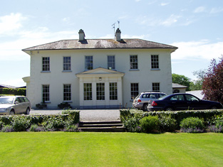
Mount Judkin House
Houses within 5km of this house
Displaying 13 houses.
Houses within 5km of Mount Judkin House
Displaying 13 houses.
| House name | Description | |
|---|---|---|
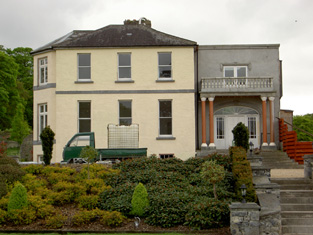
| Ardmayle/Clonmore | Ardmayle House in the townland of Clonmore North is marked on the first Ordnance Survey map. The Prices were resident here from at least the 1770s ad Wilson mentions it as the seat of Mr. Price in the 1780s. "Ardmoyle", Cashel, was the residence of Thomas Price in 1814 and in 1837. Richard Price was the occupant in 1850 holding the house valued at £21.17 shillings from John Hyde. The National Inventory of Architectural Heritage states that the present house dates from circa 1870s and was formerly the wing of an 18th century house demolished in 1951. Louis H. Grubb occupied at house at Clonmore North in 1906 valued at £56. This house is now known as Clonmore. |
|
| Mayfield House | A Price home, occupied by Thomas Price in the mid 19th century and held from William Price, it was valued at £14+. Still extant and occupied. |

|
| Ballinamona | Ballinamona was the home of the Murphy family in the 19th century, occupied by William Murphy in 1814 and in 1850. The buildings were valued at £21.15 shillings and held in fee. Edmund William Murphy was resident in 1906. |

|
| Deerpark | This house valued at £34.12 shillings was occupied by John Hare and held from the representatives of - Wyse in the mid 19th century. The National Inventory of Architectural Heritage survey indicates it was built around 1850. It is still extant. |
|
| Castlelake Cottage | Major M. Lidwell was resident at Castlelake, Cashel, in 1814. In 1837 Lewis records a distillery and the neat residence of Thomas Mathew. The Ordnance Survey Name Books refer to it as being occupied by Mathew Gilbert in 1840. These buildings appear to be in the possession of the Poor Law Commissioners at the time of Griffith's Valuation, valued at £40+ and held from General Hall. The buildings no longer exist. [In 1786 Wilson may be referring to this property when he note a seat of Mr. Burke at Castlelake]. | |
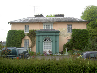
| Rock View | Rock View, Cashel, was occupied by John Lane in 1814, by Sam Cooper in 1837 and by Mrs Margaret Matthews in the early 1850s. The buildings were valued at £18.16 shillings and held from General Hall. This house, located close to the road between Golden and Cashel, is still occupied. |
|
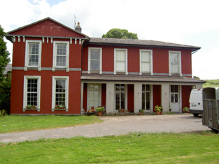
| Racecourse Hall | Lewis records Avary Jordan as the proprietor of Race-Course Lodge in 1837. The house was valued at £35 in the mid 19th century, occupied by Avary Jordan and held from the Cashel Commissioners. Mrs Jordan of Racecourse owned 3 acres in the 1870s. This house, located just south of the town of Cashel, still survives as a fine country residence. |
|
| Ballynahinch | A house valued at £14, occupied by Denis Heany and held from Richard B. H. Lowe at the time of Griffith's Valuation. This house is still extant and the centre of a working farm. |

|
| Lisheen | In 1786 Wilson writes that Lisheen was a seat sometimes occupied by the Earl of Clanwiliam. It became the seat of the Fitzgeralds, Baronets, in the 19th century, valued at £33 in the 1850s and held from the Earl of Portarlington. Edward Dalton was the tenant at the time of the sale of the Earl of Portarlington's estates in June 1856. A building is still located at this site. | |
| Clonbonane | Edmund Scully of the Silverfort branch of the Scully family lived here in the first half of the 19th century. By the time of Griffith's Valuation Jeremiah Scully held the house valued at £12 from the Earl of Norbury. This house no longer exists. | |
| Brittas House | Built in the late 19th century by James O'Heney/Heney of Cashel and valued at £25 in 1906. Brittas House is now a stud farm belonging to Peter Magnier. | |
| Camus | A house occupied by James Chadwick and held from the representatives of Eustin [Austin] Cooper at the time of Griffith's Valuation. The buildings were valued at £28.18 shillings. |
|
| Ballyfowloo House | At the time of Griffith's Valuation, James Heaney was leasing a holding of 130 acres from Lord Stanley's estate at Ballyfowloo. The 25-inch Ordnance Survey map of the later 19th century shows a house in this area labelled Ballyfowloo House. |