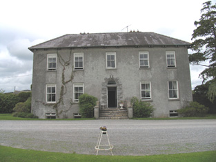
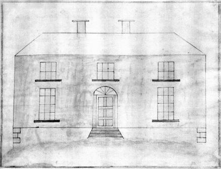
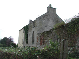
Riverstown
Houses within 5km of this house
Displaying 7 houses.
Houses within 5km of Riverstown
Displaying 7 houses.
| House name | Description | |
|---|---|---|
| Arbourhill | A house occupied by J. Antisell in 1837. The Ordnance Survey Name Books describe it as "a good dwelling house, the residence of Joseph Antisell" in 1840. It was valued at £10 when held by Thomas Pyke in fee at the time of Griffith's Valuation. There is still an extant house at the site. | |
| Sraduff | Taylor and Skinner record Antisell Esq as the proprietor of Straduff in the 1770s. T. Antisell occupied Sraduff in 1837 and Christopher Antisell was resident in a house valued at £10+ in Sraduff in the early 1850s. The house was valued at £15+ in 1906 and was held by Monsell Antisell with 342 acres of untenanted land. This house is now a ruin. | |
| Croghan | In 1841 the Ordnance Survey Name Books refer to "Croughane House" as the residence of Francis Drought. Michael Mullarchy was leasing it from James Fleetwood at the time of Griffith's Valuation when Croghan was valued at £15. This house is still in use as a family residence. |
|
| Elm Hall | Lewis records Elm Hall as the residence of Peter Burke while the Ordnance Survey Name Books refer to it as that of "Counsellor Burke". By the time of Griffith's Valuation his son Joseph Burke was the occupier, holding the property in fee, the house was valued at £10. A farm building now occupies the site of Elm Hall. |
|
| Carrig | The National Inventory of Architectural Heritage describes this as a miller's house. In 1840 The Ordnance Survey Name Books refer to it as " a good dwelling house, the residence of Christopher Dignan, there is a good flour mill close by". William Abernethy held it from the Earl of Portarlington in the mid 19th century when the house was valued at £20. It is now a ruin. James Abernethy of Carrig owned 113 acres in county Tipperary in the 1870s. |
|
| Baronne Court | The Ordnance Survey Name Books refer to Tinnakilly House and Observatory in the townland of Stonestown, the residence of Robert Robinson in 1840. The property was for sale in the Encumbered Estates' Court in February 1851. The sale details state that it was erected at a cost of £6,000 in 1830. It was altered by the Marshalls and renamed Baronne Court. Reverend Joseph Marshall is recorded as the occupier of the house valued at £53 at the time of Griffith's Valuation. The Reverend Joseph held the property in fee. William K. Marshall was recorded by Slater as the proprietor in 1894. This house is now demolished although the farm buildings still remain. |

|
| Rockville (Loughkeen) | The Ordnance Survey Name Books refer to Rock Ville House in the parish of Loughkeen as the residence of Mr. S. Lloyd in 1841. At the time of Giffith's Valuation, a house in this townland valued at £10 was occupied by William Kent, leasing from Jane Downs. On the 25-inch map of the 1890s this house is labelled Carrig Cottage. It is still extant. |