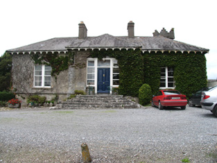
Firville
Houses within 5km of this house
Displaying 13 houses.
Houses within 5km of Firville
Displaying 13 houses.
| House name | Description | |
|---|---|---|
| Fortmoy House Lower | In 1840 the Ordnance Survey Name books refer to "Fordmoy" as "a good dwellinghouse, lately built, the residence of Mr. Prendergast".This house was vacant at the time of Griffith's Valuation. Thomas G. Prendergast was the immediate lessor and the house was valued at £11. Buildings valued at £27.5 shillings were held by the representatives of David Clarke at Fortmoy in 1906. Fortmoy House Lower is still extant. |
|
| Milford | Lewis records Milford as the occasional residence of Ralph Smith. By the early 1850s it was occupied by Thomas Bunbury and held from William Woods. Bence Jones writes that it was the home of Edmond Murphy who died in 1882. In 1840, he Ordnance Survey Name Books refer to the house as the residence of John Monsell and describe the demesne as "principally composed of plantation and ornamental grounds". |

|
| Lismacrory | An early home of the Smith family in county Tipperary. Lewis writes that Lismacrony was the ancient residence of the family of Smith now the property of Mr Bunbury. This house was in ruins at the time of the first edition Ordnance Survey map. In 1841, the Ordnance Survey Name Books description says "it was a very commodious house of the modern style of architecture with extensive offices attached to it, but it is now falling into ruins, the last occupier was Rev. Mr. Smyth of Ballingarry". | |
| Abbeville | Home of the Hemsworth family in the 18th and 19th centuries, occupied by Thomas Hemsworth in 1814. Thomas G. Hemsworth was resident in 1837 and in the early 1850s. Thomas George Hemsworth of Abbeville owned 387 acres in the 1870s. |
|
| New Grove | Marked on the first edition Ordnance Survey map as New Grove, this house appears on the 25-inch map of the 1890s and is still known by the name, St Kierans. Occupied by J. W. Bayly in 1837 and described by the Ordnance Survey Name Books as " a good dwelling house, the residence of John Bayly" in 1840. It was occupied by Thomas Fetherston at the time of Griffith's Valuation and held from John Bailey. The buildings were valued at £19+. This property was advertised for sale in November 1851, the estate of John Washington Bayly. |
|
| Kilcarren | A house occupied by Ralph Smith in 1814 and by A. Carew in 1837. The Ordnance Survey Name Books describe it as "a good dwelling house" in 1841. Alexander Carew, a descendant of Lynn Carew, held the property from Ralph Smith in the mid 19th century when the buildings were valued at £17+. The house is still extant and occupied. |

|
| Lackeen | Lackeen House is an early 18th structure attached to part of a 17th century house. John Baily was the proprietor of Lackeen Castle, Parsonstown [Birr], in 1814 and in the mid 19th century the house valued at £12.10 shillings was occupied by Hamilton English and held from Lord Cremore. This house is now unoccupied. |
|
| Ballyquirk | In 1837 Lewis refers to the ruins of Ballyquirk castle "near which is a handsome modern house of that name". Colonel Henry Dwyer was the occupant in the mid 19th century, holding the house valued at £32 and 716 acres from Edward Newingham. |
|
| Harvest Lodge | The Stoneys were resident at Harvest Lodge from at least 1837. Thomas Johnston Stoney, born 1780, fourth son of Thomas Stoney of Arran Hill held the property in fee at the time of Griffith's Valuation, when the house was valued at £30. Harvest Lodge was the home of J.M. Wilson in the 1870s. This house no longer exists. | |
| Curraghglass | J.W. Walsh is noted as the proprietor of Curraghglass in the Ordnance Survey Name Books of 1841. In the mid 19th century Thomas Meara occupied a house valued at £11 and held from the representatives of Jonathan Walsh. There is still a building located at this site. | |
| Somerset | The National Inventory of Architectural Heritage states that this house was built in 1875. It appears to have replaced an earlier house also known as Somerset marked on the first edition Ordnance Survey map circa 1840. In 1841 the Ordnance Survey Name Books refer to Somerset as "a small demesne and good dwelling house, the residence of Mr. Going". It was the home of John O'Meara in the mid 1870s. In 1906 William H. O'Meara occupied a house valued at £12+ in the townland of Abbeville. |
|
| Ross Cottage/House (Dorrha) | In 1841 the Ordnance Survey Name Books refer to Ross Cottage as "an elegant built cottage, the residence of Mr. Smyth", the proprietor of which was R. Hemsworth. The house is labelled as "Ross House" on both the 1st and 25-edition Ordnance Survey maps. By the time of Griffith's Valuation, it was occupied by Thomas Hernon, leasing from John J. Hemsworth and the buildings were valued at almost £8. The house is still extant and occupied. |
|
| Roden House | In 1841 the Ordnance Survey Name Books describe Roden House as "a good dwelling house". C.W. Hemsworth is noted as the proprietor. At the time of Griffith's Valuation, it was occupied by Thomas R. Deane, leasing from Thomas Hackett, when the buildings had a valuation of almost £3. The National Inventory of Architectural Heritage dates this property to 1784. It is still extant and occupied. |
|