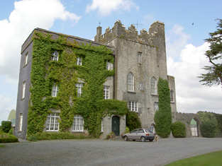
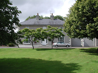
Cabragh Castle
Houses within 5km of this house
Displaying 15 houses.
Houses within 5km of Cabragh Castle
Displaying 15 houses.
| House name | Description | |
|---|---|---|
| Graiguenoe | In 1837 Lewis refers to C. Clarke "who has recently erected a spacious and elegant mansion on his estate". In 1850 this mansion was valued at £44.12 shillings and it was held in fee by Charles Clarke. Slater noted it as the seat of James Neville Clarke in 1894 and the Clarkes were still resident at Granguenoe Park in the early 20th century. The house was burnt in 1923. The site is now occupied by a stud farm. | |
| Killough | A 16th century tower house with a number of additions, Lewis records Killough Castle as the "occasional residence" of the Honourable Mrs Plunkett. In 1850 the Honourable Bowes Daly occupied the castle valued at £22.14 shillings which he held in fee. |
|
| Brittas Castle | The original castle was burnt circa 1820 (Bence Jones) when the owner was Henry Grace Langley. His nephew Major Henry Langley began to build a Medieval Revival castle to the design of William V. Morrison but died when only the gate tower was completed. The Irish Tourist Association surveyor wrote that it was to be a replica of Warwick Castle. In 1840 the Ordnance Survey Name Books commented that Brittas Castle was "a modern unfurnished building on a most magnificent scale but in all probability it will never be finished"! In the mid 19th century Henry Langley held the castle valued at £30 from the Court of Chancery. The sale rental of December 1853 records Thomas Kirwan as the tenant of the castle and 464 acres for 7 years from 25 March 1851 pending the cause of Langley v Langley. From 1853 Brittas belonged to the Knox family who lived in a single storey house located behind the gate tower. This house was described as a mansion house in 1906, valued at £25 and occupied by Fitzroy Knox. |

|
| Turtulla | A member of the Blunden family was living at "Turkla" close to Thurles in the 1770s. William Nicholson was living at Turtola in 1814. Lewis writes in 1837 that it was the property of Valentine Maher but that John B. O'Brien was resident. A flour mill was located on the property. In 1840 the Ordnance Survey Name Books record a Mr. Lister in charge of the mill. They refer to Valentine Maher as the proprietor. By the time of Griffith's Valuation Nicholas Maher was the occupier. He held the property from the Court of Chancery and the buildings were valued at £50+. Nicholas had succeeded his cousin Valentine in 1844 and died without heirs in 1871. Turtulla then became the home of the Barry family from county Limerick. It was unoccupied from 1927 to 1944 when it was purchased by the Thurles golf club and has been their club house since then. see http://www.thurlesgolfclub.com/cluboverview.html |
|
| Raheen Park | Located south east of Farneybridge this house was occupied by Edward Wilson in the mid 19th century, valued at £34 and held from William B. Armstrong. Raheen Park may have been previously known as Brasfort. Brasfort was the home of the Wilsons in the 1830s. Edward Wilson was Chief Magistrate of Police in county Tipperary in the 1820s. In 1820, his son, Edward Wilson, married Isabella, daughter of Thomas Goodricke Peacock of Fort Etna and they had a son, Thomas Goodricke Wilson, who married Mary Studdert in 1861 and emigrated to Canada. In 1840 the Ordnance Survey Name Books refer to E. Wilson as the proprietor of Raheen Park. Edward Wilson of Raheen Park died at Monkstown, county Dublin in 1880, aged 81, (see D.23260 in the National Archives). | |
| Maxfort House | Maxfort was the home of John Max in 1814 and of William Max in 1837 and at the time of Griffith's Valuation. It was held from Viscount Hawarden and valued at £15.18 shillings. A house is still extant at the site. | |
| Laurel Lodge | In the mid 19th century Vernon Lamphiere occupied a house in the townland of Moycarky held from William Max and valued at £13.5 shillings. A house is still extant at the site. | |
| Liscahill [Lodge] | The Ordnance Survey Name Books indicate that Liscahill House was the residence of P. Ryan in 1840 though it also refers to Liscahill Lodge, the residence of Mr. Baker. A vacant house valued at £12+ was located in this townland held by William Baker senior in the mid 19th century. Buildings are still located at this site. | |
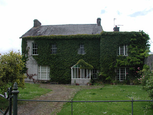
| Archerstown | The home of a branch of the Langley family, occupied at the time of Griffith's Valuation by Henry Langley and held from the Reverend Robert Lockwood. The buildings were valued at £25+. The Langley family continued to live here until the 1970s. |
|
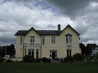
| Ardfort House | The National Inventory of Architectural Heritage dates this house from approximately 1875. It was the home of the O'Brien family of Thurles and is still extant. |
|
| Beakstown House | Major Ledwell was resident at Beakstown in 1837 and the Ordnance Survey Name Books also mention it as his residence in 1840. At the time of Griffith's Valuation one house at Beakstown appears to be in use as an auxiliary poorhouse, held by the Reverend George Peacock from the Court of Chancery and valued at £22+. Another property seems to be labelled Abbey View on the 1st Edition Ordnance Survey map but as Beakstown Cottage on the 25-inch map of the 1890s. The OS Name Books refer to this house as the residence of Mr. Mullvany, proprietor of Beakstown Flour Mills nearby. The name Beakstown Cottage had previously belonged to another property in Beakstown which is still extant [S087559]. The original Beakstown House does not appear to be extant. | |
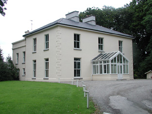
| Shanbally House (Moycarkey) | In 1786 Wilson refers to Shanbally as the seat of Colonel Slaughter. In1840 the Ordnance Survey Name Books note that "Shanbally Old Castle" was the name given to a house in the parish of Moycarkey. By the time of Griffith's Valuation the townland is part of the estate of Miss Emma Stannix. A house is still extant at this site, now part of a large farm. | |
| Holycross House | In 1840 the Ordnance Survey Name Books refer to Holycross House as a gentleman's residence. At the time of Griffith's Valuation, it was owned by Rev. Garret Wall but was unoccupied. The house was valued at almost £24. A house still stands at this site which now appears to be in use as a presbytery. |
|
| Abbeyfield / Gortnagowth | In 1840 the Ordnance Survey Name Books refer to Abbeyfield House as the residence of William Jones. At the time of Griffith's Valuation, Jeremiah O'Brien was leasing this property from the Wall estate when it was valued at £15+ and included a mill. It is labelled Abbeyfield on the 1st edition Ordnance Survey map but as Gortnagowth on the 25-inch map of the 1890s. It is still extant. | |
| Whitefort House | The Ordnance Survey Name Books refer to Whitefort House as a gentleman's residence in 1840. At the time of Griffith's Valuation, this property was leased by John Jones from the Wall estate when it was valued at almost £10. It is still extant. |