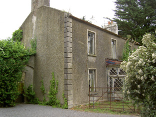
Westgrove
Houses within 5km of this house
Displaying 11 houses.
Houses within 5km of Westgrove
Displaying 11 houses.
| House name | Description | |
|---|---|---|
| Woodrooff | The seat of the Perry family in the 18th and 19th centuries, Samuel Perry was resident in 1814 and William Perry in 1837 and at the time of Griffith's Valuation, when the buildings were valued at £66+. Samuel Perry was resident in 1906. Bence Jones writes that this house is now mostly demolished. | |
| Shanballyard | Shanballyard House is marked on the first Ordnance Survey map. In the mid 19th century John Scully held buildings valued at £16+ and 299 acres from James Scully. The National Inventory of Architectural Heritage records this house as "disused". |
|
| Barn | The seat of the Moore family in the 18th, 19th and 20th centuries. In 1786 Wilson refers to it as the seat of Thomas Moore In 1840 the Ordnance Survey Letter Books note that it had "a garden nursery and ornamental ground". It was held by Stephen Moore in fee in the mid 19th century and valued at £49+. Randal K. Moore was resident in 1906 and Mr and Mrs Murray Moore in the early 1940s when the house contained a very fine library and antique art collection. Barn is still extant. |

|
| Knockeevan/Darling Hill | William Pennefather (died 1819) of Knockeevan was the second son of Richard Pennefather of New Park. Knockeevan became the home of his eldest son, Richard, Baron of the Exchequer, Ireland, who employed William Tinsley as architect in the mid 1820s. The house was originally known as Darling Hill and it belonged to the Carleton family in the 18th century. Wilson refers to it as the seat of Mr. Carleton in 1786. Oliver Carleton sold it to the Pennefathers in 1782. The house was held by the Honourable Baron Pennefather in fee at the time of Griffith's Valuation when it was valued at £54+. It later passed into the possession of Lady Emily Hankey, daughter-in-law of Baron Pennefather and then to the Stanhope family. Sold by the Stanhopes in the late 19th century or early 20th century. This house no longer exists. see http://www.dia.ie/architects/view/5338#tab_works concerning the architect. |
|
| Donegal | John O'Halloran occupied Donegal House in the mid 19th century which he held from Arthur Riall. The buildings were valued at £12.18 shillings. This house no longer exists but a farm complex is still located at the site. | |
| Loughkent | Nicholas Dogherty is recorded as the occupier of Loughkent House in 1814 and in 1850, when he held the house valued at £12.18 shillings from Arthur Riall. It is no longer extant. | |
| Woodinstown | Woodinstown was the home of a branch of the Carew family in the 18th and 19th centuries. Robert Carew was resident in the first half of the 19th century, holding the property in fee at the time of Griffith's Valuation when the buildings were valued at £16. This house is no longer extant. | |
| Maginstown | A house valued at £13+ in the townland of Maginstown was occupied by James O'Donnell at the time of Griffith's Valuation and held from William Fennell. Buildings are still located at this site. | |
| Ballinattin | In 1786 Wilson refers to "Ballattin" as the seat of Mr. Parsons. This house valued at £17+ in the mid 19th century was occupied by Thomas Cooney and held from William Moore. A farm exists at the site and the original house is not extant. | |
| Ballinattin House | Occupied by Denis Cooney at the time of Griffith's Valuation, valued at £13+ and held from Edward B. Vise. This house is still extant and occupied. | |
| Cuckoo Hill | In 1786 Wilson referred to a house he called "Clover-Hill", three miles from Caher, "the seat of Mr. Ryall". He may have been referring to the townland named Cuckoohill which appears on the 1st edition Ordnance Map. A house is present in this townland which is labelled Cuckoo Hill House on the 25-inch Ordnance Survey map of the 1890s. At the time of Griffith's Valuation, this property was leased to Patrick Heffernan by Abraham Riall when it was valued at over £6. A house and farm still occupy the site. |