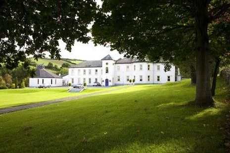
Churchtown House (Dysert)
Houses within 5km of this house
Displaying 14 houses.
Houses within 5km of Churchtown House (Dysert)
Displaying 14 houses.
| House name | Description | |
|---|---|---|
| Ballycurkeen | The home of James Manderville in the mid 19th century, held from James F. O'Ryan and valued at £19+. Ballycurkeen was still a Mandeville home in the early 1940s when Frank Mandeville was recorded as resident. The Irish Tourist Association surveyor also writes that Ballycurkeen was the residence of John O'Mahony, a Fenian leader in 1848. This house is still a family home. |

|
| Ballydine | The Mandevilles were situated at Ballydine from the 14th century. Ballydine Castle was sold to the Earl of Clonmel in 1781 and members of the Power family lived there in the first half of the 19th century, William Power in 1814 and James Power in the early 1850s. The Powers and the Mandevilles were related. A lithograph of the house is included in the Power sale rental of 4 November 1853. ''Burke's Irish Family Records'' records Frank Hackett Mandeville (1841-1905) as the last family member to live at Ballydine. He was Member of Parliament for mid Tipperary 1892-1900 and died at Ballydine Castle in 1905. Mary Lyons records the Landy family as resident from 1855-1901. | |
| The Cottage | The home of William O'Donnell in 1837 and in the early 1850s held from the representatives of Michael D. Keating. The building were valued at £18+ in the mid 19th century. Richard O'Donnell of Carrick on Suir owned 359 acres in the 1870s. | |
| Kilmurry Lodge | A house valued at £16.13 shillings was occupied by the Reverend Richard Morrissey in the townland of Ballynamona at the time of Griffith's Valuation. It was held from William P. Barker. Kilmurry Lodge is marked on the first Ordnance Survey map and is described in the Ordnance Survey Name Books as "a lodge, handsomely situated, with a garden, orchard and fir plantation". This house is still in use as a residence. |

|
| Lindville | A house named Lindville is marked on the first Ordnance Survey map in this townland close to the bank of the River Suir. At the time of Griffith's Valuation it was valued at £16+ and occupied by Thomas Lindsey who held it from William Butler. No building is now extant at this site. | |
| Ballyclohy | Leased from the Disney estate by James Moloney in 1850, when it was valued at £11 10s. | |
| Coolnamuck Court | At the time of Griffith's Valuation, Coolnamuck was held in fee by James Wall when it was valued at £64.Smith describes it as "the pleasasnt seat of William Wall" in 1777. Bence-Jones noted the house had a curved bow with domed roof and contained a ballroom. Bought by the Sadliers circa 1852. A lithograph of this house is included in both the Wall and Sadlier sale rentals of May 1852 and July 1857. Richard O'Donnell was the tenant at that time. The 1943 ITA survey mentions the existence of this house but it was demolished later in the twentieth century. A folly remains in the former demesne lands. |

|
| Glen Lower (Dysert) | Leased by Patrick Hurley from John Congreve's estate at the time of Griffith's Valuation, when the buildings were valued at £11 10s. This appears to be the property known as Glen Castle House taking its name from castle ruins nearby. A house is still extant at the site. | |
| Glen Lodge (Glen Poer) | Labelled on the first edition Ordnance Survey Map as Glen Lodge and on the later 25-inch map as Glen Poer. Held by James Gallway from James Power at the time of Griffith's Valuation, when the buildings were valued at £19. In 1876 it is given as the address of Capt. Walter Mansfield. The 1943 ITA survey notes it as the residence of Mrs. Monsell [?]. Now in the possession of the Rosminian Order as a retreat house and known as Glencomeragh House. |
|
| Landscape House | John Congreve held Landscape in fee in 1850 when it was valued at almost £20. Lewis also refers to it as a seat of the Congreve family in 1837. However, by 1906 Congreve's buildings at Landscape were only valued at £2. Landscape House is still extant and occupied. |
|
| Ballyknock | A house valued at £12 10s which was vacant at the time of Griffith's Valuation . Probably in the possession of Thomas Dooley who was leasing property from the Beresford estate in the area. There is no house visible on the later 25-inch map of the 1890s. | |
| Rathgormuck Castle | The buildings in the vicinity of Rathgormuck Castle were valued at £10 in 1850 and leased by Walter Mansfield to Thomas Terry. On the first edition Ordnance Survey map the castle is described as "in ruins". | |
| Shanakill (Upperthird) | John Hearne was leasing this property from the Power estate at the time of Griffith's Valuation, when it was valued at £11 10s. Morris states that the Hearns had held an interest in this property since the 1720s. Financial difficulties led to its sale to Mary Anne Quin in 1866. In 1906 it was owned by Anne Ussher Quin and Frances Anne Quin and was valued at £18 10s. This house was also associated with the Labarte family. A house is still extant at the site. | |
| Ballyneill | Patrick O'Donnell held buildings valued at £13 from Rodolphus Scully at Ballyneill in the mid 19th century. This may be the present house however it looks as if it might date from later in the 19th century. It is situated close to the remains of Ballyneill Castle. |

|