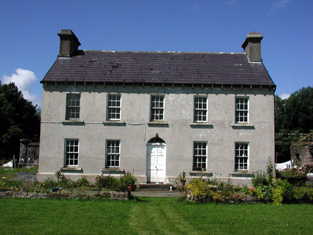
Strandhill
Houses within 10km of this house
Displaying 6 houses.
Houses within 10km of Strandhill
Displaying 6 houses.
| House name | Description | |
|---|---|---|
| Corry Lodge | At the time of Griffith's Valuation the house at Cavan, known as Corry Lodge, was owned by Francis N. Cullen and was valued at £12. In 1859 when the property was being sold it was claimed that the house had cost £1500 to build. It was the suject of a sale notice again in 1876 when the house was described as having 3 reception rooms and 5 good bedrooms. | |
| Mount Allen House/Lough Allen Cottage | Lewis records "Lough Allen Cottage" as the seat of Hugh McTernan in 1837. At the time of Griffith's Valuation, this townland was leased by Richard H. Gorghes from Arthur O'Conor. It included a house valued at £7 10s. This building is labelled Mount Allen House on the 25-inch Ordnance Survey map of the 1890s. | |
| Glasdrumman More | William Palmer was the owner of a property valued over £7 at Glassdrumman More, barony of Rosclogher at the time of Griffith's Valuation. The house is still extant and occupied. |
|
| Tawnahoney | At the time of Griffith's Valuation, Patrick Buchan, agent to the Creevlea Iron Works, was leasing buildings valued at £17 at Tawnahoney, barony of Dromahaire, from John Johnston. This property does not appear to be extant at the time of the 25-inch Ordnance Survey map in the 1890s. In 1786 Wilson had noted a property in the nearby townland of Gortermone as a seat of Mr. Johnston. It is not shown on the Ordnance Survey maps. | |
| Grouse Lodge | In 1786 Wilson refers to Grouse Lodge as the seat of Mr. Seily. At the time of Griffith's Valuation, this townland was held by the Johnston estate but there is no property with a substantial valuation. The house is shown on the 1st edition Ordnance Survey map but a larger house appears to have been constructed later on an adjacent site as shown on the 25-inch map of the 1890s. This property is still extant. | |
| Corrard | Located on the Parker estate the National Inventory of Architectural Heritage states that there have been three houses built on this site, the present house dates from the 1920s while the original was a small structure marked on the first edition six inch Ordnance Survey map (publ. 1837). John Carson occupied Corrard at the time of Griffith’s Valuation. The buildings were valued at £10. The Carson family were still resident at the beginning of the 20th century. |

|