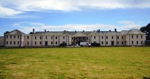
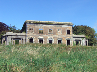
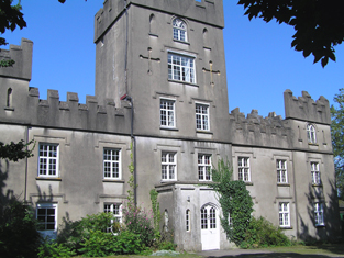
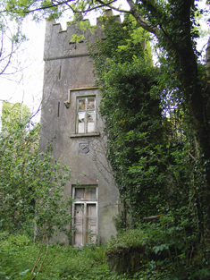
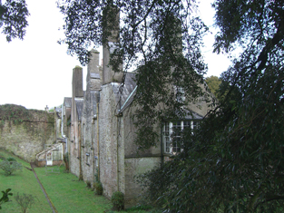
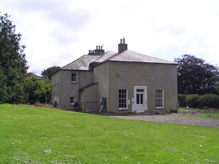
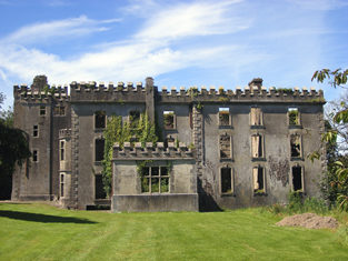
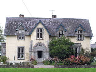
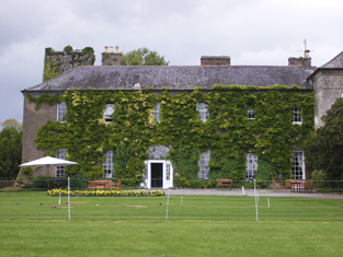
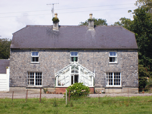
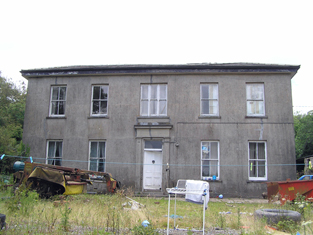
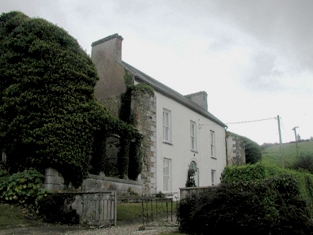
Lisquinlan
Houses within 15km of this house
Displaying 99 houses.
Houses within 15km of Lisquinlan
Displaying 99 houses.
| House name | Description | |
|---|---|---|
| Castlemartyr | Seat of the Earls of Shannon in the 18th and 19th centuries, built in the early 18th century by the 1st Earl of Shannon and enlarged by his son the 2nd Earl in the 1760s. At the time of Griffith's Valuation it was valued at £150. Sold to the Arnott family in the early 20th century, it later became a Carmelite college and now functions as a hotel. |
|
| Dromadda | A house occupied by Warham Durdin in 1814 and by G. W. Courtenay in 1837. Caroline A. Courtney was resident in the early 1850s holding the property valued at £28 from John Courtenay. It is still extant though not in good repair. |
|
| Ballynona House | The main seat of the Wigmore family, occupied by Richard H. Wigmore in 1814 and R. Wigmore in 1837. Henry Wigmore held the property from Sir Arthur Brooke in the early 1850s when the house was valued at £15+. | |
| Glenwood Lodge | Richard Harding Wigmore occupied a house, flour mill and lodge valued at £30 at this location in the mid 19th century. He held the property from Henry Wigmore. | |
| Bilberry Hill | In 1786 Wilson writes that Bilberry Hill was the residence of the late Mr. Drury. It was the home of the Garde family in the nineteenth century, occupied in 1814 by William Garde and in the early 1850s by Winifred Garde. She held the property from Sir A. Brooke and the buildings were valued at £8.15 shilllings. The 25-inch Ordnance Survey map shows a later and larger building labelled Bilberry, which is still extant. |
|
| Clashduff | Peter Warner was occupying a house valued at £18 in the townland of Clashduff at the time of Griffith's Valuation. He held this property from Sir A. Brooke. This may be the house recorded by Lewis as Castle View in the parish of Inchinabacky and inhabited by P. Warner. Peter Warner of Clashduff, Middleton owned 205 acres in the 1870s | |
| Brookdale House | A house occupied by Mr Robert Atkins in 1814 and described by Lewis in 1837 as the seat of A. Ormsby. Arthur Ormsby was married to Margaret the sister of Robert Atkins (of Firville). Margaret Ormsby was the immediate lessor of the house in the early 1850s when it was valued at £32 and occupied by John Bull. William Welland was tenant when the property part of the estate of Henry Wigmore was advertised for sale in 1871. | |
| Young Grove | Mrs Foulke was resident in 1814 and C. Foulke in 1837. At the time of Griffith's Valuation John Turpin held the property in fee and the buildings were valued at £50. Margaret T. Turpin was resident in 1906 when the buildings were valued at £45.10 shillings. | |
| Roxborough | Wilson, writing in 1786, refers to "Rocksborough" as the seat of Mr. Ball. The residence of Bent Ball in 1814 and of - McSweeny in 1837, this house was unoccupied in the early 1850s when it was valued at £22. The immediate lessor was Sir A. Brooke. The house has disappeared by the time the 25-inch Ordnance Survey map was published in the 1890s and the Youghal branch of the Great Southern & Western railway constructed close by. | |
| Stumphill | This house was the home of William Mc O'Boy in the first half of the 19th century. The house was valued at £25 at the time of Griffith's Valuation and held from Henry Newenham. |
|
| Ballyannan | The Brodricks first occupied Ballyannan Castle, a fortified house in the townland of that name, which was in ruins by 1837. In 1786 Wilson refers to Ballyanan"belonging to Lord Viscount Midleton". On the first Ordnance Survey map there is a building named Ballyannan House (W867 715) right on the shore close to the castle and there is a house in the townland of Garryduff named Ballyannan. Ballyannan was occupied by Roger Adams in 1814 and by J. Adams in 1837. At the time of Griffith's Valuation the representatives of Viscount Midleton occupied a house and offices valued at £19 in the townland of Garryduff. The house in the townland of Ballyannan was valued at £9.10 shillings and was occupied by Daniel Twomey and held from the Viscount. | |
| Breeda House | Roger G. Davis held a house in fee, valued at £17, in this townland at the time of Griffith's Valuation. Breeda House is labelled on the 25-inch Ordnance Survey map of the 1890s. A house is still extant at the site. | |
| Ballyglassin House | James Butler held this house valued at £17 from his father-in-law, Roger Green Davis, at the time of Griffith's Valuation. There is still an extant house at the site. | |
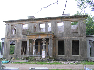
| Dromdihy | The building of this house was completed in 1833 for Roger Green Davis. He is recorded as the occupier in the early 1850s holding the house valued at £45 from Sir Arthur De Capell Brooke. The sale rental of 1863 gives a detailed description of this house - "Drumdiah House consists of a centre and two wings, ornamented with Doric columns and with a portico at the eastern end, by the hall is entered, and off which are hot, cold, vapour and shower baths. The first floor comprises five sitting-rooms; on the second floor are four best bedrooms, with dressing-rooms and water-closet......". In the 1940s the Irish Tourist Association Survey reported that the house had been "destroyed in the Troubles". It is now a ruin. |
|
| Gortnagappul | This area is marked as the farmyard of Aghadoe House on the first Ordnance Survey map. At the time of Griffith's Valuation a house and offices valued at £28 were held by Roger G. Davis from Richard Uniacke Bailey. A large farm complex exists at the site now. | |
| Aghadoe House (Killeagh) | Lewis writes in 1837 that “The present house is about to be replaced by a castellated mansion”. The earlier house is referred to by Wilson in 1786 as the seat of Simon Dring. Aghadoe wasccupied by Thomas M. Green at the time of Griffith's Valuation. The house, valued at £27, was held by him from Sir Arthur De Capell Brooke. The house is no longer extant. | |
| Mount Uniacke | A home of the Uniacke family in the 18th and 19th centuries, occupied by three generations of persons named Norman Uniacke in the 19th century. Earlier, in 1786, Wilson refers to it as the seat of James Uniacke. In the mid 19th century it was held by Norman Uniacke in fee and the house was valued at £30. The Irish Tourist Association Survey of the 1940s reported that it had been burnt in 1921 and it is no longer extant. | |
| Cornaveigh | A house in this townland was occupied by George Bowles in the mid 19th century, valued at £17 and held from his father, Spotswood Bowles. The original building is no longer extant. | |
| Mountbell | In 1786 Wilson refers to Mount Bell as a residence of the Garde family. It was ccupied by Edmund MacKey in 1814 and by Edward Lane in the early 1850s. Lane held the house valued at £10 from Sir Arthur De Capell Brooke. A house and large farm are still extant at the site. | |
| Park | Located on the Ponsonby estate The Park was occupied by John Hudson junior in 1814 and by Robert Hudson in the early 1850s when the house was valued at £10. The Hudsons may have been agents to the Ponsonbys. The address of Charles W. Talbot Ponsonby is given as Park House, Youghal in the 1870s. | |
| Burges House | This house, valued at £14, was occupied by William Hall at the time of Griffith's Valuation and held from Lord Ponsonby. | |
| Inchiquin House | In the early 1850s Henry Hall occupied this house valued at £15 located on the Ponsonby estate. | |
| Knockmonalea House | A house valued at £14, the home of John Hudson at the time of Griffith's Valuation and held from Lord Ponsonby. | |
| Ring Cottage | A house marked as Ring Cottage on the first Ordnance Survey map and occupied by Uniack Mackey in the early 1850s, when held from the Marquis of Thomond and valued at £10. Still extant and now known as Ring House. |
|
| Ring House | Lewis records J. McCarthy as proprietor of Ring in 1837. Thomas Taylor was resident in the early 1850s holding the house valued at £16 from the Marquis of Thomond. Thomas Taylor of Ring owned 76 acres in the 1870s. The house is now an ivy covered ruin. | |
| Greenlands | This house was the home of G. Gaggin in 1837 and of George Gahan in the early 1850s. Valued at £14 it was located on the estate of the Marquis of Thomond. | |
| Ballygeany | Marked as Ballygeanymore House on the first Ordnance Survey map. Valued at £15, occupied by John Nason and held from the representatives of Viscount Midleton at the time of Griffith's Valuation. This house is still a residence. |

|
| Ballykinealy | The proprietor of this house in 1837 was Captain Fitzgerald of the Royal Navy. At the time of Griffith's Valuation Michael Fitzgerald held the property from John Fitzgerald and the buildings were valued at £20. The sale rental of 1861 refers to the house as a mansion "a large and first-class residence". It was occupied by Michael Joseph Fitzgerald, a barrister and younger brother of John Fitzgerald. The National Inventory of Architectual Heritage states that this house was a rectory for some time. Lewis writes that it was formerly "a religious establishment". |
|
| Aghavine | Occupied by Michael Neville in the early 1850s, held from Francis Wyse and valued at £20. |
|
| Brooklodge | This house situated in the 6 acre townland of Brooklodge was the residence of Henry Marsden and his wife in the first part of the 19th century. By the time of Griffith's Valuation the Reverend Pierse Drew was resident. He was rector of Youghal and a member of the family of Drew of Mocollop Castle, county Waterford. The Reverend Drew held the property from John Pollock and it was valued at £40. | |
| Mary Ville | Mary Ville is marked on the first Ordnance Survey map. In the early 1850s the house was occupied by John Hurley who held it from Colonel George Teulon. It was valued at £10. A house is still extant at the site. | |
| Glenally | A house valued at £15 and held with 6 acres by James Wallis from Mary Allen at the time of Griffith's Valuation. This house is named Glenally on the first Ordnance Survey map. | |
| Clashadonagh [Frogmore] | James Barry held an unoccupied house in the townland of Glanaradotia valued at £20 at the time of Griffith's Valuation. It is labelled Clashadonagh on the 1st edition Ordnance Survey map but as Frogmore House on the 25-inch map of the 1890s. It is now a ruin. | |
| Mistletoe Castle | Marked as Eustace's Castle on the first Ordnance Survey map and apparently straddling the boundary between Cooperalley and Greencloyne, this house was the residence of John Conroy Browne in the second half of the 19th century. At the time of Griffith's Valuation the buildings were valued at £25 and held from William Fitzgerald. J.C. Browne of Mistletoe Castle owned 16 acres in county Cork in the 1870s. The house is stated to have been built in the 1770s as a summer residence for the Villiers-Stuart [Stuart] family. |
|
| Windford | A home of the Hudson family occupied by John Hudson in 1814 and by Robert Hudson in the early 1850s. Though there are buildings at the site the original house does not seem to be extant. | |
| Heathfield Towers | Captain Cotter was resident at Heathfield in 1837. This house was unoccupied at the time of Griffith's Valuation, when it was valued at £8.10 shillings. The immediate lessors were the representatives of Walter Maguire and Mary Giles. It was later the home of the Reverend Pierse Drew who was in residence in the 1870s. |
|
| Muckridge House | The Hobson family were resident at Muckridge from at least the mid 1770s. Wilson, writing in 1786, refers to it as the seat of Mr. Hobson. In 1814 Richard Fitzgerald is recorded as resident at Muckridge and in 1837 William Fitzgerald. At the time of Griffith's Valuation Samuel Le Hunte Hobson held the property in fee and the buildings were valued at £37. Still extant, well maintained and for sale at the beginning of 2010. |
|
| Seafield | The home of Mr John Hudson in 1814 and of Thomas Seward in the early 1850s. Seward held the property from Lord Stuart de Decies and it was valued at £24. The National Inventory of Architectural Heritage suggests it was built in the latter decades of the 18th century. It has recently been under renovation. |
|
| Summerfield | John Hall held a house valued at £15 and 175 acres in fee at Summerfield in the early 1850s. No house of this size is marked on the first Ordnance Survey Map for this townland. Grid Reference is approximate. | |
| Myrtle Grove | Myrtle Grove, a Tudor manor house, associated with Sir Walter Raleigh and the sixteenth-century poet, Edmund Spencer At the beginning of the 17th century it was sold to Richard Boyle, 1st Earl of Cork, and later became the property of the Hayman family, who owned it in the 18th and early 19th centuries. In 1837 Lewis writes that it was inhabited by Colonel Faunt. Later occupants include Joseph Wakefield Pim, Sir John Pope Hennessy and the Arbuthnot family. Now in private hands this house is open to the public on certain days in the year. |
|
| Jamesbrook Hall | The home of the Adams family, occupied by Michael Go[o]ld Adams in 1814 and by Richard W. G. Adams in 1837 and in the early 1850s when the house was valued at £60 and held from the Marquess of Thomond. Occupied by William R. G. Adams in 1906. Recently renovated and restored. |

|
| Kilbree | Kilbree belonged to the Boles family at the beginning of the 18th century. It became the residence of a branch of the Adams family in the late 18th and 19th centuries, occupied by S.W. Adams in 1837. The house was valued at £33 in the mid 19th century and held from Dorothea and William Boles. |
|
| Ballybane | [Leet records George Gaggin of Ballybawn, Buttevant, county Cork in 1814.] Ballybane was occupied by T. Gaggin in 1837 and by William Gaggin in the early 1850s. The house was valued at £22 and held from Laurence Corban. This house was recently renovated. |
|
| Barnabrow | This house was the residence of Timothy Lane in 1814. Located on the Thomond estate and occupied by William G. Fitzgerald who held the property from John [Royal] Wilkinson at the time of Griffith's Valuation. The buildings were valued at £28. A lithograph of this house is included in the sale rental of the Thomond estate 1857. The representatives of Edward de l'E. Litton were recorded as the occupants of this house in 1906. The house now functions as a guest house. |
|
| Cloyne House | Originally the Bishop's Palace, by 1837 it was known as Cloyne House and occupied by H. Allen. Valued at £50, occupied by John Wilkinson and held from the Ecclesiastical Commissioners at the time of Griffith's Valuation. |
|
| Kilboy/Keil Bui | Marked as Keil Bui in the townland of Kilboy on the first Ordnance Survey map, occupied by Lewis Gibson in 1814 and by John Gibson in the early 1850s who held the property in fee. The buildings were valued at £25. This house is described as a former deanery in the National Inventory of Architectural Heritage and is now in use as a private residence. |
|
| Kilcrone | An early 18th century house, the home of the Hannings in the first half of the 19th century, held by him from Mountifort Longfield at the time of Griffith's Valuation when valued at £30. The sale rental of 1858 records William G. Fitzgerald as the occupant of this house on a temporary basis. This house is occupied and well maintained. |
|
| Lindsey Cottage | Marked on the first Ordnance Survey map as Lindsey Cottage. At the time of Griffith's Valuation it was occupied by John Litton who held it from the Bishop of Cork, Cloyne and Ross. The buildings were valued at £20. | |
| Sunville | This house was the residence of Captain Durdin in 1814 and of Major Kane in the early 1850s who held it with 2 acres from Michael Connor who was leasing from Thomas G. Durdin. The house was valued at £12.10 shillings. This house was included in the Durdin estate sale of June 1855. The ruins of this house and a walled garden are situated behind a modern house. | |
| Ballyre | This house was occupied by Crofton Uniacke at the time of Griffith's Valuation when it was valued at £29.15 shillings and held from Mountifort Longfield. Earlier, in 1786, Wilson refers to it as the seat of Crofton Uniacke. The home of Robert M. Bayly in the 1870s. It is still extant. |
|
| Castle Mary | An 18th century house, remodelled as a castle in the 19th century, home of a branch of the Longfield family. In 1786 Wilson give a description of the house including that "the west front of this mansion presents a view of Cork Harbour". Valued at £85 in the mid 19th century and held by Mountifort Longfield in fee. Bence Jones writes that this house was burnt in the early 1920s and is now a ruin. A new house was constructed from the old stable courtyard and the family continued to live there for periods of time during the 20th century until Castle Mary was acquired by the Hurley family in 1978. |
|
| Glengarra | Occupied by Robert Dring in the early 1850s, valued at £25 and held from Robert Uniacke. Still extant and occupied. |
|
| Rathcoursey House (East) | At the time of Griffith's Valuation a house in Rathcoursey East valued at £18 was held by Richard Lyons from the Provost and Fellows of Trinity College, Dublin. This house is still a residence. |
|
| Rathcoursey House (West) | Home of the Smith family in the 18th and 19th centuries. John Tynte Smyth lived here in the 1770s. Occupied by John Smith in 1814 and John J. Smyth in the early 1850s. The house was valued at £35 and held from the Marquess of Thomond with 214 acres. It is now run as a guest house. |
|
| Ardavilling | The National Inventory of Architectural Heritage dates this house circa 1860. It was the home of John Litton who left it to his nephew Edward F. Litton. At the beginning of the 20th century occupied by Guildford William Jack Stacpoole of the Ballyalla, county Clare, family. |
|
| Carewswood | Inhabited by the Dowager Countess of Shannon in 1814 and by the Reverend J. Leslie in 1837. By the time of Griffith's Valuation this house valued at £40 was in the possession of Edward Garde who held it from the Earl of Shannon. A house is still extant at the site. | |
| Ballynacorra | An 18th century house, occupied by John Garde in 1814 and by Thomas Garde at the time of Griffith's Valuation, who held the building valued at £40 from the Earl of Shannon. Still in use as a residence. | |
| Broomfield | A home of the Garde family in the second half of the 18th century. The residence of D. Humphreys in 1837 and of William Humphreys in the early 1850s. At this time the house was valued at £30 and held from the representatives of Viscount Midleton. This house is still in use as a residence. |
|
| Clonmaine | At the time of Griffith's Valuation William Abbot held this house valued at £15 from Robert U.P. Fitzgerald. |
|
| Knockane | A Garde home in the early part of the 19th century, Dr T. Garde was resident in 1837. Unoccupied at the time of Griffith's Valuation when valued at £14. Richard and Henry Pratt were then the immediate lessors from the Earl of Shannon. |
|
| Ballymaloe | William Abbot was resident at Ballymaloe in 1814. It was described by Lewis in 1837 as a "very curious old house, built by the Fitzgeralds and forfeited in the war of 1641, it is now the property of Mr Forster" . By the early 1850s John Litchfield [Lichfield] was resident holding the house valued at £48 from Mountifort Longfield. It was the seat of William Lichfield in 1894. It is now the home of the Allen family who run it as a guest house with adjacent shop. Their renowned cookery school is nearby. see http://www.ballymaloe.ie/ |
|
| Rockview (Inch) | In 1837 Lewis refers to the "very pretty residence of Mr Fitzgerald" proprietor of the extensive limestone quarries at Carrigacrump. The house was named Rockview on the first Ordnance Survey map. Teresa Fitzgerald was the occupier in the early 1850s holding the property from Colonel William H.M. Hodder, the buildings were valued at £15. Teresa Fitzgerald (nee Coppinger of Rosmore) married James Fitzgerald and they had a son Maurice and daughters Teresa, Mary etc see ''The Barrys of County Cork''. Margaret Fitzgerald of Carrigacrump owned 83 acres in the 1870s. Her estate at Rockview was advertised for sale a number of time in the mid 1870s. There is still an extant house at the site. | |
| Shanagarry | A house occupied by Thomas John Keane from at least 1837. At the time of Griffith's Valuation the buildings were valued at £16 and held from Peter Gaskell. T.J. Keane's representatives were still resident in the 1870s. Part of Shanagarry, the estate of Thomas John Keane, was advertised for sale in November 1876 and June 1877. In January 1881 this house and 58 acres was for sale again. The house had "hot and cold water laid through it". This house is still a family residence. |
|
| Kinoith | Occupied by William G. Fitzgerald at the time of Griffith's Valuation, valued at £8 and held from Peter P. Gaskell. Occupied by the William Strangham in the first half of the 20th century. This house is now the home of Tim and Darina Allen of the famous Ballymaloe Cookery School. |
|
| Shanagarry Castle | A tower house with additions, mainly associated with the Penn family. Probably the building occupied by Warham Durdin in 1814. At the time of Griffith's Valuation Thomas Durdin was in possession of most of this townland. In 1942 the Irish Tourist Association Survey referred to the Penn connection and stated that the house was then in the possession of the Brazier family. |
|
| Ballyedekin | A house valued at £20 at the time of Griffith's Valuation, occupied by John Leech and held from the representatives of Viscount Midleton. Buildings are still extant at this site. | |
| Butlerstown | Daniel Keane lived at Butlerstown in the early 1850s. The buildings were valued at £15 and held from the representatives of Viscount Midleton. This house is now a ruin. | |
| Violet Hill | Occupied by Jonas Smyth at the time of Griffith's Valuation and held by him from Henry Cornelius. The buildings were valued at £12. This house is still extant and occupied. |
|
| Rose Hill | Occupied by William Rumly in 1814 and Lewis records T.H. Rumbley residing at Ballinacorra Lodge in 1837. Mountiford Longfield was the occupier in the early 1850s. Held by him in fee and valued at £15. This house is no longer occupied. |
|
| Lakeview | Located on the southern outskirts of Midleton town, Swithin Fleming is recorded as the occupier of this house on the Midleton estate and 12 acres from at least 1837 until the 1870s. In the mid 19th century it was valued at £14. | |
| Dunsfort | Occupied by Richard Adams in 1814 and by Laurence Smithwick at the time of Griffith's Valuation when valued at £20 and held from the representatives of Viscount Midleton. Only the farm buildings appear to be shown on the 25-inch map of the 1890s. | |
| Killeagh | A house on the Midleton estate occupied by W. Welland in 1837 and Henry Welland at the time of Griffith's Valuation. He held the house valued at £40 with 427 acres. William Welland of Brooklodge, Middleton, owned 185 acres in the 1870s. This house now known as Westpark House is still a family residence. |
|
| Loughatalia | A house valued at £20 was occupied by William Humphreys at Loughatalia in the mid 19th century. He held the property with 34 acres from Henry Garde. This house now functions as a guest house known as Lochcarrig. |
|
| Ballindinis | Ballindinis was associated with the Garde family in the 18th century. The house is marked on the first Ordnance Survey map and was occupied by the Reverend Maurice Hewson in the mid 19th century, when held from Sophia Bellew and valued at £16. A house is still extant at the site. | |
| Castletown | The home of James Uniache in 1814 and of Norman Uniacke in 1837. Robert Uniacke held the property in fee at the time of Griffith's Valuation when it was valued at £20. In 1786 Wilson also refers to it as the seat of James Uniacke. This house was a ruin at the beginning of the 21st century but the National Inventory of Architectural Heritage refers to its restoration. |
|
| Springfield | The home of a branch of the Boles family in the 19th century, occupied by John Boles in 1814 and the Reverend William Boles in 1837 and in the early 1850s. The house was valued at £16 and held from Foulke S. Greville. Spotiswood Boles of Springfield owned 540 acres in county Cork in the 1870s. In 1906 occupied by William Bowles. The house was derelict in the early 21st century. |
|
| Woodview | A house marked on the first Ordnance Survey map and occupied in 1837 by the Reverend J.P. Lawless. Valued at £18 at the time of Griffith's Valuation, occupied by the Reverend John L. Pyne and held from Mountifort Longfield. The location appears to be occupied by farm buildings now. | |
| Carrigshane | Thomas Smithwick held a house valued at £15 with 44 acres from the representatives of Viscount Midleton at the time of Griffith's Valuation. This may be the property mentioned by Wilson as "Carrig" in 1786, a seat of the Uniacke family. Buildings are still extant at this site. | |
| Cahermone | Wilson, writing in 1786, refers to Cahermone as the seat of Charles Broderick. The house was the residence of Thomas Poole in 1814 and in 1837. Lewis states that Poole was agent to the Midleton estates. Laurence Smithwick occupied the house at the time of Griffith's Valuation when it was valued at £8. Though buildings there were vallued at £19 in 1906 the original house is not shown on the 25-inch Ordance Survey map of the 1890s. Farm buildings occupy the site now. | |
| Kilboy | Francis Rowland was resident in 1837 and at the time of Griffith's Valuation, when the house was valued at £35 and held from Wallis Adams. It is now a ruin. | |
| Castlerichard | Occupied by Richard Fitzgerald in 1814 and in 1837. This house was unoccupied at the time of Griffith's Valuation and held by Thomas John as immediate lessor. It was valued at £9. Advertised for sale in 1858 as part of the estate of Bowles, John and others. This early 18th century house, with the old tower house nearby, is still extant and occupied. |
|
| Casino | Mrs Hyde was residing at Cassina, Castlemartyr in 1814 and in the early 1850s it was occupied by Wallace Adam Walker who held the property from the Earl of Shannon. The buildings were valued at £20. W.A. Walker was still resident in the 1870s. This house is still in use as a residence. |
|
| Monaloo | This house was built post Griffith's Valuation. In the 1870s Charles Nason of Monaloo House, Tallow, owned 797 acres in county Cork. It is still extant. |
|
| D'Loughtane | The Ronayne family were resident at D'Loughtane for many centuries. It was lost to the family in the 17th century but recovered through marriage with a Bluett. In the eighteenth century Smith refers to it as "the pleasant seat of Mr. Ronayne". The original house was destroyed by fire and a new one built in the early 19th century. At the time of Griffith's Valuation, it was held in fe by Robert P. Ronayne and valued at £26. The sale rental of June 1851 states that it was erected at a cost of £3,500. Knight writes that it was sold in the Encumbered Estates Court in 1856 to Mr Samuel Allen who sold it later to John Pedder Furlong of Fermoy. Furlong sold the property to the Land Commission in 1910. The house has had a number of occupiers since then and is now owned by the Smiddy family. |
|
| Ballynatray House | Held in fee by Richard Smyth at the time of Griffith's Valuation when the buildings, including a mill, were valued at over £100. Lewis also refers to it as the seat of R. Smyth in 1837 when he describes it as "finely situated in a much improved demesne". In 1814 it was the residence of Grice Smyth who Brady cites as the builder. Charles Smith notes an earlier residence as the seat of Richard Smith. In 1943 the ITA survey referred to is as the seat of Captain Holroyd Smyth. Ballynatray is still extant and the focus of an 850-acres estate, with notable gardens. See www.ballynatray.com for details. |
|
| Cherrymount House | Described by Lewis in 1837 as the "occasional residence" of Captain Parker. It was being leased by Thomas Carpenter from the Parker estate at the time of Griffith's Valuation, when it was valued at £24 10s. In 1852 it was offered for sale in the Encumbered Estates Court when it was described as "a suitable dwelling house and demesne, formerly occupied by the owner". It was purchased by Maj-Gen Sir Joseph Thackwell and remained in the possession of that family until the twentieth century. It is now a ruin. | |
| Garryduff House | Garryduff was held in fee by Thomas Garde at the time of Griffith's Valuation, when the buildings were valued at £35 10s. Lewis refers to it as the seat of H. Garde in 1837. This house is no longer extant. | |
| Ardsallagh House | Mrs.Olivia Ronayne was leasing this property from the estate of Lord Stuart de Decies at the time of Griffith's Valuation, when it was valued at £10 10s. It is labelled Ardsallagh House on both the 6-inch and 25-inch Ordnance Survey maps. Extant buildings remain at the site. | |
| Bayview (Clashmore) | Rev. Michael Purcell was leasing this property from Lord Decies estate in 1851 when it was valued at £12. There is still an extant house at this site. | |
| Rockview (Clashmore) | Leased by Richard Bayley from the Villiers-Stuart estate at the time of Griffith's Valuation, when it was valued at almost £7. It is labelled Rockview on both the 6-inch and 25-inch Ordnance Survey maps. There is still an extant house at the site. | |
| Monatray | In 1851 Pierce S. Smith [Smyth), a minor, held Monatray in fee when it was valued at £35. In 2013 it was offered for sale. The sale details suggest it was built by Percy Smyth of Headborough as a summer residence in the 1830s. In the twentieth century it was occupied by a religious order and later a country house club before returning to private ownership in the 1980s. In recent years the house name is spelt Monatrae. In 2014 Monatrae was offered for sale. |
|
| Newtown House (Kinsalebeg) | Built after the first Ordnance Survey, Michael Kennedy was leasing this property from the Smyth estate in 1851 when it was valued at £13 10s. It is noted on the 25-inch Ordnance Survey Map as Newtown House. There is still an extant house at the site. | |
| Pilltown House | Declan Tracy was leasing this property from the Kennedy estate at the time of Griffith's Valuation, when it was valued at over £12. Smith refers to it as "Pilltown, not long since the estate of the Walshes". The house is labelled Pilltown House on the 25-inch map of the 1890s. It is no longer extant. Tracy is noted as the owner of over 450 acres in county Waterford in the 1870s. A substantial mill, valued at £39, in the same townland was being leased by Peter Moore Fisher [X129800]. It was included in the sale of Fisher property in the Landed Estates Court in November 1865. The mill appears to have fallen into disuse by the end of the nineteenth century though the ruins remain. | |
| Mayfield (Kinsalebeg) | In 1851 Thomas P. Carew was leasing this property from the Smyth estate when it was valued at over £20. A house labelled Mayfield appears at this location on the 1st edition Ordnance Survey map. In 1837 Lewis noted it as the seat of J. Gee. It is still extant and occupied. |
|
| Prospect Villa (Kinsalebeg) | Prospect Villa seems to have been built in the later nineteenth century, close by an earlier house known as Mayfield. A house at Prospect Hall is described by Smith as "a handsome seat with good improvements made by the late Stephen Bernard" In 1786 Wilson refers to "Prospect Hall" as the seat of Mr. "Barnet". There is still an extant building at the site. |
|
| Woodbine Hill | George Roche held this property from the Smyth estate in 1851 when it was valued at over £26. Local sources suggest it was built by him earlier in the nineteenth century. It is still extant and occupied. |
|
| Clifton | Situated on the coast just south of Youghal, Clifton was occupied by Sir William Homan in 1837. Griffith's Valuation records John Keily junior as resident when the house was valued at £62. Buildings are still extant at the site. | |
| Green Park | Captain H. Parker of the Royal Navy was resident at Green Park in 1837. By the time of Griffith's Valuation William Carberry was the occupier holding the building valued at £38 from Pim Jackson. Extensive modern building has occurred in this area. | |
| Ballyvergan House | In 1786 Wilson refers to Ballyvergin as the seat of Robert Uniacke. By the time of Griffith's Valuation, this townland is part of the Leader estate. The house, valued at £12 was occupied by James O'Brien. This may be the property labelled Ballyvergan House on the 25-inch Ordnance Survey map in the 1890s.Buildings still exist at the site. |