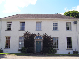
Ballyedmond
Houses within 5km of this house
Displaying 17 houses.
Houses within 5km of Ballyedmond
Displaying 17 houses.
| House name | Description | |
|---|---|---|
| Ballycurrany House | This house was occupied by Joseph Wilson at the time of Griffith's Valuation. He held it from James H. Smith Barry and it was valued at £13. It is no longer extant. | |
| Ballynaclashy House | Occupied by Henry Wilson in the early 1850s, held from James H. Smith Barry and valued at £10.10 shillings. Herny Wilson of Ballynaclashy owned 83 acres in the 1870s. A house is still extant at the site. | |
| Glenview | George Courtenay is recorded as resident at Glen-View in 1814 and also in the early 1850s when he held the property from James H. Smith Barry. The buildings were valued at £9. In 2010 it was offered for sale. |
|
| Greenville | Garret Barry, eight son of William Barry of Rockville, occupied this house in the mid 19th century. He held it in fee and it was valued at £17+. He was a racehorse owner and died unmarried. Greenville passed to his nephew Dr William Barry of Rockville and Greenville. Lucy K. Barry was resident in 1906 when the buildings were valued at £34. | |
| Curragh | At the time of Griffith's Valuation John Courtenay held a house, offices and gate lodges at Curragh, valued at £28. The first Ordnance Survey map shows a farm yard for Ballyedmond in Curragh. The 25-inch map of the 1890s still indicates extensive farm buildings, together with kennels. Farm buildings remain at the site. | |
| Bilberry Hill | In 1786 Wilson writes that Bilberry Hill was the residence of the late Mr. Drury. It was the home of the Garde family in the nineteenth century, occupied in 1814 by William Garde and in the early 1850s by Winifred Garde. She held the property from Sir A. Brooke and the buildings were valued at £8.15 shilllings. The 25-inch Ordnance Survey map shows a later and larger building labelled Bilberry, which is still extant. |
|
| Young Grove | Mrs Foulke was resident in 1814 and C. Foulke in 1837. At the time of Griffith's Valuation John Turpin held the property in fee and the buildings were valued at £50. Margaret T. Turpin was resident in 1906 when the buildings were valued at £45.10 shillings. | |
| Roxborough | Wilson, writing in 1786, refers to "Rocksborough" as the seat of Mr. Ball. The residence of Bent Ball in 1814 and of - McSweeny in 1837, this house was unoccupied in the early 1850s when it was valued at £22. The immediate lessor was Sir A. Brooke. The house has disappeared by the time the 25-inch Ordnance Survey map was published in the 1890s and the Youghal branch of the Great Southern & Western railway constructed close by. | |
| Ballyvodock House | James Barry was living at Ballyvodig House, Middleton, in 1814. In the mid 19th century William Kelleher was the occupier. He held the property from William Oliver Jackson and the buildings were valued at £11. A house and large farm are still extant at the site. | |
| Ballyannan | The Brodricks first occupied Ballyannan Castle, a fortified house in the townland of that name, which was in ruins by 1837. In 1786 Wilson refers to Ballyanan"belonging to Lord Viscount Midleton". On the first Ordnance Survey map there is a building named Ballyannan House (W867 715) right on the shore close to the castle and there is a house in the townland of Garryduff named Ballyannan. Ballyannan was occupied by Roger Adams in 1814 and by J. Adams in 1837. At the time of Griffith's Valuation the representatives of Viscount Midleton occupied a house and offices valued at £19 in the townland of Garryduff. The house in the townland of Ballyannan was valued at £9.10 shillings and was occupied by Daniel Twomey and held from the Viscount. | |
| Ballytrasna House | No house with demesne is marked on the first Ordnance Survey map in this townland but by the time of Griffith's Valuation Timothy O'Regan was occupying a house and other buildings valued at £19+ which he held from John Courtenay. Farm buildings are still extant at this site. A property labelled Ballytrasna House is shown on the 25-inch map of the 1890s, located in the next townland of Glenawillin [W876796]. This property was also being leased by O'Regan from the Courtenay estate at the time of Griffith's Valuation, when it was valued at £5+. However, it had become a more substantial property by the 1890s. A house is still extant at the site. | |
| Broomfield | A home of the Garde family in the second half of the 18th century. The residence of D. Humphreys in 1837 and of William Humphreys in the early 1850s. At this time the house was valued at £30 and held from the representatives of Viscount Midleton. This house is still in use as a residence. |
|
| Lakeview | Located on the southern outskirts of Midleton town, Swithin Fleming is recorded as the occupier of this house on the Midleton estate and 12 acres from at least 1837 until the 1870s. In the mid 19th century it was valued at £14. | |
| Dunsfort | Occupied by Richard Adams in 1814 and by Laurence Smithwick at the time of Griffith's Valuation when valued at £20 and held from the representatives of Viscount Midleton. Only the farm buildings appear to be shown on the 25-inch map of the 1890s. | |
| Killeagh | A house on the Midleton estate occupied by W. Welland in 1837 and Henry Welland at the time of Griffith's Valuation. He held the house valued at £40 with 427 acres. William Welland of Brooklodge, Middleton, owned 185 acres in the 1870s. This house now known as Westpark House is still a family residence. |
|
| Carrigshane | Thomas Smithwick held a house valued at £15 with 44 acres from the representatives of Viscount Midleton at the time of Griffith's Valuation. This may be the property mentioned by Wilson as "Carrig" in 1786, a seat of the Uniacke family. Buildings are still extant at this site. | |
| Cahermone | Wilson, writing in 1786, refers to Cahermone as the seat of Charles Broderick. The house was the residence of Thomas Poole in 1814 and in 1837. Lewis states that Poole was agent to the Midleton estates. Laurence Smithwick occupied the house at the time of Griffith's Valuation when it was valued at £8. Though buildings there were vallued at £19 in 1906 the original house is not shown on the 25-inch Ordance Survey map of the 1890s. Farm buildings occupy the site now. |