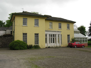
Grange (Athnowen)
Houses within 5km of this house
Displaying 15 houses.
Houses within 5km of Grange (Athnowen)
Displaying 15 houses.
| House name | Description | |
|---|---|---|
| Elm Park | Garyhasty was described by Smith in 1750 as the "pleasant country house" of Mr Riggs Faulkner. I A house located on the Riggs Falkiner estate, Wilson notes it as the seat of Rev. Mr. Kenney in 1786. It was occupied by Valentine Barry in 1837 and by Thomas Barry at the time of Griffith's Valuation and valued at £36. Home of Richard Ashe Orpen in the 1870s. Elm Park is still extant and occupied. |
|
| Springmount | In 1837 and at the time of Griffith's Valuation this property was occupied by Samuel McCarthy. Valued at £19.10 shillings it was held from Lady Carbery's estate. There is still an extant house at the site. | |
| Classes | Classes was occupied by William O'Callaghan in the early 1850s and held from John Stevely. The buildings were valued at £11. There are two houses at Classes on the 1st edition Ordnance Survey map. Classes House is located at W562705 while the second is labelled Classes House East and located at the site of the current Classes House which bears a date label of 1823. |
|
| Lisheens | The residence of Richard Donovan at the time of Griffith's Valuation, held from the representatives of John Stevely and valued at £16. | |
| Oriel House | Built in the first decade of the 19th century by the Board of Ordnance. The house was occupied by Charles Wilkes, the superintendant of the gunpowder mills until purchased by the Tobins of Liverpool in the mid 1830s. Mrs Tobin was a painter and their residence became known as Oriel House under Tobin ownership. The house has been a hotel since 1983. |

|
| Coolyduff House | At the time of Griffith's Valuation this house valued at £16 was occupied by Alfred Parnell and held from Richard Beamish. Labelled as Coolyduff House on the 25-inch Ordnance Survey map of the 1890s. There is still an extant house at the site. | |
| Lackenshoneen | Benjamin Cross occupied this house in the mid 19th century. He held it from Philip Cross and the buildings were valued at £12. The buildings have all but disappeared on the 25-inch edition Ordnance Survey map of the 1890s and nothing remains at the site now. | |
| Surmount/Sirmount | Sirmount was the residence of Emmanuel Moor in 1750. In 1786 Wilson refers to it as the seat of Mr. Hawkes. This house was occupied by G. Hawkes in 1837 and by Quaile Hawkes in the early 1850s. The property was held from Lady Carbery. The buildings were valued at £8.15 shillings. It is no longer extant. | |
| Bride View | Occupied by Samuel Hawkes and held from the representatives of William Hawkes at the time of Griffith's Valuation. The buildings were valued at £13.10 shillings. The property at this location is labelled Knockanemore House on the 25-inch Ordnance Survey map of the 1890s. There is still an extant house at the site. | |
| Ballyshoneen | A house valued at £13.10 shillings at the time of Griffith's Valuation, occupied by James Cross and held from Anthony Morgan. It is labelled Ballyshoneen on both the 1st and 25-inch edition Ordnance Survey maps. A house and substantial farm still exist at the site. | |
| Woodview | A house named Wood-view near Cork was occupied by Thomas Cuthbert in 1814. The Reverend William Spedding occupied Woodview in the early 1850s. He held it from Sir George Colthurst and the buildings were valued at £12. A house is still extant at the site. | |
| Ballynora | A house valued at £14 and held by Thomas Magner in the mid 19th century from the representatives of John McSweeny. | |
| Maglin | A house valued at £15 and held by James Barry [Berry] from John Popham and others at the time of Griffith's Valuation. Buildings are still extant at this location. | |
| Ballincollig | In 1786, Wilson mentions a seat of Mr.Lloyd at Ballincollig, "near the ruins of the castle". By the time of Griffith's Valuation, this area appears to have been in the possession of Thomas Tobin and the house may have been that leased by Rev. David Horgan, when the buildings were valued at £14. A substantial farm still exists at this site. | |
| Greenfield (Ballincollig) | In 1786, Wilson refers to Greenfield, near Ballincollig, as the seat of Mr. Carleton with another house, the seat of Mr. Wetheral, opposite. Greenfield House is labelled on the 1st edition Ordnance Survey map but is not shown on the 25-inch edition of the 1890s. Greenfield Upper, across the road, is shown on both maps. At the time of Griffith's Valuation this townland was in the possession of Francis Carleton. Greenfield House was valued at £11 while the second house in the townland was valued at almost £10. Neither were occupied. A building is still extant at the Greenfield Upper site though extensive modern housing has been built in the surrounding area. |