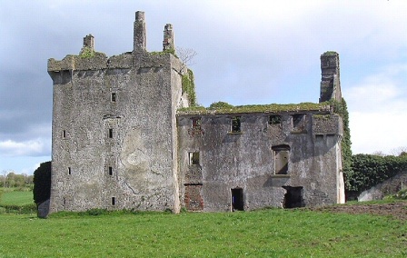
Rappa Castle
Houses within 5km of this house
Displaying 10 houses.
Houses within 5km of Rappa Castle
Displaying 10 houses.
| House name | Description | |
|---|---|---|
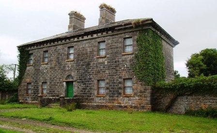
| Croftonpark | ||
| Deel Castle | James Cuff, Lord Tyrawley, built a house beside the Old Bourke Castle in 1791. It is labelled Deel Castle on 1st edition Ordnance survey map but as Castle Gore on the later 25-inch edition The house was burnt in 1922 and not rebuilt. |
|
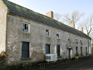
| Croftonpark | Described in the Ordnance Survey Name Books as a 'neat house', built in 1784 and occupied by Hugh Dane [Deane]. Robert Hunter lived there at the time of Griffith's Valuation and Patrick Ruane refers to the recent death of James Hunter, the owner of the house in the early 1990s. The house is still extant but no longer in use. |
|
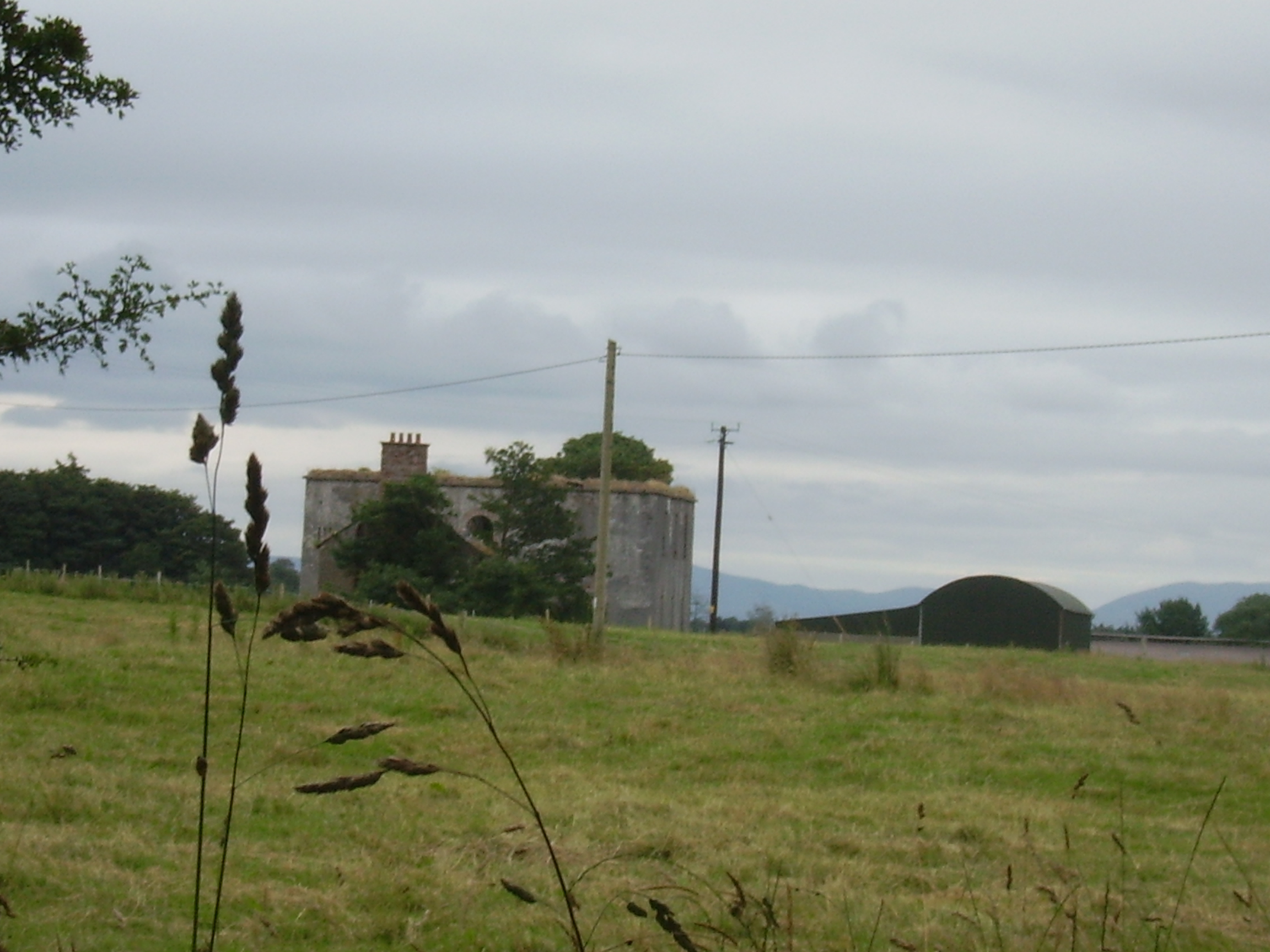
| Castle Gore | The old Bourke Castle on the river Deel was granted to the Gores at the end of 17th century. They added a large wing to the old castle in the 18th century and renamed it Castle Gore. The castle along with other lands was leased to James Cuff, Lord Tyrawley towards the end of the 18th century. Wilson refers to it as "the pleasant old seat of the Earl of Arran, now occupied by Rt. Hon. James Cuffe" in 1786. Occupied by the Cuff's steward for part of the 19th century. At the time of Griffith's Valuation it was occupied by Captain St. George Cuffe and valued at £60. In 1894 Slater refers to it as a seat of the Earls of Arran though this may refer to the late eighteenth century house nearby. |

|
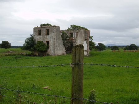
| Netley House | The home of Henry William Knox, fourth son of Francis Knox of Rappa, occupied by Richard Burke at the time of Griffith's Valuation when the house was valued at £30.. The house is now a ruin. |
|
| Greenwoodpark | Built in 1814, the home of Major John Knox, sixth son of Francis Knox of Rappa and sold by his daughter Florence to her cousin, a Knox of Mount Falcon. The Armitages lived at Greenwoodpark in the 20th century but the house is now a ruin. |
|
| Knockglass House/Woodville | Also known as Knockglass House, this residence was situated close to the demesne of Greenwoodpark. At the time of Griffith's Valuation it was leased by John McDonnell from Major Knox when it was valued at £6. It is labelled Knockglass House on the 1st edition Ordnance Survey map but appears to be in ruins by the publication of the 25-inch edition map in the 1890s. | |
| Knockglass | The main residence of the Paget family in the 19th century. Afterwards it passed into the possession of Patrick Rowe and later served as the home of the Church of Ireland Bishop of Tuam, Achonry and Killala. In 2011 it was offered for sale. |

|
| Ballybroony | An 18th century house, occupied by Fallon in the late 1770s and in 1786. The residence of the Perkins family from the early 19th century. It was held by Arthur Perkins from the Earl of Arran at the time of Griffith's Valuation when it was valued at £17. Lived in until the early 21st century and for sale in 2006. Restoration work was underway in 2010. |
|
| Carnisk | John Sproule was leasing this property from Sir James Stewart's estate at the time of Griffiths Valuation in the 1850s, when it was valued at £18. This appears to be the house labelled Carnisk on the 25-inch Ordnance Survey map of the early twentieth century. An earlier house, shown on the 1st edition Ordnance Survey map, was located nearby at C209209. A large farming complex exists at the Carnisk site now. |